LEO vs GEO Satellite Internet: What Is the Difference?

Key Takeaways
- LEO is usually better for interactive activities, including video meetings, remote desktops, cloud applications, voice calls, and many online games.
- GEO covers a much larger area per satellite and normally communicates through a dish aimed at one fixed orbital position.
- Orbit does not determine download speed by itself. Spectrum, gateways, local demand, routing, equipment, and service priority also matter.
- LEO normally needs a broad view of the required sky area. GEO needs a clear path at the provider’s required azimuth and elevation.
- The practical choice depends on latency, visibility, and address-level capacity—not on which orbit is newer.
This guide explains the differences that affect everyday use, calculates how orbital altitude changes the theoretical propagation floor, and provides a practical framework for investigating services at a particular property.
How This Article Was Researched
This comparison was prepared using orbital definitions and communications material from NASA and the European Space Agency, the NIST value for the speed of light, the FCC’s April 2026 U.S. satellite spectrum-sharing order, and dated first-party provider documentation.
The propagation examples are CosmoBasics worked calculations based on published orbital altitudes and the NIST speed-of-light constant. They illustrate the effect of distance rather than predicting the latency of a particular service.
No satellite internet service was hands-on tested for this article. Provider specifications are included as dated examples, not endorsements.
What Do LEO and GEO Mean?
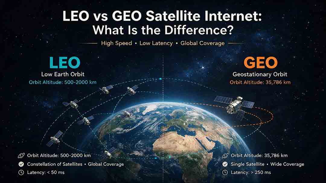
Low Earth orbit, or LEO, generally refers to Earth-centered orbits approximately 160 to 2,000 kilometers above Earth.
NASA gives this approximate range in its overview of satellite orbits. Because a LEO satellite moves rapidly relative to a user on the ground, continuous broadband service requires a constellation of satellites rather than one permanently visible spacecraft.
Geostationary Earth orbit, or GEO, is a circular equatorial orbit approximately 35,786 kilometers above Earth.
A GEO satellite moves at the same angular rate as Earth rotates. From the ground, it appears to remain in one position, allowing an antenna to stay pointed toward it.
The European Space Agency’s guide to communications orbits explains GEO’s fixed apparent position, large coverage area, and the constellation requirement for continuous LEO communications.
GEO is a specific type of geosynchronous orbit. A geosynchronous satellite shares Earth’s rotational period, but only a circular orbit directly above the equator appears stationary over one point.
How Do LEO and GEO Satellite Internet Compare?
The central difference is distance from Earth. That distance affects latency, coverage geometry, antenna design, routing, and the number of satellites required.
| Factor | LEO satellite internet | GEO satellite internet |
|---|---|---|
| Typical orbital altitude | Approximately 160–2,000 km | Approximately 35,786 km |
| Position seen from the ground | Moves across the sky | Appears fixed |
| Common network design | Constellation of moving satellites | One or more fixed-position satellites using regional or spot beams |
| Propagation latency | Relatively low | Inherently high |
| Coverage per satellite | Smaller footprint | Very large footprint |
| Connection continuity | Network changes serving satellites or beams as geometry changes | Fixed users normally communicate through the same satellite |
| User antenna | Often electronically steered or designed for changing geometry | Fixed, accurately aligned dish |
| Visibility requirement | Broad view of the required sky area | Clear path in one required direction |
| High-latitude geometry | Potentially favorable with suitable inclined or polar coverage | May become difficult because of low elevation angles |
| Strongest general use case | Interactive broadband | Wide fixed coverage and delay-tolerant traffic |
| Common constraints | Obstructions, routing complexity, and local capacity | Propagation delay, alignment, and low-elevation geometry |
These are architectural tendencies, not performance guarantees. Individual networks may use different altitudes, frequency bands, gateways, antennas, and routing methods.
The key distinction: Orbit sets physical limits, but it does not rate the quality of a provider or plan.
Why Does GEO Satellite Internet Have Higher Latency?
GEO satellite internet has higher latency because each request and response must travel tens of thousands of kilometers through space.
Radio signals travel close to the speed of light, but that speed is not instantaneous. The distance to geostationary orbit creates a delay that software cannot remove.
NIST defines the speed of light in a vacuum as exactly 299,792,458 meters per second.
A Simplified GEO Propagation Calculation
Consider a conventional request-and-response path:
- The user terminal sends a request to the GEO satellite.
- The satellite relays the request to a provider gateway.
- The response travels from the gateway back to the satellite.
- The satellite sends the response to the user.
Using GEO altitude as a simplified minimum:
- Four space legs × 35,786 km = 143,144 km
- 143,144 km ÷ 299,792 km per second = approximately 0.477 seconds
- The propagation-only floor is therefore about 477 milliseconds
This simplified geometry effectively assumes that the user and gateway are ideally positioned beneath the satellite. Real paths are normally longer because the user and gateway are geographically separated and communicate along slanted paths.
The calculation also excludes:
- Satellite processing
- Radio scheduling
- Network queues
- Terrestrial routing
- Congestion
- Packet retransmission
- VPN routing
- Local Wi-Fi delay
- Destination-server response time
Viasat presents approximately 600 milliseconds as a consumer-facing illustration of GEO latency in its explanation of satellite internet delay.
That figure comes from a provider education page. It is not an independent industry measurement or a fixed value for every GEO network.
How Orbital Altitude Changes the Propagation Floor
The same simplified four-space-leg calculation shows how altitude affects minimum signal travel time.
| Illustrative altitude | Four-leg space distance | Propagation-only floor |
|---|---|---|
| 550 km | 2,200 km | About 7.3 ms |
| 1,200 km | 4,800 km | About 16.0 ms |
| 2,000 km | 8,000 km | About 26.7 ms |
| 35,786 km | 143,144 km | About 477.5 ms |
Method: Four times the illustrative altitude, divided by the NIST speed of light.
These values are not advertised service ranges or measured customer pings. They isolate orbital altitude so readers can see why LEO and GEO have fundamentally different physical latency limits.
Propagation, routing, and processing all contribute to end-to-end latency.
Why Is Measured LEO Latency Higher Than the Orbital Floor?
A real internet connection includes satellites, ground infrastructure, network processing, and local equipment—not only signal travel through space.
Measured latency may include:
- A satellite that is not directly overhead
- Travel to a geographically distant gateway
- Radio-resource scheduling
- Beam changes
- Network processing
- Terrestrial backhaul
- Inter-satellite routing in equipped systems
- The destination server
- VPN overhead
- Wi-Fi interference
- Packet loss and retransmission
As one dated provider example, Starlink’s official service specifications listed land-based latency of 25–60 milliseconds when checked on August 2, 2026.
That range is specific to Starlink’s published specifications and is not a universal LEO benchmark. The same document states that performance can vary by location, time of day, network demand, remote-area routing, and the priority assigned to a service plan.
Does LEO Always Have Faster Download Speeds?
No. LEO generally has lower latency, but orbital altitude does not independently determine download or upload speed.
Latency measures how long information takes to make a round trip. Throughput measures how much information can be transferred over time.
Actual speed depends on:
- Satellite and beam capacity
- Available spectrum
- Frequency reuse
- Number of active users
- Gateway capacity
- User-terminal capabilities
- Service-plan priority
- Provider traffic management
- Weather and signal margin
- Terrestrial backhaul
- The destination server
Modern GEO systems can use high-capacity satellites, multiple spot beams, adaptive coding, and frequency reuse. LEO services can slow during busy periods when demand in a local service area exceeds available capacity.
In the United States, the FCC’s April 2026 Modernizing Spectrum Sharing for Satellite Broadband order illustrates how interference protections, power rules, coordination requirements, and spectrum reuse can affect NGSO capacity.
The document concerns U.S. regulation and should not be treated as a global regulatory standard. NGSO is also a broader category than LEO.
Orbit establishes physical limits. Provider engineering determines how effectively a network operates within them.
How Do LEO and GEO Networks Maintain a Connection?
LEO Network Path
A typical LEO connection moves data from the user terminal to an available satellite and then to a ground gateway connected to the terrestrial internet.
As satellites move, the network changes serving beams or satellites. This process is commonly called a handover.
A handover is a normal network function, not automatically an interruption. It requires coordinated satellite tracking, radio-resource scheduling, gateway selection, and routing.
In constellations equipped with inter-satellite links, traffic may travel through one or more satellites before reaching a gateway. This can extend connectivity over oceans or remote regions, but inter-satellite routing is not a feature of every LEO system.
GEO Network Path
A conventional GEO connection sends traffic from a fixed user dish to the GEO satellite, then to a provider gateway and the terrestrial internet.
Because the satellite appears fixed, a stationary dish does not need to track satellites moving across the sky. This simplifies antenna pointing but does not reduce the delay caused by orbital distance.
A complete satellite internet path includes the user terminal, one or more satellites, gateways, and terrestrial internet backhaul.
Which Is Better for Video Calls and Remote Work?
LEO is usually better for frequent video meetings and interactive remote work because lower latency improves conversational timing and application responsiveness.
Video quality depends on more than download speed. Important factors include:
- Round-trip latency
- Jitter
- Packet loss
- Upload capacity
- Download capacity
- Wi-Fi quality
- Application-server performance
A GEO connection may have enough bandwidth for clear video while still producing delayed responses, overlapping speech, or unnatural pauses.
LEO normally reduces that delay. However, a poorly positioned LEO terminal may suffer obstruction-related interruptions that are more disruptive than a stable but delayed GEO connection.
Online Gaming
LEO is generally the stronger satellite option for latency-sensitive multiplayer games.
GEO may remain usable for turn-based games, single-player games, downloads, updates, and slower-paced online titles. Competitive shooters, racing games, fighting games, and cloud gaming generally benefit more from LEO.
Even over LEO, performance depends on routing, server location, packet loss, Wi-Fi quality, local demand, and service priority.
Streaming Video
Both LEO and GEO can support streaming when adequate throughput and data allowance are available.
Streaming becomes less sensitive to latency after a buffer forms. GEO delay is more noticeable when starting a video, navigating menus, changing channels, or jumping to another point in a stream.
Repeated buffering is more often associated with insufficient throughput, congestion, packet loss, traffic priority, or Wi-Fi problems than with propagation delay alone.
VPNs and Cloud Applications
LEO usually provides a better experience for remote desktops, secure business portals, cloud accounting systems, terminal sessions, and applications that make many sequential requests.
A VPN can add encryption, server, and routing delay on top of the satellite connection. GEO can remain practical for email, scheduled backups, downloads, and other asynchronous work.
Which Orbit Provides Better Coverage?
GEO provides more coverage per satellite, while LEO achieves broad coverage through many smaller moving footprints.
A GEO satellite can serve a large country, region, continent, or wider area through regional beams or multiple spot beams.
A LEO satellite covers a smaller area at any moment. Continuous service depends on enough satellites being available in suitable orbital planes.
Commercial coverage requires more than a satellite passing overhead. Address-level service may depend on:
- Regulatory authorization
- Local network capacity
- Gateway access
- Spectrum rights
- Terminal certification
- Provider service boundaries
- Plan eligibility
- Import or mobility restrictions
A general coverage map is therefore an initial check, not proof that a suitable plan can be purchased at a particular address.
High-Latitude Geometry
GEO satellites remain above the equator. From far northern or southern locations, they appear progressively lower on the horizon.
Low elevation angles can make the path more vulnerable to mountains, buildings, trees, local terrain, and a longer route through the lower atmosphere.
LEO may offer more favorable high-latitude geometry when a constellation includes suitable high-inclination or polar coverage. That is a potential advantage rather than an automatic one.
Actual suitability still depends on orbital inclination, satellite density, regulatory approval, available terminals, network infrastructure, local capacity, and the provider’s service boundary.
Is LEO or GEO More Reliable?
Neither orbit is always more reliable. Reliability depends on the complete system and the likely failure modes at the property.
A practical assessment should consider:
Orbit + provider network + installation + equipment + power + weather + local capacity
Common LEO constraints include:
- Obstructions across the required sky area
- Changing satellite geometry
- Local capacity limits
- Gateway or routing problems
- Terminal, cable, or power faults
- Weather-related attenuation
Common GEO constraints include:
- Dish misalignment
- A blocked fixed line of sight
- Low elevation angles
- Heavy rain or atmospheric attenuation
- Snow or ice on equipment
- Gateway problems
- Network congestion
- Permanent propagation delay
A GEO dish may be highly stable when a correct directional opening exists. A LEO terminal may offer a more responsive connection when it has a clear sky view and sufficient local capacity.
How Do Weather and Obstructions Change the Comparison?
Both LEO and GEO links can be affected by weather, but their visibility requirements create different installation risks.
Higher-frequency satellite links can experience attenuation from rain, atmospheric moisture, clouds, snow, or ice. The severity depends on frequency, precipitation, antenna design, link margin, elevation angle, adaptive coding, and provider engineering.
ESA’s project on propagation elements for Ka- and Q/V-band broadband systems explains that higher-frequency links are more vulnerable to attenuation from atmospheric gases, clouds, rain, and tropospheric conditions.
Weather at a provider gateway can also affect service when conditions at the customer’s property appear clear.
Rain, snow, wind, clouds, and installation conditions can affect the radio link in different ways.
The Visibility Tradeoff Most Comparisons Miss
A LEO terminal normally needs a broad view of the required sky because usable satellites move relative to the property.
A GEO dish needs one clear path in the provider’s required pointing direction.
That creates a counterintuitive result:
- An open roof or field may strongly favor LEO.
- A wooded property may favor GEO only if an opening matches the required azimuth and elevation.
- A clear opening in the wrong direction cannot support the GEO service.
- A blocked equatorial horizon may prevent GEO even when the overhead sky is open.
- Branches in a critical part of the sky may cause recurring LEO interruptions.
Starlink’s official obstruction-checking guidance advises users to inspect multiple locations and explains that trees, poles, and roofs may interrupt connectivity.
Exact visibility requirements vary by provider, terminal, latitude, and network design. Use the provider’s official pointing or obstruction tool before ordering whenever one is available.
The CosmoBasics LVC Satellite Internet Decision Framework
The LVC framework compares satellite internet using three practical constraints:
- Latency
- Visibility
- Local capacity
It is an editorial screening framework, not an engineering certification, numerical performance score, or service guarantee.
Its purpose is to identify what a buyer should investigate next—not to make the purchase decision automatically.
LVC Quick Screening Table
| Condition | LEO | GEO |
|---|---|---|
| Daily video meetings or remote desktops are essential | Strong fit | Poor fit |
| Low latency is essential | Strong fit | Poor fit |
| Latency-sensitive online gaming is important | Strong fit | Poor fit |
| The property has a broad, unobstructed sky view | Strong fit | Possible fit |
| One opening matches the required GEO azimuth and elevation, but the broader sky is obstructed | Poor fit | Strong fit |
| Main tasks are streaming, downloads, email, or sensor uploads | Possible fit | Possible fit |
| The property is at a very high latitude | Potentially favorable with suitable coverage | May be difficult because of low elevation angles |
| Local LEO service is unavailable or capacity-limited | Poor fit | Possible fit |
| A permanently fixed dish is easier to install and maintain at the property | Possible fit | Strong fit |
| Essential tasks can tolerate long round-trip delay | Possible fit | Strong fit |
A strong fit does not prove that service is available, affordable, or reliable at a particular address.
A directional opening favors GEO only when it matches the provider’s required azimuth and elevation.
How to Interpret the Framework
- When essential activities consistently favor low latency and the property has a broad, open sky view, investigate LEO first.
- When the workload tolerates delay and the property has a valid fixed GEO line of sight, GEO may be the more practical installation.
- When the indicators are mixed, compare address-level capacity, installation feasibility, total cost, and cancellation terms.
- When reliable fiber or cable is available, compare the terrestrial option before committing to satellite.
Latency
Identify the household’s three essential activities and classify each as high, moderate, or low in latency sensitivity.
Interactive applications generally favor LEO. Buffered or asynchronous activities may work over either orbit.
Visibility
For LEO, inspect:
- Trees in multiple directions
- Roof edges and chimneys
- Utility poles
- Nearby buildings
- Hills or cliffs
- Seasonal foliage
- Future tree growth
- Snow accumulation
- Safe mounting and cable routes
For GEO, confirm:
- The provider’s required azimuth
- The provider’s required elevation angle
- Terrain in that direction
- Trees and structures
- Dish-mount stability
- Wind and snow exposure
- Local mounting restrictions
Local Capacity
Review the service offered at the exact address, including:
- Expected download and upload performance
- Published latency
- Local peak-hour expectations
- Data priority
- Fair-use rules
- Congestion management
- Equipment eligibility
- Installation requirements
- Return and cancellation terms
- Support availability
- Static IP options
- Mobility permissions
A favorable orbit cannot compensate for unavailable service or insufficient local capacity.
A Six-Step Selection Process
The LVC framework identifies which conditions favor each orbit. This process explains how to complete the purchase investigation.
Step 1: Check Terrestrial Broadband
Determine whether the address can receive:
- Fiber
- Cable
- Fixed wireless
- Reliable 4G or 5G home internet
- A local wireless internet service
A dependable terrestrial connection often offers lower latency, greater capacity, and fewer installation constraints.
The practical comparison with cable depends on address-level availability, latency, capacity, installation, and total cost.
Step 2: Identify Three Essential Activities
Avoid vague requirements such as “regular internet use.”
List the three activities that would cause the greatest disruption if they performed poorly. Rank them by the consequences of poor performance, not only by how often they are used.
Examples include video meetings, remote desktop access, multiplayer gaming, security-camera uploads, streaming, cloud backups, and remote monitoring.
Step 3: Survey at Least Two Installation Locations
Use the provider’s official pointing, obstruction, or installation tool at two or more suitable locations.
Possible locations include a roof, yard, pole mount, outbuilding, existing antenna mast, or open field.
Do not perform unsafe roof work. Use a qualified installer when structural mounting, electrical grounding, or working at height is required.
Step 4: Verify Address-Level Service and Current Terms
Confirm:
- Exact-address availability
- Current expected performance
- Local capacity restrictions
- Equipment eligibility
- Priority and fair-use policies
- Installation requirements
- Mobility permissions
- Warranty and return period
- Cancellation terms
Do not rely solely on an old review, nationwide average, or general coverage map.
Step 5: Calculate the Full First-Year Cost
Include:
- Hardware
- Shipping
- Professional installation
- Roof or pole mounts
- Approved cables
- Vegetation management
- Surge protection
- Backup power
- Monthly service
- Taxes and fees
- Replacement equipment
- A backup connection
The lowest monthly price is not necessarily the lowest-cost workable system.
Step 6: Plan for an Outage
No consumer internet connection should be treated as guaranteed.
Critical work may justify a mobile hotspot, second provider, offline-capable software, local file copies, backup power, or an alternative calling method.
Illustrative Scenarios
The following examples are based on common workloads and installation conditions. They are not customer case studies, testimonials, field tests, or performance guarantees.
A Remote Home With Daily Video Meetings
Two adults work remotely and spend several hours each day in video calls. Cable and fiber are unavailable, and the roof has a wide, open sky view.
Likely starting point: LEO.
Lower latency should improve conversational timing and cloud-application responsiveness. The household should still verify upload performance, local capacity, service priority, return terms, and backup connectivity.
An Agricultural Monitoring Site
A remote site sends sensor data, uploads reports, receives software updates, and occasionally streams training material. Most traffic is asynchronous.
The site has a stable mounting location and a clear path in the required GEO direction.
Likely starting point: Compare both.
GEO delay may have little operational effect. Equipment support, data policy, reliability, and total cost may matter more than latency.
A Cabin Surrounded by Trees
Tall trees obstruct much of the overhead sky, but one opening matches the provider’s required GEO azimuth and elevation.
Likely starting point: GEO may be more practical.
A LEO terminal could experience recurring obstruction events as network geometry changes. A fixed GEO dish may maintain a stable path through the opening, provided seasonal growth does not block it.
A High-Latitude Worksite
A northern worksite has a very low elevation angle toward equatorial GEO satellites.
Likely starting point: Investigate suitable LEO coverage.
A high-inclination or polar LEO constellation may provide better geometry. The operator must still confirm licensing, satellite density, capacity, equipment availability, winter mounting requirements, and local support.
LEO Satellite Internet Advantages and Limitations
Advantages
- Lower propagation delay
- Better fit for interactive applications
- Potentially favorable high-latitude geometry
- Constellation-based coverage
- Possible inter-satellite routing in equipped systems
Limitations
- Broad sky-view requirement
- Sensitivity to physical obstructions
- Local capacity constraints
- Complex routing and changing geometry
- Performance variation by plan and location
Some LEO systems support approved mobile or remote-use configurations. Availability depends on the terminal, service plan, coverage area, operating environment, and local regulations.
GEO Satellite Internet Advantages and Limitations
Advantages
- Large coverage area per satellite
- Fixed antenna direction
- Predictable orbital geometry
- Established fixed-site architecture
- Suitable for buffered and asynchronous workloads
Limitations
- High propagation latency
- Poor fit for highly interactive applications
- Difficult geometry at some high-latitude locations
- Alignment and fixed-line-of-sight requirements
- Weather attenuation at some frequencies
Common Mistakes When Comparing LEO and GEO
Comparing Only Advertised Download Speed
Download speed is only one part of performance.
Also examine upload speed, latency, jitter, packet loss, local peak-hour performance, and service priority.
A connection can produce a strong download result while still feeling slow during video calls or remote work.
Assuming LEO Is Automatically Reliable
Low orbital altitude does not prevent interruptions caused by obstructions, congestion, equipment faults, routing problems, weather, or unstable power.
Assuming GEO Cannot Stream Video
Streaming can tolerate substantial latency after a buffer forms. Throughput, congestion, traffic policy, and Wi-Fi quality often matter more during continuous playback.
Choosing Before Inspecting the Sky
A capable satellite network cannot overcome a blocked signal path.
LEO and GEO require different visibility checks, so the site survey should happen before the final plan decision.
Using Broad or Outdated Data to Predict One Address
Nationwide averages cannot reliably predict one beam, cell, gateway region, service plan, or installation.
Old reviews also cannot replace current first-party information about availability, equipment, priority rules, prices, and cancellation terms.
Assuming More Satellites Always Mean More Local Capacity
Constellation size alone does not reveal available spectrum, frequency reuse, gateway capacity, beam allocation, traffic priority, routing efficiency, or local demand.
Quick Troubleshooting Guide
When a LEO Connection Drops or Slows
Check:
- The provider’s obstruction report
- Trees, roofs, poles, chimneys, and nearby buildings
- Whether slowdowns occur mainly during busy hours
- The plan’s priority or fair-use policy
- Power, cables, connectors, and local Wi-Fi
Regular short interruptions may indicate an obstruction in the required field of view. Consistent evening slowdowns may indicate local demand or service prioritization.
When a GEO Connection Feels Slow or Loses Signal
Check:
- Whether the problem is high latency rather than low bandwidth
- Whether the dish or mount has shifted
- Whether the required directional path has become obstructed
- Snow, ice, intense rain, cables, and connectors
- Whether a geographically closer VPN endpoint or cloud region reduces additional network delay
Configuration changes can reduce added network delay, but they cannot remove the GEO propagation floor.
Do not adjust a professionally aligned dish or climb onto a roof without appropriate training and safety equipment.
LEO vs GEO Buying Checklist
- Fiber, cable, fixed wireless, and reliable mobile broadband have been checked
- Service is available at the exact address
- The installation location has suitable visibility
- Any GEO opening matches the required azimuth and elevation
- Essential activities have been classified by latency sensitivity
- Published latency is suitable for those activities
- Upload capacity is adequate
- Local peak-hour expectations have been reviewed
- Fair-use and priority policies are understood
- Equipment and installation costs are included
- Return, warranty, and cancellation terms are acceptable
- Mobility is permitted if required
- Power and backup-power needs are understood
- A backup connection exists for critical work
- The decision is not based solely on a nationwide average
Which Is Better: LEO or GEO Satellite Internet?
LEO is generally the better satellite option when low latency matters, the property has a broad view of the sky, and sufficient local capacity is available.
It is usually the stronger starting point for video meetings, remote desktops, interactive cloud tools, voice calls, and latency-sensitive games.
GEO may be more practical when the workload tolerates delay and the property has a clear path in the provider’s required pointing direction.
It can remain effective for streaming, downloads, email, scheduled data transfers, remote monitoring, and other buffered or asynchronous tasks.
Address-level capacity and installation conditions can overturn the theoretical advantage of an orbit. An obstructed LEO terminal may be less reliable than a properly aligned GEO dish. A congested LEO service may provide less useful capacity than an available GEO plan. A clear opening in the wrong direction cannot support a GEO satellite.
Reliable and reasonably priced fiber, cable, or fixed wireless should normally be compared before satellite service.
Orbit shapes latency and coverage geometry. Provider engineering shapes capacity and routing. Installation shapes visibility. The service plan shapes priority and usage conditions. Local demand shapes peak-hour performance.
Frequently Asked Questions
Can LEO Satellite Internet Replace Cable or Fiber?
LEO can provide a practical broadband alternative where cable or fiber is unavailable or unreliable.
It does not automatically equal a well-engineered wired connection. Fiber commonly provides lower latency, greater capacity, and fewer sky-view restrictions.
Is GEO Satellite Internet Becoming Obsolete?
No. GEO remains useful for broadcasting, aviation and maritime communications, remote infrastructure, backhaul, government networks, regional coverage, and fixed broadband.
LEO and GEO solve different engineering and economic problems. Some networks may combine more than one orbital layer.
Why Does LEO Need So Many Satellites?
A LEO satellite covers a smaller area and remains usable from one location for a limited period.
Continuous service requires other satellites and beams to become available as network geometry changes.
Can Better Software Eliminate GEO Latency?
No. Software can improve routing, buffering, compression, processing, and application behavior.
It cannot eliminate the time required for a signal to travel between Earth and geostationary orbit.
Is LEO Always Better in Bad Weather?
No. Weather performance depends on frequency, precipitation, antenna design, link margin, installation quality, gateway conditions, elevation angle, and provider engineering.
The shorter LEO path does not make a service immune to rain, snow, ice, or atmospheric attenuation.
Can Satellite Internet Be Used While Traveling?
Only when the terminal, service plan, coverage area, provider rules, and local regulations permit mobile or in-motion use.
A fixed residential plan should not be assumed to work legally or technically on a vehicle, vessel, aircraft, or in another country.
Sources
NASA Earthdata — Orbits
Supports LEO and GEO altitude ranges and orbit classifications.NASA — Commercial Space Frequently Asked Questions
Supports NASA’s definition of LEO as Earth-centered orbits at or below approximately 2,000 kilometers.European Space Agency — Orbits
Supports GEO’s fixed apparent position, large coverage area, and LEO constellation requirements.NIST — CODATA Value: Speed of Light in Vacuum
Supports the constant used in the propagation calculations.Federal Communications Commission — Modernizing Spectrum Sharing for Satellite Broadband
Provides April 2026 U.S. context for GSO and NGSO spectrum sharing.Starlink — Starlink Specifications
Supports the dated provider-specific latency example and performance qualifications.Starlink Help Center — How to Check for Obstructions
Supports guidance concerning trees, poles, roofs, and installation visibility.Viasat — Satellite Internet Latency: What’s the Big Deal?
Supports Viasat’s consumer-facing GEO latency illustration.European Space Agency — Propagation Elements for Ka- and Q/V-Band Broadband Systems
Supports the discussion of atmospheric attenuation at higher satellite frequencies.
Information Currency Notice
Provider specifications, performance ranges, plans, equipment, prices, priority policies, availability, mobility permissions, and service terms may change after publication.
Confirm current address-level information directly with the provider before purchasing or installing equipment.
More from Satellite Internet & Connectivity
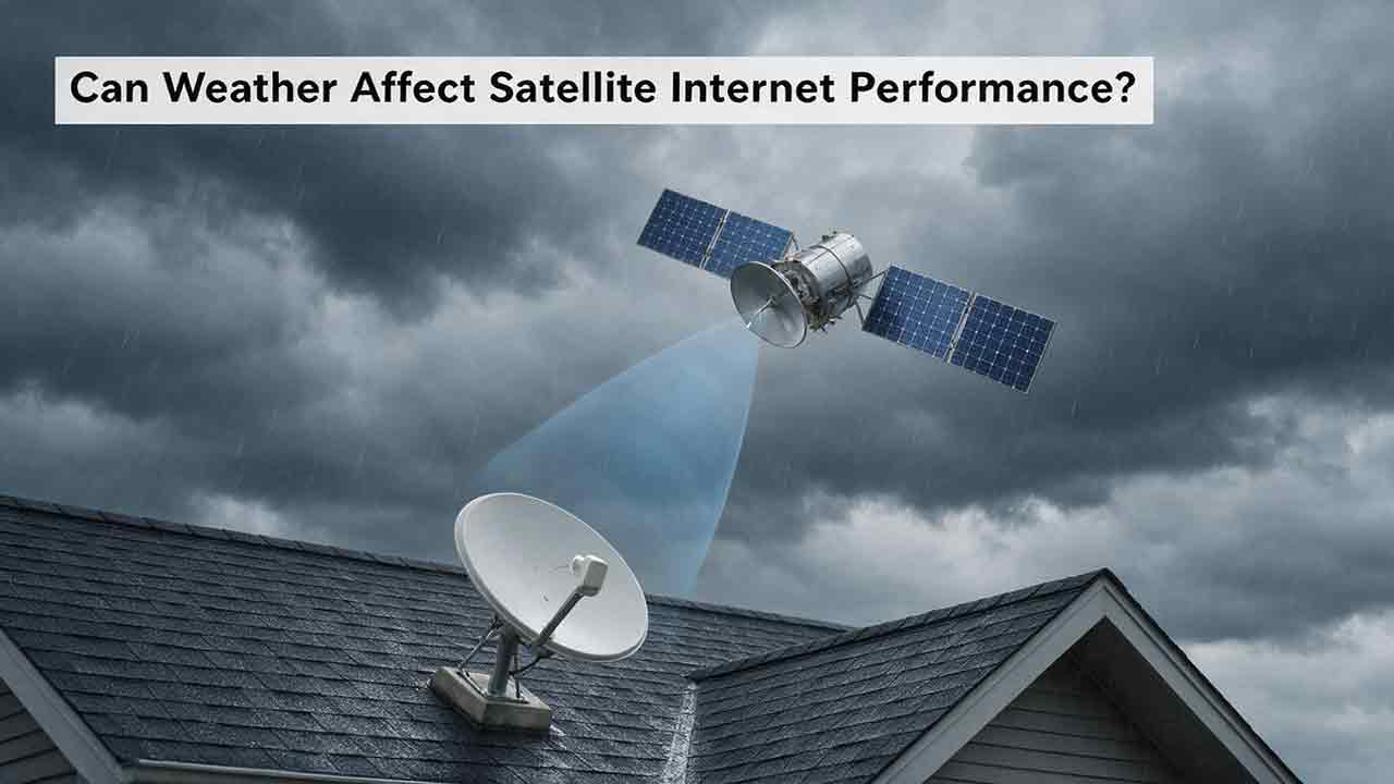
Can Weather Affect Satellite Internet Performance?
Weather can affect satellite internet performance, but the severity depends on the type of weather, signal frequency, equipment condition, installation quality, and network architecture. This guide explains how intense rain can cause temporary signal attenuation, why wet snow and ice may affect both the radio path and the terminal, and how wind, lightning, extreme temperatures, and power failures can disrupt service indirectly. It also explains why users may experience an outage under clear local skies when severe weather affects a distant provider gateway. To help readers diagnose problems safely, the article introduces the CosmoBasics Weather Impact Triangle, separating signal-path, terminal, and infrastructure risks. Readers also receive a practical troubleshooting process, a reusable weather incident log, common-mistake warnings, and a harsh-climate buying checklist. The guide relies on ITU, NASA, NOAA, FCC, and provider documentation while clearly distinguishing general engineering principles from model-specific equipment features.
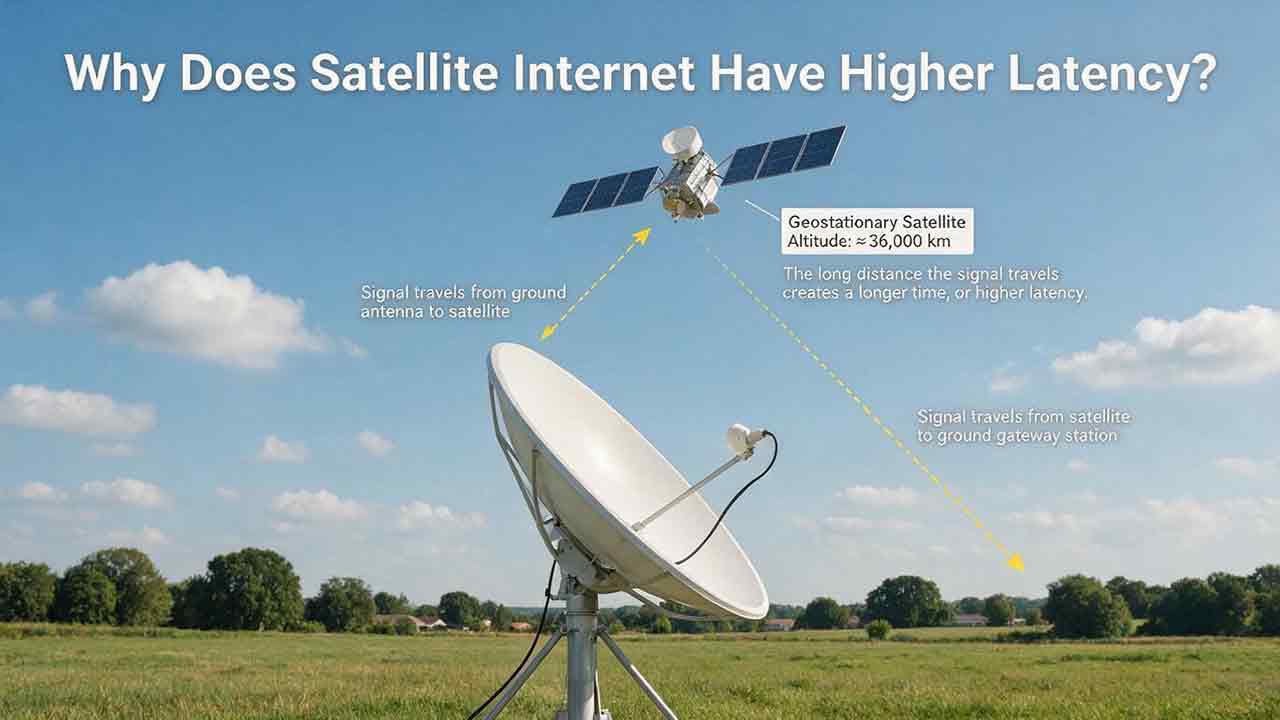
Why Does Satellite Internet Have Higher Latency?
Satellite internet often has higher latency because data must travel between a ground terminal, an orbiting satellite, a gateway and the wider internet before a response returns. This guide explains that delay through a transparent GEO propagation calculation, showing why an idealized four-leg path to a geostationary satellite corresponds to about 477 milliseconds before routing and processing are added. It also compares GEO and LEO architectures, clarifies the difference between bandwidth and latency, and examines how congestion, gateways, packet loss, Wi-Fi and upload saturation affect real-world performance. Readers can use the original Three-Layer Latency Framework, Two-Test Rule, diagnostic matrix and performance log to distinguish unavoidable orbital delay from provider-network or home-network problems. The article also helps rural households, remote workers and prospective buyers judge whether satellite latency is suitable for streaming, video calls, gaming, cloud applications and other everyday uses.
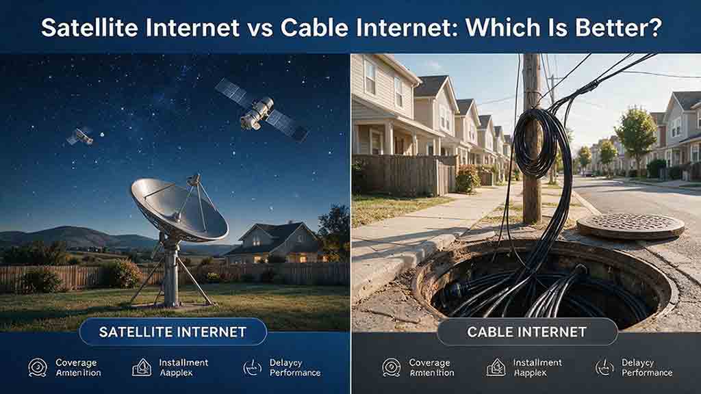
Satellite Internet vs Cable Internet: Which Is Better?
Cable internet is usually the stronger option when reliable service is available at a reasonable total cost, while satellite internet is often more practical for rural, remote, or difficult-to-wire properties. This guide compares both technologies across download speed, upload capacity, latency, reliability, data policies, installation requirements, and long-term cost. It explains why LEO and GEO satellite systems provide different user experiences and includes a transparent GEO propagation estimate, a household bandwidth example, and a rural installation cost comparison. Readers can also use the Eligibility-First Internet Selection Test to eliminate nonviable services, protect critical requirements, and score the remaining options according to their priorities. Reliability evidence, confidence levels, troubleshooting steps, and a detailed buying checklist help prevent decisions based only on advertised speed or promotional pricing. The article uses official FCC, NASA, CableLabs, Starlink, Netflix, and Zoom documentation while clearly separating published specifications from editorial calculations and planning recommendations.
Explore More Topics
How Do Satellites Detect Wildfires and Smoke?
Satellites detect wildfires by measuring unusual heat in infrared wavelengths, while visible, multispectral, and aerosol observations help analysts follow smoke across the atmosphere. This guide explains how systems such as GOES, VIIRS, MODIS, Landsat, and Sentinel contribute different pieces of the wildfire-monitoring picture. Readers will learn why a thermal hotspot is not the same as an exact fire perimeter, why satellite smoke imagery cannot replace ground-level PM2.5 measurements, and how clouds, terrain, viewing geometry, and satellite overpass timing can affect detection. The article also compares commonly used fire and smoke products, explains fire radiative power and the Normalized Burn Ratio, and provides a practical framework for choosing the right map. A documented Camp Fire example shows how multiple satellite and surface datasets can complement one another. Satellite information is valuable for situational awareness, but official emergency agencies remain the appropriate source for evacuation orders, road closures, and immediate safety decisions.

How Are Satellite Images Used in Agriculture?
Satellite images help farmers, agronomists, researchers, insurers, and public agencies monitor agricultural land across fields, regions, and growing seasons. This guide explains how optical, radar, thermal, and microwave satellite observations support crop-development monitoring, irrigation analysis, field mapping, flood and drought assessment, crop classification, and regional production forecasting. It distinguishes what satellites directly observe from calculated indices, classification results, and modeled estimates such as evapotranspiration. Readers will also learn how NDVI works, why spatial resolution and image timing matter, and when drones or field scouting are more appropriate. The original CosmoBasics SCALE Framework provides a practical way to decide whether satellite imagery fits a specific agricultural problem. Documented examples from USDA and OpenET show how operational products combine multiple observations, reference data, weather information, and models. Throughout the guide, satellite imagery is treated as a screening and monitoring tool—not a substitute for field verification, laboratory testing, or professional agricultural judgment.
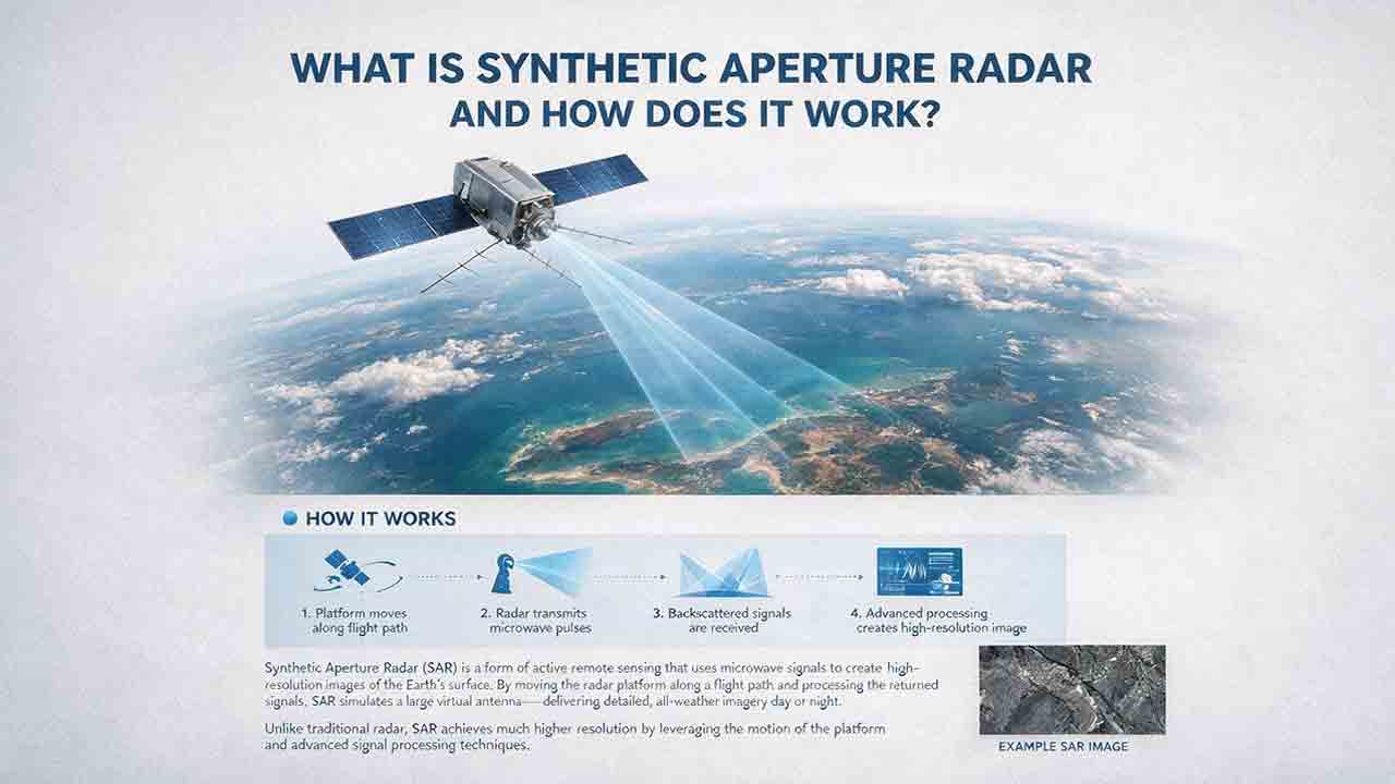
What Is Synthetic Aperture Radar and How Does It Work?
Synthetic aperture radar, or SAR, is an active Earth-observation technology that creates detailed images by transmitting microwave pulses and measuring the echoes returned from the surface. This article explains how a moving satellite or aircraft collects repeated observations to form a virtual antenna, why SAR can operate at night and through most cloud cover, and how amplitude, phase, wavelength, polarization, surface roughness, moisture, and viewing geometry affect radar imagery. It also distinguishes pixel spacing from true spatial resolution, provides a transparent range-resolution calculation, and compares SAR with optical satellite imagery. Practical sections examine scattering mechanisms, flood mapping, agriculture, forests, ice, maritime monitoring, and InSAR-based ground-deformation analysis. Original interpretation and data-selection frameworks help readers evaluate backscatter patterns, choose suitable products, identify common errors, troubleshoot unexpected results, and communicate uncertainty without treating derived radar products as guaranteed ground truth.