LEO vs MEO vs GEO Orbits Explained

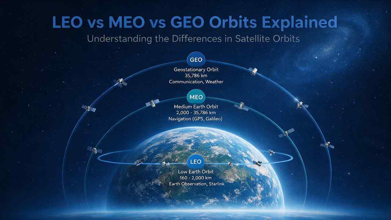
LEO, MEO, and GEO are different regions of Earth orbit with different strengths. LEO favors shorter signal paths and detailed observations. MEO provides wider coverage and is widely used for navigation. GEO remains above the same longitude, allowing continuous regional coverage but requiring signals to travel much farther.
Key Takeaways
- LEO is commonly used for Earth observation, human spaceflight, science, and lower-delay satellite communications.
- MEO balances distance and coverage and is best known as the operating region of navigation constellations such as GPS.
- GEO continuously covers the same large region and allows many ground antennas to remain pointed in one direction.
- Higher altitude generally means a longer orbital period, a larger footprint, and greater propagation delay.
- No orbit is universally best. Capacity, coverage, latency, geometry, satellite count, resilience, and system cost must be evaluated together.
This guide compares LEO, MEO, and GEO, calculates their theoretical space-segment delay using transparent assumptions, and provides a practical framework for matching an orbit to a mission.
LEO vs MEO vs GEO at a Glance
The main distinction between LEO, MEO, and GEO is altitude. That difference affects orbital speed, period, visibility, coverage, signal distance, ground equipment, and constellation design.
LEO and MEO are broad operational classifications rather than single, universally fixed altitude bands. GEO is more narrowly defined because a geostationary satellite must follow a specific circular, equatorial orbit.
| Property | LEO | MEO | GEO |
|---|---|---|---|
| Full name | Low Earth orbit | Medium Earth orbit | Geostationary Earth orbit |
| General location | Closest major orbital region to Earth | Above LEO and below geosynchronous altitude | About 35,786 km above the equator |
| Common altitude reference | About 160–2,000 km | Above roughly 2,000 km and below GEO altitude | Approximately 35,786 km |
| Typical orbital period | About 90 minutes to slightly over 2 hours | Roughly 2 hours to less than one sidereal day | One sidereal day: about 23 hours, 56 minutes |
| Appearance from the ground | Moves quickly across the sky | Moves more slowly across the sky | Appears fixed above one longitude |
| Coverage per satellite | Relatively small | Medium to large | Very large |
| Signal travel distance | Shortest | Intermediate | Longest |
| Common uses | Imaging, science, broadband, human spaceflight | Navigation, timing, specialized communications | Weather, broadcasting, regional communications |
The European Space Agency’s LEO reference notes that low Earth orbit can extend down to roughly 160 kilometers, although many practical LEO missions operate several hundred kilometers above Earth. NASA commonly describes LEO as encompassing Earth-centered orbits at or below approximately 2,000 kilometers.
The lower boundary is a classification reference, not a normal long-duration operating altitude. A spacecraft flying very low encounters substantial atmospheric drag and may require active propulsion to maintain its orbit.
According to the NASA Catalog of Earth Satellite Orbits, the geosynchronous orbital radius is approximately 42,164 kilometers from Earth’s center. This corresponds to an altitude of roughly 35,786 kilometers above Earth’s surface.
Operational tradeoffs
| Operational question | LEO | MEO | GEO |
|---|---|---|---|
| Potential propagation delay | Lowest | Moderate | Highest |
| Continuous service | Usually requires a constellation | Usually requires a constellation | One satellite can continuously cover a large region |
| Ground antenna | Tracks satellites or steers electronically | Tracks moving satellites | Can usually remain fixed |
| High-latitude access | Often strong with suitable inclination | Can be strong with suitable inclination | Weak geometry near the poles |
| Handovers | Frequent | Less frequent than LEO | Normally unnecessary within one GEO service area |
| Atmospheric drag | Relevant, especially at low altitude | Usually negligible | Negligible |
| Launch energy | Generally lower | Higher than LEO | Higher than LEO and most MEO missions |
| Typical architecture | Often a large constellation | Constellation | One or several regional satellites |
Coverage is not capacity. A satellite may be visible from a location without having enough spectrum, antenna beams, power, gateway access, or onboard processing to serve every user inside its footprint.
Representative Orbit Altitudes
The values below provide practical reference points. They do not define every possible mission within each orbital category.
| Reference point | Altitude above Earth | Example role |
|---|---|---|
| Very low LEO reference | About 160 km | Classification boundary; substantial atmospheric drag |
| Representative communications LEO | 550 km | Lower-delay communications example |
| Landsat 9 | 705 km | Near-polar, Sun-synchronous Earth observation |
| Upper LEO reference | About 2,000 km | Commonly used classification boundary |
| GPS orbit | About 20,200 km | Navigation and timing |
| GEO | About 35,786 km | Communications and continuous weather observation |
NASA lists Landsat 9 in a near-polar, Sun-synchronous orbit at approximately 705 kilometers, with a 99-minute orbital period.
According to GPS.gov, GPS satellites operate in MEO at approximately 20,200 kilometers and circle Earth twice per day. The European Space Agency defines GEO as a circular orbit 35,786 kilometers above Earth’s equator.
An altitude-ratio check
Using 550 kilometers as a representative LEO example:
- GPS altitude is about 37 times higher.
- GEO altitude is about 65 times higher.
- The altitude difference between GPS orbit and GEO is approximately 15,586 kilometers.
These ratios help explain why ordinary orbit diagrams cannot show Earth, LEO, MEO, and GEO at a readable true scale. They also make the large differences in physical signal travel time easier to understand.
The ratios do not directly predict coverage area, network capacity, end-to-end latency, or required satellite count. Those results also depend on geometry, antennas, payload capability, gateways, spectrum, minimum elevation angle, and network design.
How Altitude Changes Satellite Performance
Altitude influences almost every part of a satellite system, but it is only one design variable.
Lower circular orbits have higher orbital speeds
For a circular orbit, orbital speed decreases as orbital radius increases. Lower satellites therefore move faster and complete an orbit sooner, while higher satellites move more slowly and have longer orbital periods.
A typical LEO spacecraft may circle Earth in roughly 90 to 100 minutes. GPS satellites circle Earth about twice per day, while a GEO satellite completes one orbit in one sidereal day.
Satellites in every orbital region remain under Earth’s gravitational influence. They stay in orbit because their forward motion carries them around Earth while gravity continuously bends their path toward the planet.
Higher satellites can see more of Earth
A satellite’s horizon extends farther as altitude increases. A GEO spacecraft can therefore view a much larger portion of Earth than a LEO spacecraft.
That wide view is useful for regional broadcasting, communications, and continuous weather observation. A LEO imaging satellite sees a narrower area during each pass but can collect more detailed measurements with a comparable instrument.
A larger footprint is not automatically better. A satellite still has finite power, spectrum, antenna beams, processing resources, and gateway connectivity.
Lower satellites pass overhead more quickly
A LEO satellite may remain visible from one location for only several minutes. A continuous communications network must transfer the connection to another satellite before the first moves below the usable elevation angle.
MEO satellites generally remain visible for longer. A GEO satellite remains in the same apparent position, provided that operators perform the station-keeping needed to control its assigned orbital location.
Signal delay increases with distance
Radio signals travel at nearly the speed of light, but the distance to a satellite and back is not negligible.
LEO can provide much shorter space paths than GEO. A GEO link has an unavoidable propagation disadvantage because every signal must travel tens of thousands of kilometers upward and downward.
Actual end-to-end latency also depends on:
- The satellite’s slant range
- User distance from the gateway
- Terrestrial backhaul
- Inter-satellite links
- Satellite and terminal processing
- Routing and network architecture
- Queuing and congestion
- Security systems
- Server location
- Application processing
Altitude influences the physical lower bound. It does not determine the complete network result.
Higher orbits generally require more launch energy
Placing a spacecraft into MEO or GEO typically requires more energy than reaching LEO. GEO spacecraft may first enter an elliptical transfer orbit and later use propulsion to reach and circularize their operational orbit.
Altitude does not determine total mission cost by itself.
A large LEO service may require many spacecraft, gateways, replacement launches, tracking resources, collision-avoidance operations, and a complex network-control system. A GEO service may use fewer satellites but rely on larger spacecraft, more demanding launch profiles, and long-duration station-keeping.
The meaningful comparison is the complete system rather than the launch cost of one satellite.
Low Earth Orbit: Close to Earth and Fast-Moving
LEO is generally favored when a mission benefits from proximity, shorter signal paths, detailed observations, or high-latitude access.
Low Earth orbit is commonly described as extending to approximately 2,000 kilometers above Earth, although organizations may use somewhat different practical definitions. Many active missions operate below 1,000 kilometers.
Why missions use LEO
LEO provides several useful characteristics:
- Shorter radio-signal paths
- Better potential ground resolution for a comparable sensor
- Lower transmission-power requirements in some link designs
- Access to polar and Sun-synchronous orbital geometries
- Frequent passes over different regions
- Lower launch-energy requirements than higher orbital regions
- Accessibility for human spaceflight
- The possibility of relatively rapid natural reentry at some lower altitudes
Many Earth-observation spacecraft use near-polar or Sun-synchronous LEO paths. As Earth rotates below the orbit, the spacecraft can observe different longitudes on successive passes.
For example, Landsat 9 flies at approximately 705 kilometers and completes one orbit in 99 minutes, equal to roughly 14.5 orbits per day.
NOAA’s Joint Polar Satellite System circles Earth from pole to pole approximately 14 times per day. Earth rotates below the orbital path, allowing repeated global environmental observations and giving many locations roughly two observing opportunities per day across the system.
The precise revisit pattern depends on the satellite, instrument, swath width, latitude, cloud conditions, and the definition of usable coverage.
LEO strengths and limitations
| Strengths | Limitations |
|---|---|
| Lower physical propagation delay | Smaller footprint per satellite |
| Detailed Earth observations | Frequent handovers for continuous service |
| Good high-latitude access | Tracking or steerable antennas are often required |
| Lower launch energy than higher orbits | Atmospheric drag affects orbital lifetime |
| Flexible orbital inclinations | Busy altitude bands require collision coordination |
| Some spacecraft can naturally reenter | Large networks require frequent replenishment |
LEO is not one uniform operating environment. Satellite traffic is concentrated in particular altitude and inclination bands, so operational risk depends on the exact orbit rather than the LEO label alone.
A dated orbital-environment snapshot
ESA’s Space Environment Statistics were last updated on July 31, 2026. The table reported approximately:
- 27,373 catalogued objects in LEO
- 1,142 catalogued objects in MEO
- 954 catalogued objects in GEO
These figures include multiple object categories, such as active and inactive payloads, rocket bodies, mission-related objects, fragments, and unidentified objects. They should not be interpreted as counts of functioning satellites.
The totals change as new objects are launched, identified, fragmented, moved, or removed from orbit. The comparison is most useful as a dated indication of how strongly the catalogued orbital population is concentrated in LEO.
ESA’s Annual Space Environment Report, Issue 10.0, issued on May 1, 2026, describes continued growth in LEO traffic and identifies heavily used altitude bands as areas requiring effective space-traffic coordination and debris mitigation.
Missions commonly placed in LEO
- Optical Earth observation
- Synthetic aperture radar
- Polar weather monitoring
- Human spaceflight
- Scientific measurements
- Lower-delay satellite broadband
- Technology demonstrations
- Ship, aircraft, and asset tracking
LEO is less suitable when one spacecraft must remain continuously visible from the same ground location.
Medium Earth Orbit: A Broad Middle Region
MEO provides wider coverage per satellite than LEO while remaining closer than GEO. Its most familiar use is global navigation.
MEO is an operational classification rather than a single internationally fixed altitude band. It broadly includes orbits above the commonly recognized LEO region and below geosynchronous altitude.
Two MEO missions can therefore have substantially different periods, inclinations, radiation exposure, footprints, and operational requirements.
Why Navigation Constellations Favor MEO
According to GPS.gov, GPS satellites fly at approximately 20,200 kilometers and circle Earth twice per day. The baseline constellation is arranged across six orbital planes.
This architecture provides a useful balance:
- Each satellite is visible across a large area.
- Multiple satellites can be observed simultaneously.
- Satellites appear in different parts of the sky.
- Fewer spacecraft are generally required than in a comparable low-altitude navigation architecture.
- High-latitude users receive better geometry than they would from satellites confined to equatorial GEO.
A GPS receiver does not need one satellite to remain overhead. It calculates position and time from precisely timed signals transmitted by several satellites whose orbital positions are known.
MEO strengths and limitations
| Strengths | Limitations |
|---|---|
| Larger footprint than LEO | Greater propagation delay than LEO |
| Longer visibility from one location | Satellites still move relative to users |
| Efficient balance between coverage and constellation size | Higher launch energy than LEO |
| Effective geometry for navigation | Radiation conditions can be demanding |
| Better high-latitude access than GEO | Continuous service still requires a constellation |
MEO is not automatically the best compromise for every communications mission. A network may prefer LEO for shorter signal paths or GEO for stationary regional coverage.
Missions commonly placed in MEO
- Global navigation satellite systems
- Precise timing distribution
- Specialized communications
- Regional broadband architectures
- Scientific missions requiring intermediate orbital periods
GPS is the most familiar MEO example, but MEO should not be treated as synonymous with GPS.
Geostationary Orbit: A Continuous View of One Region
A GEO satellite appears fixed because it follows a circular orbit directly above the equator with the same period and direction as Earth’s rotation.
The required altitude is approximately 35,786 kilometers above the equator. Its orbital radius is about 42,164 kilometers from Earth’s center.
The European Space Agency explains that this matching orbital period allows a geostationary satellite to appear motionless in one part of the sky.
Geostationary and geosynchronous are different terms
The distinction matters:
- Geosynchronous means that the orbital period matches Earth’s rotational period.
- Geostationary is the special circular, prograde geosynchronous orbit directly above the equator.
- An inclined or elliptical geosynchronous spacecraft appears to move north, south, east, or west during the day.
Every geostationary orbit is geosynchronous. Not every geosynchronous orbit is geostationary.
Why GEO is useful
A fixed apparent position allows many ground antennas to remain pointed in one direction. GEO also provides a continuous view of the same large region.
These properties support:
- Television and radio distribution
- Fixed satellite communications
- Regional internet services
- Continuous weather observation
- Emergency communications
- Search-and-rescue signal relay
- Data-relay services
GEO strengths and limitations
| Strengths | Limitations |
|---|---|
| Continuous view of one region | Long signal path |
| Very large footprint | Higher unavoidable propagation delay |
| Fixed ground antennas are practical | Weak polar-region geometry |
| Well suited to broadcasting | Higher launch-energy requirement |
| Fewer satellites can cover broad regions | Limited orbital positions and spectrum |
| No rapid constellation handovers | One failure may affect a large service area |
GEO is usually favored when continuous regional coverage matters more than minimum interactive delay.
A Transparent Propagation-Delay Calculation
The effect of altitude can be illustrated by calculating a simplified physical lower bound for the space segment.
These figures are nadir-equivalent theoretical estimates. They are not commercial internet latency figures and do not represent a real route between widely separated ground locations.
Assumptions
The calculation assumes:
- A bent-pipe connection through one satellite
- Both ground endpoints located near the point directly below the satellite
- A simplified vertical path
- Uplink and downlink distances equal to the representative altitude
- The same simplified path for the return trip
- No inter-satellite links
- No gateway or terrestrial-backhaul distance
- No routing, processing, congestion, or queuing
- A propagation speed of 299,792 kilometers per second
NASA’s Basics of Space Flight gives 299,792 kilometers per second as the speed at which electromagnetic radiation propagates through empty space.
Formulas
Idealized one-way delay
≈ 2 × altitude ÷ speed of light
Idealized round-trip delay
≈ 4 × altitude ÷ speed of light
Calculated theoretical lower bounds
| Representative orbit | Altitude used | One-way space path | Idealized one-way delay | Idealized round-trip delay |
|---|---|---|---|---|
| LEO example | 550 km | 1,100 km | 3.7 ms | 7.3 ms |
| GPS-altitude MEO example | 20,200 km | 40,400 km | 134.8 ms | 269.5 ms |
| GEO | 35,786 km | 71,572 km | 238.7 ms | 477.5 ms |
Calculation note: The representative altitude was multiplied by two for the one-way path and by four for the round-trip path. Each path length was divided by 299,792 km/s, and results were rounded to the nearest tenth of a millisecond.
Calculations were performed independently for this guide using the stated assumptions and official representative altitude values. The underlying distance-divided-by-speed relationship is standard physics, not a new scientific model.
The 550-kilometer value is an illustrative LEO altitude rather than a definition of LEO. The MEO example uses GPS altitude as a recognizable reference, although GPS is a one-way navigation system rather than a conventional two-way internet relay.
Why real latency is higher
A real satellite is rarely directly above both endpoints. When it appears closer to the horizon, the slant distance can be considerably longer than its nominal altitude.
A real network may also add:
- User-terminal processing
- Satellite payload processing
- Gateway distance
- Terrestrial network routing
- Inter-satellite routing
- Network congestion
- Traffic management
- Security systems
- Server response time
- Application processing
The table explains the physical effect of altitude. It should not be used to predict the measured performance of a particular provider.
The Tradeoff Between Coverage and Satellite Count
Lower satellites see less of Earth and remain visible for less time. Continuous service therefore tends to require more satellites as altitude decreases.
There is no universal satellite count for a LEO, MEO, or GEO system. The answer depends on:
- Orbital altitude
- Inclination
- Number of orbital planes
- Minimum elevation angle
- Antenna field of view
- Geographic service area
- Required availability
- User distribution
- Capacity per spacecraft
- Beam design
- Gateway availability
- Inter-satellite links
- Tolerable coverage gaps
A single LEO Earth-observation satellite may be useful even though it only provides scheduled passes. A communications service has a different requirement: it may need continuous geometric coverage, overlapping handover opportunities, and enough capacity in every active service area.
Several GEO satellites can cover much of Earth outside the polar regions, but geometric coverage does not guarantee equal bandwidth or service quality everywhere.
Matching an Orbit to a Mission
| Mission requirement | Common starting point | Main reason |
|---|---|---|
| Detailed land or ocean imaging | LEO | Shorter sensor-to-surface distance |
| Polar observation | Near-polar LEO | Strong high-latitude access |
| Global navigation and timing | MEO | Wide coverage with changing multi-satellite geometry |
| Lower-delay satellite communications | LEO | Shorter physical signal paths |
| Continuous regional weather monitoring | GEO | Persistent view of the same region |
| Television broadcasting | GEO | Large footprint and fixed antennas |
| Small research mission | Often LEO | Accessible launch opportunities |
| Persistent high-latitude communications | Specialized elliptical orbit | Standard GEO geometry is weak near the poles |
These are starting points, not engineering rules. Some missions use elliptical paths, multiple orbital layers, relay satellites, or hybrid constellations.
The CosmoBasics SCOPE Orbit-Fit Framework
The SCOPE Orbit-Fit Framework is a CosmoBasics editorial tool for organizing the main orbit-selection tradeoffs.
It is not an industry standard, certification method, scientifically validated engineering model, or replacement for professional mission analysis. Real mission design requires orbital simulations, link budgets, payload engineering, launch analysis, regulatory review, and operational-risk assessment.
S — Speed Tolerance
How much signal delay can the service accept?
Interactive communications usually place greater value on shorter paths. Broadcasting and bulk data delivery may tolerate more delay.
Navigation requires precise timing, but navigation performance should not be evaluated using ordinary internet round-trip latency.
C — Coverage Persistence
Must the same region remain visible continuously?
GEO is strong when one area must be watched without interruption. A single LEO satellite provides periodic passes, while a constellation can create continuous coverage through handovers.
O — Observation Detail
How much spatial or measurement detail is required?
Lower altitude generally helps a comparable sensor resolve smaller surface features. GEO systems trade some local detail for a persistent, wide-area view.
Altitude is only one factor. Aperture size, wavelength, detector quality, processing, viewing angle, and atmospheric conditions also affect the result.
P — Platform Count and Operations
How many spacecraft can the mission build, launch, replace, track, and control?
A LEO network may require many satellites. MEO can provide wider footprints with fewer spacecraft. A GEO service may need only one spacecraft for a region, but losing it can disrupt a large service area.
E — Endpoint Geometry
Where are the users, targets, gateways, and ground stations?
Inclined LEO and MEO architectures can provide strong high-latitude access. GEO works well across many low- and mid-latitude regions but appears close to the horizon from far northern or southern locations.
Terrain, buildings, vegetation, antenna placement, and minimum elevation requirements can change the practical result.
SCOPE Applied to Three Missions
The following examples are educational comparisons, not formal engineering assessments.
Hurricane monitoring
- Speed tolerance: Conversational latency is not the main requirement.
- Coverage persistence: Continuous viewing is highly valuable.
- Observation detail: Regional storm structure matters more than maximum local detail.
- Platform count: A limited number of major observing platforms is practical.
- Endpoint geometry: A wide view of ocean basins and continents is required.
- Likely starting point: GEO, complemented by polar LEO observations.
GEO lets meteorologists follow storm development continuously. Polar-orbiting spacecraft add global measurements, different viewing angles, and complementary instruments.
Global navigation
- Speed tolerance: Precise timing is critical.
- Coverage persistence: Global continuity is required.
- Observation detail: Imaging resolution is not relevant.
- Platform count: A managed constellation is expected.
- Endpoint geometry: Users benefit from satellites distributed across the sky.
- Likely starting point: MEO.
MEO gives each navigation satellite a wide footprint while preserving the changing geometry needed for receivers to calculate position and time.
Lower-delay global broadband
- Speed tolerance: Shorter propagation paths are a major priority.
- Coverage persistence: Users expect continuous service.
- Observation detail: Imaging performance is not relevant.
- Platform count: A large constellation may be acceptable.
- Endpoint geometry: Users, gateways, and demand are globally distributed.
- Likely starting point: LEO constellation.
LEO shortens the physical space path but requires frequent handovers, more spacecraft, and a more complex control and ground-network architecture.
Common Claims That Cause Orbit Confusion
“MEO is exactly halfway between LEO and GEO”
MEO is not a mathematical midpoint. It is a broad operational classification containing many possible altitudes.
“Higher satellites move faster”
For circular Earth orbits, the opposite is true. Lower satellites travel faster and complete their orbits sooner.
“Every satellite near GEO altitude is geostationary”
Altitude alone is not enough. A geostationary satellite must have the correct orbital period, an essentially circular path, an equatorial orbit with essentially zero inclination, and motion in the same direction as Earth’s rotation.
“One LEO satellite can provide continuous global service”
One LEO satellite can pass over many regions, but it cannot remain visible everywhere. Continuous communications normally require a constellation.
“GEO covers the entire planet”
A GEO satellite sees a large part of Earth, not the whole planet. Earth blocks the opposite hemisphere, and viewing geometry becomes poor near the poles.
“A larger footprint means more capacity”
Footprint describes potential visibility. Capacity depends on spectrum, antenna beams, power, onboard processing, gateways, and how resources are divided among users.
“LEO is always cheaper”
LEO generally requires less launch energy per satellite, but a complete service may need many spacecraft, gateways, replacement launches, tracking resources, and collision-avoidance operations.
“Altitude tells you the actual internet latency”
Altitude establishes part of the physical lower bound. Actual latency also depends on slant range, gateways, routing, processing, congestion, and server location.
A Practical Orbit-Selection Checklist
Coverage and timing
- Does the mission require continuous coverage or scheduled revisits?
- Is the service global, regional, or local?
- How long can a coverage gap last?
- How much propagation delay is acceptable?
- Is the mission providing observation, navigation, one-way delivery, or two-way communication?
Geometry and sensing
- Must the system serve polar or high-latitude users?
- What minimum antenna elevation angle is acceptable?
- Could terrain, buildings, or vegetation block low-elevation signals?
- What surface detail must the payload resolve?
- Does the mission require a consistent local observation time?
- Is a persistent wide view more valuable than detailed local imagery?
Spacecraft and operations
- How many satellites can be built and controlled?
- How many orbital planes are practical?
- Can the network manage frequent handovers?
- What happens if one spacecraft fails?
- How frequently will spacecraft need replacement?
- Is propulsion available for station-keeping and disposal?
Ground infrastructure
- Can terminals track moving satellites?
- Are electronically steered antennas required?
- Where will gateways be located?
- Does the architecture require inter-satellite links?
- Is sufficient terrestrial backhaul available?
- Would a fixed antenna materially reduce user cost or complexity?
Safety, regulation, and sustainability
- How busy is the proposed altitude and inclination band?
- Can the satellite perform collision-avoidance maneuvers?
- How will debris release be prevented?
- What is the end-of-life disposal plan?
- How long would an uncontrolled spacecraft remain in orbit?
- Are radio-frequency coordination and orbital-position approvals required?
This checklist supports educational comparison and early-stage discussion. It does not replace professional orbit design, link-budget analysis, coverage simulation, regulatory advice, launch analysis, or mission assurance.
Which Orbit Should You Choose?
Choose LEO as the initial candidate when proximity, shorter propagation paths, detailed observation, or polar access is important.
Choose MEO when a mission needs broad moving coverage, effective navigation geometry, or fewer satellites than a comparable low-altitude architecture.
Choose GEO when continuous regional visibility, fixed antennas, or wide-area broadcasting matters more than minimum delay.
The final decision should consider the complete system: altitude, inclination, capacity, satellite count, payload design, gateways, antennas, launch strategy, resilience, regulation, debris exposure, and end-of-life planning.
Frequently Asked Questions
Is GEO farther away than MEO?
Yes. GEO is approximately 35,786 kilometers above the equator. MEO broadly occupies the region below geosynchronous altitude and above the commonly recognized LEO region.
Can a LEO satellite remain above one city?
Not in an ordinary unpowered Earth orbit. A LEO satellite moves rapidly relative to Earth’s surface and eventually passes below the local horizon. Continuous service requires multiple satellites or a different orbital architecture.
Why does GEO perform poorly near the poles?
GEO satellites orbit above the equator. From high latitudes, they appear close to the horizon, making signals easier to block with terrain, buildings, or vegetation.
Can a satellite move between LEO, MEO, and GEO?
A spacecraft can change altitude if it has enough propulsion, fuel, guidance capability, and authorization. Large changes require substantial energy, so most satellites are designed for a particular orbital region.
Is an elliptical orbit classified as LEO, MEO, or GEO?
An elliptical orbit may pass through more than one altitude region. It is more accurately described using its perigee, apogee, inclination, period, eccentricity, and mission purpose.
Does a GEO satellite actually stop moving?
No. A GEO satellite continues traveling around Earth at orbital speed. It appears stationary from the ground because its orbital motion matches Earth’s rotation.
Sources
NASA Science — Catalog of Earth Satellite Orbits
Used for orbital geometry, GEO radius, MEO examples, inclination, and geostationary behavior.NASA Science — Landsat 9
Used for Landsat 9 altitude, orbital period, inclination, and Sun-synchronous mission details.NASA Science — Basics of Space Flight: Electromagnetics
Used for the electromagnetic propagation speed applied in the delay calculation.NASA — Commercial Low Earth Orbit Frequently Asked Questions
Used for NASA’s common 2,000-kilometer LEO boundary.European Space Agency — Low Earth Orbit
Used for the lower LEO reference, common operational altitudes, orbital periods, and constellation behavior.European Space Agency — Orbits
Used for GEO altitude, fixed-antenna operation, orbital-period comparisons, and communications behavior.European Space Agency — Where and Why We Whizz Around Earth
Used for ESA’s comparative LEO, MEO, and GEO altitude classifications.GPS.gov — Space Segment
Used for GPS altitude, twice-daily orbital frequency, constellation arrangement, and MEO navigation geometry.NOAA NESDIS — Joint Polar Satellite System
Used for the polar-orbiting weather-satellite example, approximately 14 daily orbits, and repeated global coverage.ESA Space Debris User Portal — Space Environment Statistics
Used for the dated orbital-object counts and definitions of catalogued object categories.ESA Space Debris Office — ESA’s Annual Space Environment Report, Issue 10.0
Final report issued May 1, 2026. Used for orbital-environment trends, LEO traffic, conjunction risk, debris mitigation, and end-of-life context.
Editorial Notes
Editorial method: This guide was prepared by comparing primary technical documentation from NASA, ESA, NOAA, and GPS.gov. Orbital altitudes and periods were cross-checked against official sources. The propagation-delay examples and altitude ratios were calculated independently using the assumptions stated in the article.
The dated orbital-environment figures were taken from ESA statistics updated on July 31, 2026. Because the orbital population changes over time, those figures should be read as a dated snapshot rather than permanent totals.
The SCOPE Orbit-Fit Framework is an original CosmoBasics editorial tool for organizing common mission tradeoffs. It is not an engineering standard, certification system, or substitute for professional mission analysis.
This guide is based on primary technical documentation, established orbital-mechanics principles, and transparent calculation assumptions.
More from Orbits, Tracking & Ground Systems
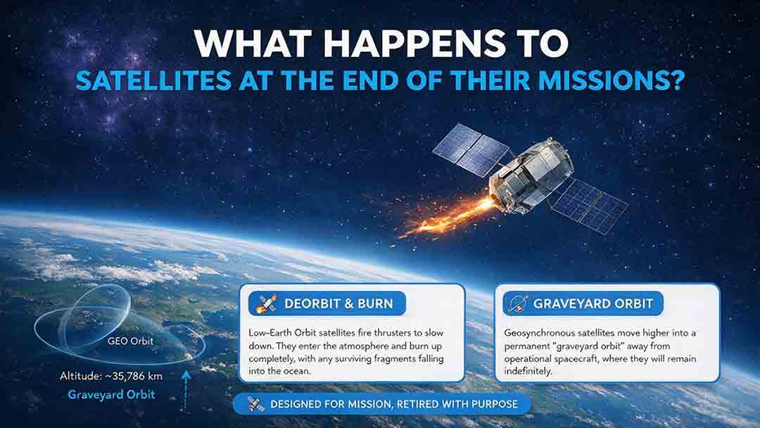
What Happens to Satellites at the End of Their Missions?
When a satellite reaches the end of its mission, it is not simply switched off and forgotten. Depending on its orbit, remaining fuel, control systems, and reentry risk, it may be guided into Earth’s atmosphere, moved to a higher disposal orbit, or left as a tracked non-functional object if recovery fails. This article explains how natural decay, assisted reentry, controlled reentry, graveyard orbits, and spacecraft passivation work. It also compares disposal strategies for low, medium, and geostationary Earth orbits, clarifies the limited scope of major regulatory requirements, and examines real-world examples such as ESA’s Aeolus and ClearSpace-1 missions. Original tools—including the Three-Finish Test and the Orbit–Control–Risk Framework—help readers distinguish mission completion from safe orbital and energy disposal. The guide is based on current NASA, FCC, ESA, UN, and IADC documentation.
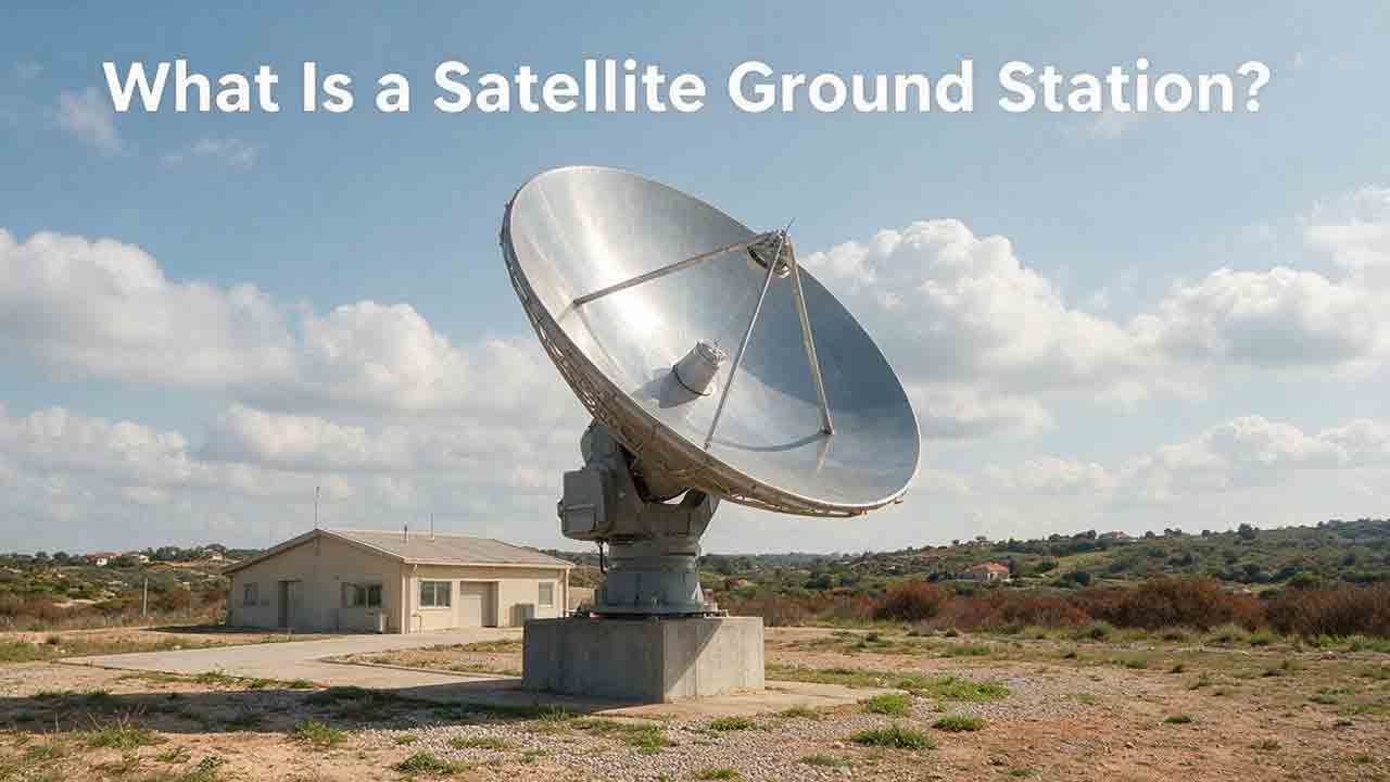
What Is a Satellite Ground Station?
A satellite ground station is the Earth-based link that allows spacecraft to exchange information with operators, processing systems, and data users. This guide explains how ground stations receive telemetry and payload data, support spacecraft tracking, and transmit authorized commands. It follows a satellite contact from pass prediction and antenna pointing through signal acquisition, decoding, terrestrial delivery, and mission use. Readers will also learn how antennas, amplifiers, modems, tracking systems, software, and networks work together; why location and orbit geometry matter; and how to estimate usable data from a single pass. The article includes an original PASS compatibility framework, a worked data-capacity example, a private-versus-managed-service comparison, a troubleshooting table, and a practical selection checklist. It also distinguishes ground stations, ground segments, and earth stations while explaining the engineering, security, licensing, and operational limits that mission teams must consider.
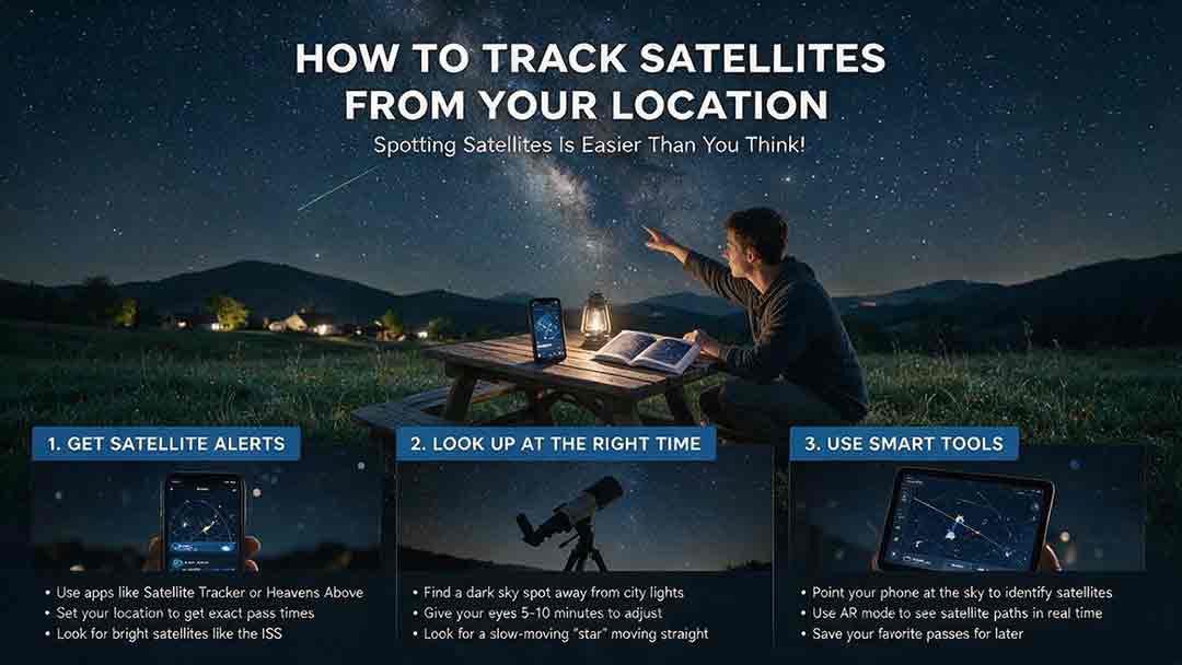
How to Track Satellites From Your Location
Tracking a satellite from your location becomes much easier once you know how to read a pass prediction. This practical guide explains how to select a reliable satellite tracker, confirm your observing location and local time, and interpret appearance direction, azimuth, elevation, maximum height, and visibility status. It provides a step-by-step beginner workflow for finding the International Space Station and other visible satellites, along with a comparison of tracking tools, a troubleshooting table, and a reusable observation log. Readers will also learn why a satellite may be above the horizon but remain invisible, how to distinguish satellites from aircraft, and how weather, local obstructions, outdated orbital data, and phone compass errors affect results. The guide includes the original CosmoBasics Local Pass Readiness Score for comparing viewing opportunities, plus advanced notes on TLE, GP, OMM, and the satellite catalog changes introduced in 2026.
Explore More Topics
How Do Satellites Detect Wildfires and Smoke?
Satellites detect wildfires by measuring unusual heat in infrared wavelengths, while visible, multispectral, and aerosol observations help analysts follow smoke across the atmosphere. This guide explains how systems such as GOES, VIIRS, MODIS, Landsat, and Sentinel contribute different pieces of the wildfire-monitoring picture. Readers will learn why a thermal hotspot is not the same as an exact fire perimeter, why satellite smoke imagery cannot replace ground-level PM2.5 measurements, and how clouds, terrain, viewing geometry, and satellite overpass timing can affect detection. The article also compares commonly used fire and smoke products, explains fire radiative power and the Normalized Burn Ratio, and provides a practical framework for choosing the right map. A documented Camp Fire example shows how multiple satellite and surface datasets can complement one another. Satellite information is valuable for situational awareness, but official emergency agencies remain the appropriate source for evacuation orders, road closures, and immediate safety decisions.
How Are Satellite Images Used in Agriculture?
Satellite images help farmers, agronomists, researchers, insurers, and public agencies monitor agricultural land across fields, regions, and growing seasons. This guide explains how optical, radar, thermal, and microwave satellite observations support crop-development monitoring, irrigation analysis, field mapping, flood and drought assessment, crop classification, and regional production forecasting. It distinguishes what satellites directly observe from calculated indices, classification results, and modeled estimates such as evapotranspiration. Readers will also learn how NDVI works, why spatial resolution and image timing matter, and when drones or field scouting are more appropriate. The original CosmoBasics SCALE Framework provides a practical way to decide whether satellite imagery fits a specific agricultural problem. Documented examples from USDA and OpenET show how operational products combine multiple observations, reference data, weather information, and models. Throughout the guide, satellite imagery is treated as a screening and monitoring tool—not a substitute for field verification, laboratory testing, or professional agricultural judgment.
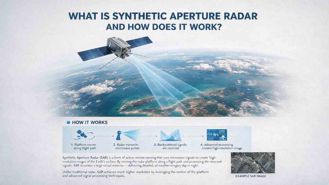
What Is Synthetic Aperture Radar and How Does It Work?
Synthetic aperture radar, or SAR, is an active Earth-observation technology that creates detailed images by transmitting microwave pulses and measuring the echoes returned from the surface. This article explains how a moving satellite or aircraft collects repeated observations to form a virtual antenna, why SAR can operate at night and through most cloud cover, and how amplitude, phase, wavelength, polarization, surface roughness, moisture, and viewing geometry affect radar imagery. It also distinguishes pixel spacing from true spatial resolution, provides a transparent range-resolution calculation, and compares SAR with optical satellite imagery. Practical sections examine scattering mechanisms, flood mapping, agriculture, forests, ice, maritime monitoring, and InSAR-based ground-deformation analysis. Original interpretation and data-selection frameworks help readers evaluate backscatter patterns, choose suitable products, identify common errors, troubleshoot unexpected results, and communicate uncertainty without treating derived radar products as guaranteed ground truth.