How to Track Satellites From Your Location

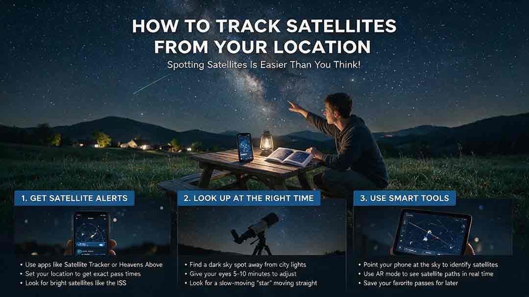
To track satellites from your location, use a location-based pass predictor, confirm your exact position and local time, and choose a pass marked visible. Note when and where the satellite will appear, its maximum elevation, and where it will disappear. Go outside several minutes early and look for a steady point of light moving smoothly along the predicted path.
Key Takeaways
- Satellite predictions depend on an accurate observing location, correct local time, and reasonably current orbital data.
- A satellite can be above your horizon without being visible to the unaided eye.
- The most useful pass details are appearance time, direction, maximum elevation, disappearance direction, and visibility status.
- Higher passes are usually easier because buildings, trees, terrain, and horizon haze block less of the path.
- The International Space Station is a practical first target because NASA provides location-specific viewing predictions.
Quick Start: Track a Satellite Tonight
- Open NASA Spot the Station or another location-based satellite tracker.
- Confirm your observing location, local date, time zone, and daylight-saving setting.
- Choose a pass explicitly described as visible.
- Note the appearance direction, start time, maximum elevation, and disappearance direction.
- Be outside about five minutes early and look for a steadily moving point of light.
A pass reaching more than about 40° above the horizon is often easier for a beginner because it is less vulnerable to buildings, trees, terrain, and thick horizon haze. This is a practical planning preference, not an official visibility threshold.
Important: A tracker can show that a satellite is above your horizon even when you cannot see it. For unaided-eye viewing, the object must usually be sunlit, bright enough, and positioned in a sufficiently dark and unobstructed sky.
Prediction notice: Satellite pass predictions are estimates. Actual visibility depends on orbital-data age, spacecraft maneuvers, weather, sky brightness, local obstructions, observer location, and the brightness of the object.
What This Guide Covers
This article shows how to:
- Choose an appropriate satellite-tracking tool.
- Set an accurate observing location.
- Read azimuth, elevation, pass times, and visibility information.
- Select a beginner-friendly pass.
- Distinguish a likely satellite from an aircraft.
- Troubleshoot a missed prediction.
- Record observations using a reusable log.
It also explains the 2026 change affecting traditional satellite catalog identifiers and legacy TLE-based software.
Methodology note: This guide was prepared by comparing official mission guidance, orbital-data documentation, tracking-software documentation, and practical observing requirements. The general workflow was reviewed across several tool categories, but every app and website named here was not independently field-tested on every device, operating system, or location.
Scope note: This article is intended for casual observation and education. Consumer pass predictors should not be used as the sole source for navigation, collision avoidance, professional antenna control, flight safety, or other safety-critical operations.
How Does Location-Based Satellite Tracking Work?
A satellite tracker combines a predicted orbit with the observer’s position and time.
The tracker needs:
- The satellite’s orbital data.
- The observer’s latitude and longitude.
- The observation date and time.
- A mathematical model that predicts the satellite’s motion.
It then calculates where the satellite should appear relative to that observer. The result may be shown as a sky chart, compass direction, azimuth, elevation, ground track, or list of upcoming passes.
Location matters because every observer has a different local horizon. A satellite passing nearly overhead for one person may appear low in the sky—or remain below the horizon—for someone hundreds of kilometers away.
Orbit height strongly affects apparent motion: LEO satellites cross the sky quickly, while higher-orbit spacecraft usually move more slowly from an observer’s perspective.
Tracking Is Not the Same as Seeing
A geometric pass occurs when the satellite rises above the observer’s calculated horizon. A visible pass occurs only when the lighting and observing conditions also make the satellite detectable.
Most satellites visible without a telescope are seen because they reflect sunlight. A favorable visual pass generally requires:
- The satellite to be illuminated by the Sun.
- The observer’s sky to be dark enough.
- The satellite to rise above local obstacles.
- The object to be bright enough for the conditions.
NASA explains that International Space Station sightings normally occur within a few hours of sunrise or sunset. During those periods, the station can remain sunlit while the sky below is relatively dark. See NASA’s Spot the Station guidance.
This is why a live world map is not enough. A map may show where a spacecraft is above Earth, while a visible-pass prediction evaluates the event from your location.
Which Satellite Tracker Should You Use?
The most suitable tool depends on whether you want to see the International Space Station, browse brighter satellites, simulate the sky, or work directly with orbital data.
On a phone, swipe horizontally if a table extends beyond the screen.
| Your goal | Suitable tool type | Useful features | Important limitation |
|---|---|---|---|
| See the International Space Station | Official NASA tracker | Local sighting times, alerts, maximum height, appearance direction | Primarily focused on the ISS |
| Browse bright satellite passes | Location-based prediction service | Visible-pass lists, brightness estimates, sky paths | Accuracy depends on location and current data |
| Identify objects in a simulated sky | Planetarium software | Sky charts, labels, star background, time controls | Catalogs must be updated |
| Follow a satellite over Earth | Live ground-track map | Current ground path, altitude, speed, map position | A ground track does not guarantee visibility |
| Build a custom tracking system | GP or OMM data with an SGP4-compatible library | Custom calculations and catalog access | Requires technical validation and maintenance |
A Practical Starting Point for the ISS
NASA Spot the Station provides local viewing opportunities, alerts, a real-time map, and explanations of pass fields.
NASA defines:
- Time as the beginning of the sighting opportunity in the selected location’s local time.
- Maximum Height as the station’s greatest elevation above the horizon.
- Appears as the direction where the visible pass begins.
- Disappears as the direction where the station leaves the observer’s view.
The ISS is useful for a first attempt because it can become conspicuously bright during favorable passes and does not require a telescope.
Tools for Tracking Multiple Satellites
Heavens-Above provides location-based predictions for the ISS, brighter satellites, recent launches, and other objects.
N2YO provides live ground tracks, pass predictions, azimuth, elevation, and orbital information for many cataloged objects.
These are examples, not endorsements or guarantees of accuracy. When evaluating any third-party tracker, check:
- Whether your location is correct.
- When the orbital data were updated.
- Whether times are local or UTC.
- How the service defines a visible pass.
- Whether the prediction includes illumination or shadow information.
- Whether the service distinguishes geometric passes from visible passes.
No consumer tracker can guarantee that weather, haze, obstructions, or an observer’s viewing direction will allow a successful sighting.
Desktop Sky Simulation
Stellarium can display artificial satellites against a simulated sky when its Satellites plug-in is enabled.
The official Stellarium plug-in documentation states that the plug-in manages an updatable satellite catalog and calculates positions using SGP4/SDP4-based methods.
A planetarium view can be especially helpful when a compass abbreviation is not enough. However, the observer location, computer clock, and satellite catalog must still be correct.
How to Track a Satellite Step by Step
Step 1: Set the Actual Observing Location
Enter the location where you will stand, not merely the nearest major city.
Depending on the tracker, you may be able to use:
- A map pin.
- Latitude and longitude.
- A saved observing site.
- Device location services.
- A nearby city as an approximation.
A city-level position may be adequate for a casual bright pass, but a precise location becomes more important for short events, high passes, photography, antenna pointing, and lunar or solar transit predictions.
Do not rely blindly on IP-based location detection. An internet connection can be associated with the wrong neighborhood, city, state, or time zone.
Step 2: Confirm the Date, Clock, and Time Zone
Check that the tracker shows the correct:
- Local date.
- Local time.
- Time zone.
- Daylight-saving status, where applicable.
- Twelve-hour or twenty-four-hour format.
A one-hour time-zone error is enough to miss a complete low-Earth-orbit pass.
NASA’s Spot the Station service presents sightings in the local time of the selected location. Other services may handle time zones differently, so verify the setting instead of assuming it is correct.
Enable automatic clock synchronization on your phone or watch. For ordinary viewing, being outside early matters more than trying to arrive at the exact predicted second.
Step 3: Choose a Beginner-Friendly Target
For a first observation, look for:
- A pass explicitly labeled visible.
- A relatively high maximum elevation.
- A clear appearance direction.
- A useful duration.
- An object expected to be bright.
- A path through an open portion of your sky.
The ISS is usually easier to plan for than an unfamiliar faint satellite. Many objects listed in public catalogs are too dim for unaided-eye observation.
A catalog may also contain rocket bodies, inactive spacecraft, fragments, and debris. Being cataloged does not mean an object is easily visible.
Step 4: Compare the Available Passes
Do not select a pass based on brightness alone.
Compare:
- Maximum elevation.
- Start time.
- Appearance direction.
- Disappearance direction.
- Predicted duration.
- Illumination status.
- Cloud cover.
- Local obstacles.
A high pass through an open sky may be more practical than a brighter low pass hidden behind trees or buildings.
Step 5: Identify the Direction Before the Pass
A prediction might say:
- Appears in the west-southwest.
- Reaches maximum elevation toward the northwest.
- Disappears in the northeast.
Identify these directions before the pass begins.
A phone compass can provide an initial reference, but it may be affected by:
- Metal railings.
- Vehicles.
- Power equipment.
- Speakers or magnetic cases.
- Poor calibration.
- Nearby structures.
Whenever possible, compare the compass with a map and fixed landmarks.
Step 6: Arrive Several Minutes Early
Move to a position with a clear view toward the predicted appearance direction.
Lower your screen brightness and let your eyes adjust. Avoid spending the entire pass looking at the app.
Do not stare only at the geometric horizon. A satellite may become visible only after climbing above buildings, trees, haze, or terrain.
Step 7: Look for Smooth Motion
A satellite usually appears as a moving point of light rather than a recognizable spacecraft.
Common visual characteristics include:
- Smooth motion against the stars.
- A generally consistent direction.
- No obvious engine sound.
- Gradual brightening or fading.
- A possible sudden disappearance at shadow entry.
Brightness can change as the distance, viewing angle, spacecraft orientation, and reflective surfaces change.
Step 8: Compare the Observation With the Prediction
After the pass, compare what you saw with:
- The predicted appearance time.
- The direction of travel.
- The point of maximum elevation.
- The disappearance direction.
- Any expected shadow entry.
This comparison helps distinguish the intended satellite from an aircraft, drone, or unrelated moving object.
It also improves your next attempt by revealing whether your local horizon, compass, or location setting needs adjustment.
How Do You Read a Satellite Pass Prediction?
Only a few fields are essential for ordinary observation.
| Pass field | Meaning | How to use it |
|---|---|---|
| Start or rise time | When the pass begins above a stated horizon threshold | Be outside before this time |
| Appears | Direction where the visible portion begins | Face this region first |
| Azimuth | Horizontal direction around the horizon | Convert it to a compass direction |
| Elevation | Angular height above the horizon | Higher values usually mean fewer obstacles |
| Maximum elevation | Highest point reached during the pass | Use it to compare pass quality |
| Culmination | Time of maximum elevation | Expect the object near its highest point |
| Disappears or sets | Direction where the listed pass ends | Use it to confirm the path |
| Duration | Length of the geometric or visible segment | Longer events give more time to locate the object |
| Magnitude | Estimate of apparent brightness | Lower or more negative values indicate greater brightness |
| Sunlit or eclipsed | Whether direct sunlight reaches the satellite | An eclipsed object is normally harder or impossible to see visually |
| Range | Distance from the observer to the satellite | Greater distance often reduces apparent brightness |
What Does Elevation Mean?
Elevation is the angle between the local horizon and an object in the sky.
- 0° is on the horizon.
- 30° is moderately low.
- 45° is halfway between the horizon and overhead.
- 90° is directly overhead.
NASA uses this interpretation for the ISS Maximum Height field in Spot the Station.
Low-elevation passes are commonly harder because the observer looks through more atmosphere and is more likely to encounter haze, light pollution, buildings, trees, hills, or mountains.
What Does Azimuth Mean?
Azimuth is the horizontal direction measured clockwise from north.
| Azimuth | Approximate direction |
|---|---|
| 0° or 360° | North |
| 45° | Northeast |
| 90° | East |
| 135° | Southeast |
| 180° | South |
| 225° | Southwest |
| 270° | West |
| 315° | Northwest |
For casual viewing, a clear compass sector is usually more useful than a direction expressed to a fraction of a degree.
Why Can a Satellite Disappear Before Reaching the Horizon?
The visible portion of a pass can end when the satellite enters Earth’s shadow.
The spacecraft may still be physically above your horizon, but it no longer reflects direct sunlight toward the observer. It can therefore fade or appear to vanish in a clear sky.
A tracker may label this event as shadow entry, eclipse entry, or the end of visibility.
CosmoBasics Local Pass Readiness Score
The CosmoBasics Local Pass Readiness Score was developed for this article as a quick planning aid.
It is not an official astronomical standard, a scientifically validated visibility model, or a substitute for a current pass prediction. Its purpose is to prevent observers from evaluating a pass using only one factor.
Assign each category 0, 1, or 2 points.
| Factor | 0 points | 1 point | 2 points |
|---|---|---|---|
| Location accuracy | Wrong or uncertain location | Correct city or nearby area | Exact observing site |
| Elevation and path | Low or heavily obstructed | Moderate elevation or partial obstruction | High pass through open sky |
| Illumination and darkness | Not listed as visible | Marginal twilight or uncertain status | Clearly listed as visible |
| Sky conditions | Cloudy or poor visibility | Patchy clouds or noticeable haze | Mostly clear sky |
| Preparation | Direction and time not checked | Basic details reviewed | Time, path, landmarks, and direction prepared |
Interpreting the Score
- 8–10 points: Strong candidate for a beginner.
- 5–7 points: Reasonable attempt, but one or more conditions may interfere.
- 0–4 points: Consider choosing another pass.
Example Score
Consider a hypothetical observer with:
- Exact observing location: 2 points
- High, unobstructed pass: 2 points
- Clearly listed as visible: 2 points
- Patchy clouds: 1 point
- Direction and timing prepared: 2 points
Total: 9 out of 10 — a strong beginner candidate.
This score does not guarantee a sighting. Patchy cloud, unexpected haze, orbital-data changes, or an incorrect identification can still affect the outcome.
Worked Example: Planning a Visible Pass
The following is a teaching example, not a report of an actual observation.
Suppose a tracker gives this prediction:
- Start time: 8:42 p.m.
- Appearance direction: west-southwest.
- Maximum elevation: 63°.
- Time of maximum elevation: 8:45 p.m.
- Disappearance direction: northeast.
- End time: 8:47 p.m.
- Visibility status: sunlit during the listed segment.
How to Use the Prediction
1. Confirm the observing site.
Check that the tracker uses the actual location rather than a city-center default.
2. Inspect the western sky.
Move if a building, hill, or row of trees blocks the west-southwest.
3. Arrive at about 8:37 p.m.
This provides time to verify directions and reduce screen brightness.
4. Start looking before 8:42 p.m.
The 8:45 p.m. time is the highest point, not the beginning of the pass.
5. Follow the predicted path.
A maximum elevation of 63° means the object should climb well above the horizon without passing directly overhead.
6. Check the behavior.
A steady light moving from west-southwest toward northeast would fit the prediction better than a flashing light that turns.
7. Record the outcome.
Note the actual appearance time, local obstructions, cloud cover, and disappearance point.
The value of this exercise is not the invented time or direction. It is the repeatable planning process.
How Can You Tell a Satellite From an Aircraft?
No single characteristic guarantees identification. Use several clues together.
| Observation | Likely satellite | Likely aircraft |
|---|---|---|
| Path | Smooth, predictable track | May turn or change direction |
| Lights | Often one steady point | Frequently multiple or flashing lights |
| Sound | Normally silent to the observer | Engine noise may be audible |
| Apparent speed | Usually changes gradually | Can vary with direction and distance |
| Disappearance | May fade at shadow entry | Less likely to vanish abruptly in clear sky |
| Prediction match | Time and path agree with tracker | Often does not match the predicted pass |
A distant aircraft can appear silent and steady. A rotating satellite can also vary in brightness. Identification should therefore rely on the complete path, timing, and behavior rather than one visual clue.
Stars and planets remain nearly fixed relative to nearby stars during a short observation. A low-Earth-orbit satellite crosses a noticeable part of the sky within minutes.
Why Did You Miss a Predicted Pass?
The Satellite Was Not Illuminated
A satellite can be above your horizon while inside Earth’s shadow.
If direct sunlight does not reach it, the object may be too faint to see even under clear skies.
The Sky Was Too Bright
Daylight and bright twilight can overwhelm reflected satellite light.
The ISS is usually easier to see when the station remains sunlit but the observer’s surroundings are darker. NASA explains this geometry in its ISS sighting guidance.
The Pass Was Too Low
Low passes are vulnerable to:
- Buildings.
- Trees.
- Hills and mountains.
- Haze.
- Thin cloud.
- Urban light pollution.
- An uneven local horizon.
The mathematical horizon used by a tracker is not necessarily the horizon visible from your observing position.
The Location Was Wrong
An incorrect map pin can shift the predicted path and timing.
Recheck:
- Latitude and longitude.
- The selected city.
- Device location permission.
- Observation-site elevation, if the tool uses it.
- Whether the app reverted to a previous location.
The Time Setting Was Wrong
Possible causes include:
- An incorrect time zone.
- Daylight-saving mismatch.
- Confusing local time with UTC.
- Manual clock drift.
- Opening a prediction for the wrong date.
Check the complete date and time rather than the hour alone.
The Orbital Data Were Old
A satellite element set describes the orbit most accurately near its stated epoch. Prediction quality generally worsens as the data age.
The Skyfield Earth satellite documentation recommends obtaining fresh elements for later dates rather than treating an old element set as permanently accurate.
For casual viewing, refresh the tracker before leaving home. For photography, radio work, or telescope pointing, check the element epoch and use current data.
The Satellite Maneuvered
Operational spacecraft may change their orbits. Atmospheric drag can also affect low-Earth-orbit predictions.
A tracking service needs updated orbital information before it can reflect the new trajectory accurately.
The Phone Compass Was Wrong
A correct pass prediction can still appear incorrect if the phone points toward the wrong part of the sky.
Try:
- Recalibrating the compass.
- Removing magnetic accessories.
- Moving away from vehicles and metal railings.
- Comparing the phone with a map.
- Using fixed landmarks instead of augmented reality alone.
Satellite-Tracking Troubleshooting Table
| Problem | Likely explanation | Practical response |
|---|---|---|
| Nothing appeared at the listed start time | Wrong direction, obstruction, cloud, or time setting | Check the appearance sector and arrive earlier |
| The object appeared later than predicted | Local obstruction or stale data | Refresh the prediction and improve the horizon view |
| The light vanished midway across the sky | Shadow entry or cloud | Check the predicted illumination status |
| The light flashed repeatedly | Aircraft or changing reflection angle | Compare the complete path and timing |
| The app points in the wrong direction | Compass error or magnetic interference | Use a map and fixed landmarks |
| Two trackers show different times | Different data ages, locations, or horizon rules | Compare settings and update times |
| No visible passes are listed | Object is too faint or geometry is unfavorable | Choose a brighter object or another date |
| A recently cataloged object is missing | Catalog or software-format limitation | Update the software and check GP or OMM support |
How Accurate Are Satellite Predictions?
A public pass prediction is a calculated estimate, not a guaranteed appointment.
Its reliability depends on:
- The age and quality of the orbital data.
- The propagation model.
- Recent spacecraft maneuvers.
- Atmospheric drag.
- Observer coordinates.
- Time accuracy.
- The horizon threshold.
- The service’s definition of visibility.
Near-term predictions from a maintained service are normally adequate for casual observation of a bright object. More demanding tasks require tighter controls.
Examples include:
- Telescope imaging.
- Antenna pointing.
- Satellite radio contacts.
- Narrow-field photography.
- Lunar transit photography.
- Solar transit photography.
These uses may require current orbital elements, precise coordinates, synchronized clocks, independent prediction checks, and equipment-specific planning.
What Are TLE, GP, and OMM Data?
A Two-Line Element set, or TLE, is a fixed-format representation of an Earth-orbiting object’s orbital parameters for use with compatible propagation models such as SGP4.
The traditional field layout is documented in the CelesTrak TLE format reference.
General Perturbations data, or GP data, are orbital element records intended for use with General Perturbations models such as SGP4.
An Orbit Mean-Elements Message, or OMM, is a standardized and more extensible way to distribute orbital element information. OMM-compatible data can be provided in formats such as XML, KVN, JSON, and CSV.
For ordinary visual tracking, a maintained consumer service should handle these details internally.
The Five-Digit TLE Catalog Limit Was Reached in July 2026
This section is mainly for developers and advanced users. Beginners can skip it without affecting ordinary visual tracking.
The traditional numeric TLE satellite-number field contains five characters. CelesTrak reported that the available five-digit catalog-number sequence was exhausted on July 11, 2026, when the official catalog moved into six-digit identifiers.
CelesTrak states that newly cataloged six-digit objects are not available through its traditional numeric TLE delivery. Its current GP data page directs software users toward newer formats that do not depend on the five-digit numeric field.
Space-Track also documents an Alpha-5 encoding that can represent part of the expanded range within a TLE-style field. However, Space-Track recommends extensible formats such as JSON, XML, KVN, and CSV for better compatibility with expanded catalog identifiers.
CelesTrak’s GP data-format documentation supports queries using catalog identifiers up to nine digits and provides GP data in OMM XML, OMM KVN, JSON, and CSV formats.
The practical conclusion is straightforward:
- Do not assume every catalog identifier contains five numeric digits.
- Do not assume all software interprets Alpha-5 identifiers correctly.
- Prefer current GP or OMM-compatible formats when broad catalog coverage is required.
- Test how software handles recently cataloged six-digit objects.
Older applications may continue to display established satellites while silently omitting newer catalog entries.
What Equipment Do You Need?
Basic Visual Tracking
For a bright pass, you normally need only:
- A current prediction.
- An accurate clock.
- A clear observing location.
- Basic compass awareness.
NASA states that the ISS can be seen without a telescope during suitable viewing opportunities.
Are Binoculars Helpful?
Binoculars may help with fainter satellites, but a moving object can be difficult to acquire through a narrow field of view.
A practical sequence is:
- Locate the satellite with the unaided eye.
- Follow its path for several seconds.
- Raise the binoculars while maintaining the same direction.
- Return to unaided viewing if the object is difficult to follow.
Eye-safety warning: Never look at or near the Sun through ordinary binoculars, a telescope, a camera lens, or other unfiltered optics. Concentrated sunlight can cause severe and permanent eye injury.
NASA states that solar observation through cameras, telescopes, or binoculars requires a suitable solar filter secured over the front of the optics. Regular sunglasses and handheld eclipse viewers are not substitutes for front-mounted optical filters. Review NASA’s solar-viewing safety guidance before any observation near the Sun.
Do You Need a Telescope?
A telescope is not recommended for a beginner’s first satellite pass. Its narrow field of view makes manual acquisition difficult.
A telescope may be useful for advanced goals such as:
- Imaging the ISS.
- Recording faint satellites.
- Identifying geostationary objects.
- Following a computer-generated path.
- Capturing a carefully predicted lunar transit.
Solar transit observation introduces serious eye and equipment hazards and should not be attempted with unfiltered optics.
Which Approach Fits Your Goal?
Beginners
Start with the ISS or another bright object, choose a high visible pass, and use only the start direction, maximum elevation, and end direction.
The goal of the first attempt is not to master orbital mechanics. It is to connect a prediction with a real moving object.
Families and Educators
Choose a pass that:
- Occurs at a convenient time.
- Lasts long enough for several people to find it.
- Reaches a useful elevation.
- Can be viewed from a safe, accessible location.
Explain the path before the pass begins so participants do not spend the event looking at a phone.
Amateur Astronomers
Useful features may include:
- Updated orbital elements.
- Shadow entry and exit.
- Magnitude estimates.
- Sky charts.
- Star-background simulation.
- Telescope-control support.
A planetarium program can help identify the track, but its catalog and observer settings must be current.
Photographers
Confirm:
- Exact observing coordinates.
- Current orbital data.
- Clock synchronization.
- Lens field of view.
- Intended composition.
- Local obstructions.
- Whether the prediction is geometric or visible.
A broad ISS trail is more forgiving than a narrow lunar or solar transit. Consumer pass apps should not be treated as sufficient planning tools for every specialized shot.
Amateur-Radio Operators
A radio pass may be usable even when the satellite is not optically visible.
Radio planning can additionally require:
- Acquisition and loss of signal.
- Operating frequency.
- Doppler correction.
- Published operating schedules.
- Antenna characteristics.
- Local radio-horizon information.
Tracking, antennas, telemetry, and command links are all parts of the broader satellite ground-segment workflow.
Software Developers
Use a maintained SGP4-compatible implementation and a current orbital-data source.
Also verify:
- Supported identifier length.
- OMM or GP import support.
- Alpha-5 behavior, if applicable.
- Epoch handling.
- Time-scale assumptions.
- Error handling for missing objects.
- Data-source usage policies.
A program that successfully parses an older five-digit TLE is not necessarily ready for the post-July-2026 catalog.
Can You Track LEO, MEO, and GEO Satellites?
Yes, but “tracking” does not always mean watching an obvious light cross the sky.
Low Earth Orbit
Low-Earth-orbit satellites can cross a large portion of the sky within minutes. Bright LEO objects are the most intuitive targets for unaided-eye pass tracking.
Medium Earth Orbit
Medium-Earth-orbit satellites usually move more slowly against the background stars and are often too faint for casual unaided-eye observation.
Locating them generally requires more precise coordinates, optical equipment, or imaging.
Geostationary Orbit
A geostationary satellite remains near the same direction in the sky because its orbital period and direction correspond closely to Earth’s rotation.
Instead of sweeping from horizon to horizon, it appears nearly fixed while the stars move around it. Identification typically requires:
- A telescope or sensitive camera.
- Accurate coordinates.
- A star chart.
- Comparison over time.
The result is still satellite tracking, even though the apparent movement is very different from a LEO pass.
Common Satellite-Tracking Mistakes
Using a Ground-Track Map as a Visibility Prediction
A world map shows where a satellite is over Earth. It does not prove that the object is above your horizon, sunlit, bright enough, or visible through your weather.
Looking Only at the Maximum-Elevation Time
Maximum elevation occurs after the pass has already begun.
Use the listed appearance time and direction to know when and where to start looking.
Choosing Brightness Without Checking the Path
A bright prediction behind a building is less useful than a slightly fainter pass across open sky.
Trusting Automatic Location Detection
Open the location on a map and confirm that it matches the observing site.
Assuming Every Moving Light Is a Satellite
Use the complete direction, timing, behavior, and disappearance point before making an identification.
Reusing Old Orbital Data
Refresh saved elements before an important observation, especially for low-orbit, maneuvering, or recently launched objects.
Watching the App Instead of the Sky
Use the screen to prepare. Once the pass begins, concentrate on the predicted path.
Satellite-Tracking Checklist
Before the Pass
- Confirm the observing location.
- Check the date, local time, and time zone.
- Refresh the prediction or orbital data.
- Choose a pass explicitly listed as visible.
- Note the appearance direction.
- Check the maximum elevation.
- Note the disappearance direction.
- Review cloud cover and visibility.
- Identify local obstacles.
- Set an alert several minutes early.
- Lower screen brightness.
During the Pass
- Face the appearance direction early.
- Scan above the visible horizon.
- Look for smooth motion.
- Compare the track with the prediction.
- Watch for flashing lights or turns.
- Avoid using optics anywhere near the Sun.
After the Pass
- Record the actual appearance time.
- Record the disappearance time and direction.
- Note cloud, haze, and obstructions.
- Check whether shadow entry was predicted.
- Correct location or compass settings if needed.
- Use the result to plan the next pass.
Satellite Observation Log
Copy this template for repeated observations:
Date:
Observing location:
Satellite or object name:
Tracker used:
Prediction updated at:
Predicted appearance time:
Actual appearance time:
Predicted appearance direction:
Maximum elevation:
Predicted disappearance direction:
Sky conditions:
Local obstructions:
Actual disappearance time:
Possible shadow entry:
Identification confidence:
Notes for the next pass:
A log can reveal patterns that an app cannot know, such as a building blocking the western horizon or haze regularly obscuring low northern passes.
Start With One Clearly Visible Pass
For a first attempt, select one visible ISS or bright-satellite pass with a useful elevation and an unobstructed path. Confirm the location and local time, face the appearance direction early, and compare the moving light with the predicted route.
After you can reliably interpret a basic pass, you can add planetarium software, binoculars, radio equipment, photography planning, or direct orbital-data processing. The advanced tools become more useful once the basic relationship between time, direction, elevation, illumination, and local conditions is familiar.
How This Article Was Reviewed
Technical terminology, tracking instructions, safety guidance, and orbital-data claims were checked against current documentation from NASA, Space-Track, CelesTrak, Stellarium, and Skyfield in August 2026.
The article compares categories of satellite-tracking tools but does not claim that every named app or website was independently tested on every device, operating system, network, or observing location.
The CosmoBasics Local Pass Readiness Score is an original editorial planning framework. It is not presented as a scientific visibility model or as evidence that a sighting will occur.
Frequently Asked Questions
Can I track every satellite from my location?
No. You can calculate the positions of many publicly cataloged satellites, but only a smaller number are bright enough, suitably illuminated, and positioned above your local horizon for visual observation.
Some objects may also be absent from public data, too faint for consumer equipment, or difficult to identify without specialized tools.
Why does a satellite suddenly disappear in a clear sky?
A satellite can disappear when it enters Earth’s shadow. The spacecraft remains in orbit and may still be above your horizon, but it stops reflecting direct sunlight toward you.
Thin cloud can cause a similar effect, so compare the disappearance point with the tracker’s illumination information.
Can I see satellites during the day?
Occasionally, a very bright spacecraft may be detectable in daylight under favorable conditions, but ordinary unaided-eye satellite watching is much easier against a darker sky.
Never sweep the daytime sky near the Sun with binoculars, a telescope, or a camera lens unless the equipment has a correctly installed front-mounted solar filter and you understand the required safety procedures.
How far in advance should I trust a pass prediction?
Near-term predictions based on current data are generally preferable. Reliability can decrease as the orbital elements age, especially for low satellites affected by drag or spacecraft that maneuver.
Refresh the prediction on the day of the observation when timing matters.
Why do two trackers give different pass times?
Two trackers may use different orbital-data updates, observer coordinates, elevation thresholds, time settings, or definitions of a visible pass.
Compare the selected location, time zone, element age, minimum elevation, and illumination settings before deciding that one prediction is wrong.
Can I track geostationary satellites with the naked eye?
Most geostationary satellites are not practical unaided-eye targets. They are normally identified with accurate coordinates, a telescope or sensitive camera, and a star chart.
Their apparent motion is subtle because they remain near the same direction relative to the ground.
Sources
Official Mission and Safety Guidance
- NASA — Spot the Station
- NASA — Spot the Station Frequently Asked Questions
- NASA Science — Eclipse and Solar Viewing Safety
Orbital Data and Format Documentation
- Space-Track.org — Documentation
- CelesTrak — Current GP Element Sets
- CelesTrak — A New Way to Obtain GP Data
- CelesTrak — NORAD Two-Line Element Set Format
Tracking-Software Documentation
- Stellarium — Satellites Plug-in Documentation
- Skyfield — Earth Satellite Documentation
- Skyfield — Earth Satellite API Reference
Location-Based Tool Examples
Editorial review: Technical claims, safety guidance, orbital-data terminology, and external references were checked against current NASA, CelesTrak, Space-Track, Stellarium, and Skyfield documentation in August 2026. This was an editorial source review, not an institutional peer review or certification.
More from Orbits, Tracking & Ground Systems
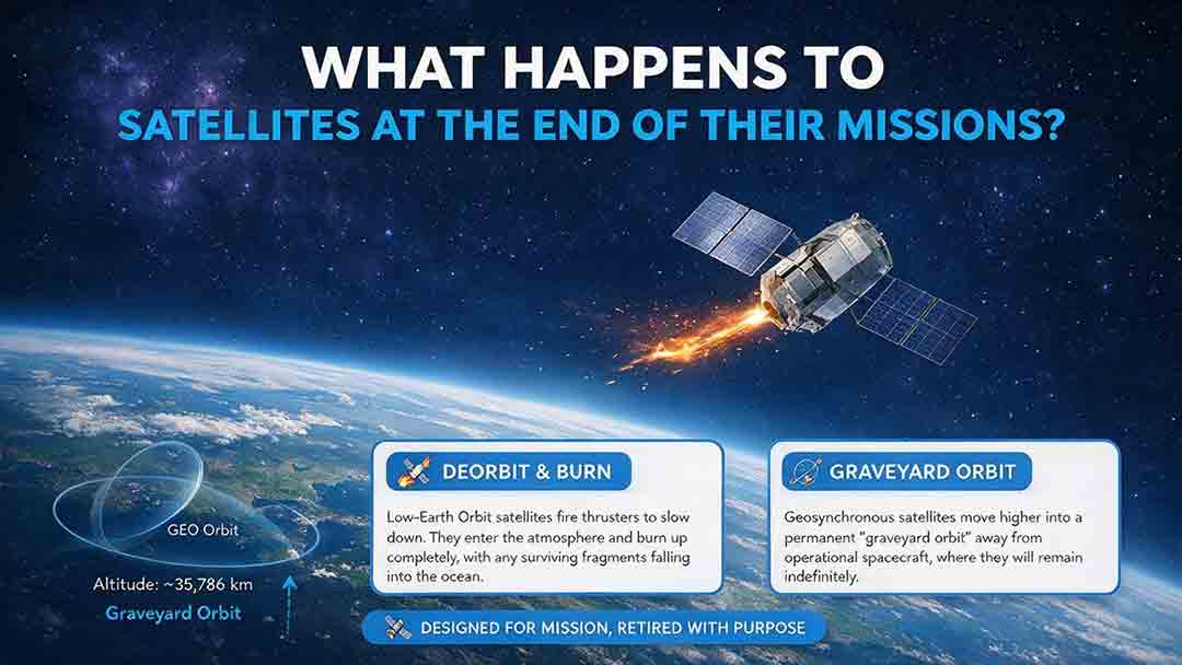
What Happens to Satellites at the End of Their Missions?
When a satellite reaches the end of its mission, it is not simply switched off and forgotten. Depending on its orbit, remaining fuel, control systems, and reentry risk, it may be guided into Earth’s atmosphere, moved to a higher disposal orbit, or left as a tracked non-functional object if recovery fails. This article explains how natural decay, assisted reentry, controlled reentry, graveyard orbits, and spacecraft passivation work. It also compares disposal strategies for low, medium, and geostationary Earth orbits, clarifies the limited scope of major regulatory requirements, and examines real-world examples such as ESA’s Aeolus and ClearSpace-1 missions. Original tools—including the Three-Finish Test and the Orbit–Control–Risk Framework—help readers distinguish mission completion from safe orbital and energy disposal. The guide is based on current NASA, FCC, ESA, UN, and IADC documentation.
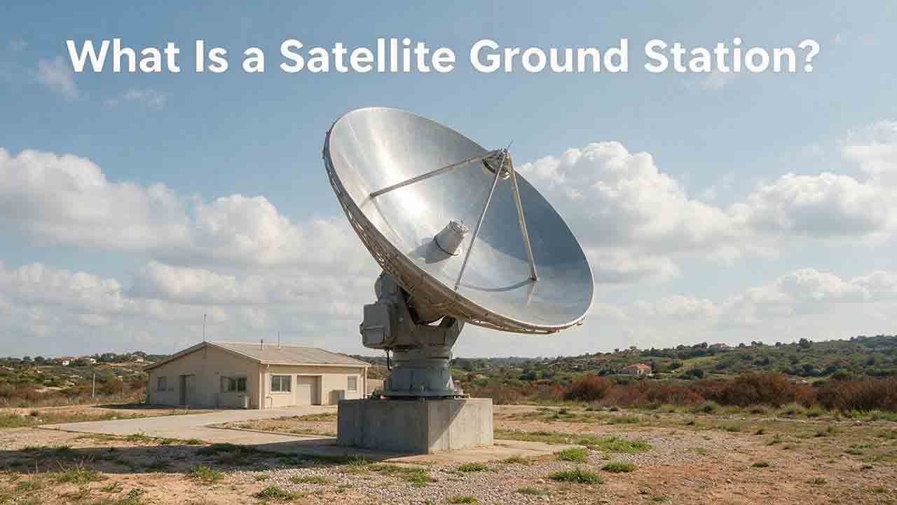
What Is a Satellite Ground Station?
A satellite ground station is the Earth-based link that allows spacecraft to exchange information with operators, processing systems, and data users. This guide explains how ground stations receive telemetry and payload data, support spacecraft tracking, and transmit authorized commands. It follows a satellite contact from pass prediction and antenna pointing through signal acquisition, decoding, terrestrial delivery, and mission use. Readers will also learn how antennas, amplifiers, modems, tracking systems, software, and networks work together; why location and orbit geometry matter; and how to estimate usable data from a single pass. The article includes an original PASS compatibility framework, a worked data-capacity example, a private-versus-managed-service comparison, a troubleshooting table, and a practical selection checklist. It also distinguishes ground stations, ground segments, and earth stations while explaining the engineering, security, licensing, and operational limits that mission teams must consider.
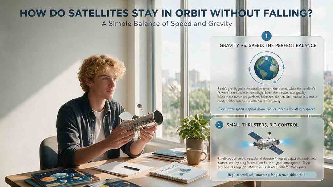
How Do Satellites Stay in Orbit Without Falling?
Satellites stay in orbit because gravity continually pulls them toward Earth while their sideways velocity carries them forward fast enough to keep missing the surface. This guide explains that balance through clear orbital mechanics, a worked calculation for a simplified 400-kilometer circular orbit, and a one-second example showing how gravity bends a satellite’s path. It also compares low Earth orbit, medium Earth orbit, and geostationary orbit, explaining why orbital speed decreases as altitude increases. Readers will learn why satellites do not need continuous engine thrust, why the International Space Station requires periodic reboosts, how atmospheric drag and other disturbances change real orbits, and why inactive satellites can continue circling Earth. Practical tables, a three-check orbit framework, troubleshooting guidance, and a reality-check checklist help readers evaluate claims about satellites falling, drifting, reentering, or appearing stationary above one location.
Explore More Topics
How Do Satellites Detect Wildfires and Smoke?
Satellites detect wildfires by measuring unusual heat in infrared wavelengths, while visible, multispectral, and aerosol observations help analysts follow smoke across the atmosphere. This guide explains how systems such as GOES, VIIRS, MODIS, Landsat, and Sentinel contribute different pieces of the wildfire-monitoring picture. Readers will learn why a thermal hotspot is not the same as an exact fire perimeter, why satellite smoke imagery cannot replace ground-level PM2.5 measurements, and how clouds, terrain, viewing geometry, and satellite overpass timing can affect detection. The article also compares commonly used fire and smoke products, explains fire radiative power and the Normalized Burn Ratio, and provides a practical framework for choosing the right map. A documented Camp Fire example shows how multiple satellite and surface datasets can complement one another. Satellite information is valuable for situational awareness, but official emergency agencies remain the appropriate source for evacuation orders, road closures, and immediate safety decisions.
How Are Satellite Images Used in Agriculture?
Satellite images help farmers, agronomists, researchers, insurers, and public agencies monitor agricultural land across fields, regions, and growing seasons. This guide explains how optical, radar, thermal, and microwave satellite observations support crop-development monitoring, irrigation analysis, field mapping, flood and drought assessment, crop classification, and regional production forecasting. It distinguishes what satellites directly observe from calculated indices, classification results, and modeled estimates such as evapotranspiration. Readers will also learn how NDVI works, why spatial resolution and image timing matter, and when drones or field scouting are more appropriate. The original CosmoBasics SCALE Framework provides a practical way to decide whether satellite imagery fits a specific agricultural problem. Documented examples from USDA and OpenET show how operational products combine multiple observations, reference data, weather information, and models. Throughout the guide, satellite imagery is treated as a screening and monitoring tool—not a substitute for field verification, laboratory testing, or professional agricultural judgment.
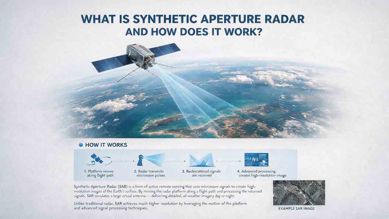
What Is Synthetic Aperture Radar and How Does It Work?
Synthetic aperture radar, or SAR, is an active Earth-observation technology that creates detailed images by transmitting microwave pulses and measuring the echoes returned from the surface. This article explains how a moving satellite or aircraft collects repeated observations to form a virtual antenna, why SAR can operate at night and through most cloud cover, and how amplitude, phase, wavelength, polarization, surface roughness, moisture, and viewing geometry affect radar imagery. It also distinguishes pixel spacing from true spatial resolution, provides a transparent range-resolution calculation, and compares SAR with optical satellite imagery. Practical sections examine scattering mechanisms, flood mapping, agriculture, forests, ice, maritime monitoring, and InSAR-based ground-deformation analysis. Original interpretation and data-selection frameworks help readers evaluate backscatter patterns, choose suitable products, identify common errors, troubleshoot unexpected results, and communicate uncertainty without treating derived radar products as guaranteed ground truth.