Why Does Your Phone Sometimes Show the Wrong Location?

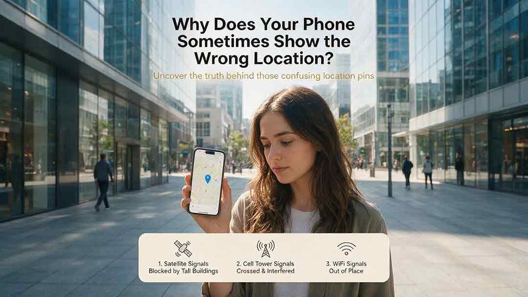
Your phone can show the wrong location because it does not rely on GPS alone. It combines satellite signals with Wi-Fi, cellular towers, Bluetooth, motion sensors, app permissions, and map data. Weak or reflected signals, an old cached position, approximate permission, battery restrictions, or an incorrect map pin can move the blue dot even when the phone’s hardware is working normally.
Key Takeaways
- A wrong blue dot does not automatically mean the phone’s GPS hardware has failed.
- The fastest useful test is to compare two location apps indoors and again in an open outdoor area.
- A correct blue dot beside a wrong address usually indicates a map-data problem.
- Compass calibration can improve the direction indicator, but usually not a position that is far away.
- Consider manufacturer support only when multiple apps remain seriously inaccurate outdoors after settings and software checks.
This guide will help you determine whether the problem follows one app, one environment, the map, or the entire device—and then choose the least disruptive response.
Editorial note: This guide is based on first-party technical documentation and practical troubleshooting criteria rather than hands-on phone testing. The Two Apps, Two Places Rule and PLACE Test are CosmoBasics editorial tools, not official Apple, Google, or GPS industry diagnostic standards.
In This Guide
- Diagnose the location error
- Use the Two Apps, Two Places Rule
- Use the PLACE Test
- Fix an incorrect phone location
- Understand where location errors occur
- Review the common causes
- Understand expected phone accuracy
- Know when to contact manufacturer support
- Read the frequently asked questions
What Does Your Location Error Usually Mean?
The pattern of the error often reveals more than the distance by which the phone is wrong.
A problem affecting only one app points toward different causes than a problem affecting every app outdoors. A correct blue dot beside an incorrect street name also requires a different response from a blue dot that jumps across several blocks.
| What you see | Most likely explanation | Is manufacturer support likely to be needed? |
|---|---|---|
| Only one app shows the wrong location | App permission, cached data, or an app-specific issue | Usually not |
| Every app is inaccurate indoors but improves outdoors | Blocked or reflected satellite signals | Usually not |
| The blue dot is correct but the address is wrong | Map or address database error | No |
| The dot is correct but the direction beam is wrong | Compass or orientation problem | Usually not |
| The dot shows somewhere you visited earlier | Old cached location or delayed update | Usually not |
| Several apps remain far off in open sky | System, software, antenna, or hardware issue | Possibly |
| Persistent errors began after impact, liquid exposure, or repair | Possible device damage | More plausible |
Important: The final column is an escalation guide, not a diagnosis. Permissions, software, environmental conditions, and map data should be ruled out before assuming that a phone component has failed.
A useful troubleshooting principle is to ask what the error follows:
- If it follows one app, investigate the app.
- If it follows one building or neighborhood, investigate signal conditions.
- If it follows the address but not the blue dot, investigate the map.
- If it follows the phone everywhere, investigate the system or device.
This “follow the error” approach is more informative than repeatedly switching location settings off and on without comparing the results.
What Is the Fastest Way to Diagnose the Problem?
Use the Two Apps, Two Places Rule.
This CosmoBasics method helps separate app-level, environmental, mapping, and device-wide errors before you reset settings or decide whether a professional assessment is appropriate.
How to Run the Test
- Open two reputable location or navigation apps, preferably from different developers.
- Check the blue dot in your current indoor location.
- Move to an open outdoor area with a clear view of the sky.
- Check both apps again.
- Compare the blue dot, address label, accuracy circle, and direction indicator.
How to Interpret the Result
| Test result | Most likely explanation |
|---|---|
| Both apps become accurate outdoors | Indoor obstruction or reflected signals |
| One app stays wrong while the other is correct | App permission, cache, update logic, or provider-specific map data |
| Both apps show the correct dot but the wrong address | Address or map-data problem |
| The dot is correct but the direction indicator is wrong | Compass or heading problem |
| Both apps remain seriously wrong outdoors | System-wide setting, software, antenna, or hardware problem |
| One map provider is correct and another is not | Provider-specific cartography problem |
What This Test Cannot Prove
Two apps may use the same operating-system location service. Agreement between them does not prove that every sensor or antenna is functioning correctly.
The apps may also use overlapping map data. An incorrect address can therefore appear in both.
Use this rule to classify the problem, not as a substitute for manufacturer diagnostics.
How Can the PLACE Test Identify the Cause?
The PLACE Test checks five common parts of a phone-location problem.
Its purpose is to identify the most relevant next action before using broad resets or deciding whether a professional assessment is appropriate.
P — Permissions
Check whether the affected app can access location and whether precise access is enabled.
Possible signs include:
- The app shows only a broad neighborhood.
- One app works while another does not.
- Precise Location is disabled.
- Background tracking stops when the app closes.
- The app repeatedly requests permission.
Action: Give the app only the access level its function requires. Navigation usually benefits from precise access while the app is in use.
L — Line of Sight
Check whether the phone has a clear view of the sky.
Possible signs include:
- The position improves outdoors.
- The dot jumps between streets near tall buildings.
- The accuracy circle becomes much larger indoors.
- Location fails in garages, tunnels, or large buildings.
Action: Move to an open area and request a new location.
A — App Freshness
Check whether the app is displaying a recent position.
Possible signs include:
- The dot remains at a place you recently left.
- The app says the location is old or unavailable.
- Reopening the app changes the position.
- Another app already shows the correct place.
Action: Tap the current-location control, reopen the app, and install any relevant app update.
C — Cartography
Check whether the coordinate is correct but the map content is wrong.
Possible signs include:
- The blue dot matches your physical position, but the address does not.
- A building entrance is shown on the wrong side.
- Deliveries are routed to the neighboring property.
- One map provider shows a road or business that another does not.
Action: Report the incorrect map information instead of changing GPS settings.
E — Environment and Equipment
Check system restrictions, device condition, and whether the error affects the entire phone.
Possible signs include:
- Battery-saving settings limit updates.
- Several apps show the same error.
- The problem continues in open sky.
- The issue began after impact, liquid exposure, or device repair.
- Other phones in the same place work normally.
Action: Review settings and software first. Contact the manufacturer only if the problem remains after controlled outdoor testing.
How Do You Fix an Incorrect Phone Location?
Work through the following steps in order. Stop when the position becomes reliable.
1. Separate the Blue Dot, Address, and Direction Indicator
These elements represent different information:
- The blue dot estimates the phone’s coordinate.
- The accuracy circle represents uncertainty in the location estimate.
- The beam or arrow estimates which direction the phone is facing.
- The address label comes from a mapping database.
A wrong address does not necessarily mean the coordinate is wrong. A wrong direction arrow does not necessarily mean the coordinate is wrong either.
Google Maps explains in its location-accuracy guidance that a wide blue circle and a low-accuracy message indicate uncertainty about the phone’s position. The app may also offer troubleshooting or calibration instructions.
The circle should be treated as an estimate, not as a guaranteed error boundary or proof of hardware condition.
2. Request a Fresh Location
Tap the app’s current-location button and keep the app open briefly.
Some apps initially display a cached or last known location because it is fast and power-efficient. Google’s Fused Location Provider documentation distinguishes a stored last-known position from a request for a current location.
Try:
- Tapping the current-location control
- Closing and reopening the app
- Checking whether the displayed location has a timestamp
- Comparing the result with a second app
An old location is especially plausible after travel, a restart, airplane mode, or a period without usable signals.
3. Move to an Open Outdoor Area
Satellite navigation performs best when the phone can receive signals from several parts of the sky.
Move away from:
- Tall buildings
- Metal roofs
- Covered parking structures
- Bridges
- Dense trees
- Large vehicles
- Tunnels
- Mountain walls
According to GPS.gov’s GPS Accuracy guidance, buildings, bridges, trees, and similar obstructions can block satellite signals.
Signals can also reflect from walls or buildings before reaching the phone. This is called multipath. Because the reflected signal follows a longer path, the receiver may estimate its distance from a satellite incorrectly.
Multipath can make a stationary phone appear to drift or place a pedestrian on a neighboring street.
If the position improves outdoors, manufacturer support is unlikely to be the first appropriate step.
4. Check Location and Precise-Location Permissions
Make sure the phone’s main location service is enabled, then check the affected app.
On current iPhone versions, Apple documents this general path:
Settings → Privacy & Security → Location Services → [App]
Apple’s Location Services guidance explains that supported apps can receive precise or approximate location access, depending on the user’s choice.
On many Android devices, the path is similar to:
Settings → Location → App location permissions → [App]
Android’s official guide to managing app location permissions explains that available choices can include access all the time, only while using the app, each time the app is opened, or no access. When supported, users can also turn precise location on or off.
Menu names vary with:
- Device manufacturer
- Android or iOS version
- Region
- Device-management policy
Samsung, Google Pixel, Motorola, Xiaomi, and other Android phones may use different labels. Follow the current manufacturer instructions when the path does not match.
For most navigation apps, precise access while the app is in use is a reasonable starting point. Permanent background access should be granted only when the feature genuinely needs it.
5. Enable Supporting Location Signals
A smartphone does not rely on satellite signals alone.
Apple explains that Location Services may use GPS, Bluetooth, crowd-sourced Wi-Fi hotspots, and cellular towers.
Google’s Android Location Accuracy documentation explains that supported Android devices may combine GPS and wireless signals with accelerometer, gyroscope, and barometer data.
These supporting inputs can improve:
- Initial location speed
- Indoor positioning
- Accuracy near large buildings
- Continuity when satellite visibility is poor
- Recognition of nearby places
The phone may use nearby Wi-Fi information without connecting to every detected network.
Does GPS Require an Internet Connection?
No. A compatible GNSS receiver can calculate coordinates from satellite signals without a normal internet connection.
Internet access can still help by providing:
- Assistance data that may speed up the first fix
- Wi-Fi and cellular positioning information
- Map tiles and address labels
- Traffic data
- Search results
- Route updates
A phone can therefore know its coordinates while failing to display a usable online map.
Google Maps allows users to download areas for offline navigation, although availability varies by region. Public-transit, cycling, and walking directions may be unavailable offline, and offline driving generally does not include traffic information or alternative routes.
6. Check Battery and Background Restrictions
Frequent high-accuracy updates can use more power than occasional approximate updates.
Battery Saver, Low Power Mode, app sleep settings, and background restrictions may reduce how often an app receives a new position.
Google Maps recommends reviewing Battery Saver when the location jumps around. Its troubleshooting guidance also covers connectivity, weak GPS or Wi-Fi signals, compass calibration, airplane mode, and restarting the device.
For testing:
- Temporarily disable Battery Saver or Low Power Mode.
- Remove aggressive battery restrictions from the affected app.
- Reopen the app and request a new location.
- Restore your preferred power settings after the test.
There is no need to leave every power-saving feature disabled permanently.
7. Review Airplane Mode Without Assuming GPS Needs the Internet
Airplane mode may disable cellular, Wi-Fi, or Bluetooth radios, although the exact behavior varies by phone and operating-system version.
On many devices, Wi-Fi or Bluetooth can be turned back on while airplane mode remains active. Satellite reception and app behavior may also differ by hardware.
Turning airplane mode off during troubleshooting can restore supporting network signals and allow an app to refresh maps or assistance data. It does not mean that satellite positioning always requires cellular service.
The practical distinction is:
- GNSS signals help calculate coordinates.
- Internet and local wireless signals can speed, supplement, display, or share the result.
8. Restart and Update Before Resetting the Phone
Use the least disruptive actions first:
- Update the affected app.
- Close and reopen it.
- Restart the phone.
- Check for relevant operating-system updates.
- Repeat the outdoor test.
Avoid immediately resetting all settings or performing a factory reset. A broad reset can remove saved networks, permissions, and preferences without identifying the cause.
A factory reset should normally be considered only after following the device manufacturer’s official support process and protecting important data.
9. Calibrate the Compass Only When Direction Is Wrong
Compass calibration is appropriate when:
- The blue dot is in the correct place.
- The direction beam is wide.
- The arrow points the wrong way.
- The map rotates unpredictably.
Google Maps may offer camera-based calibration or a device-motion method, depending on the phone and available imagery.
Nearby magnets, magnetic mounts, speakers, and some accessories can also affect heading estimates.
Calibration is unlikely to fix a blue dot that appears several streets or cities away.
10. Report Incorrect Map Data
If the blue dot matches your physical position but the displayed address, building, entrance, or road is wrong, report the map.
Google Maps provides an official process to fix a missing address or wrong pin location.
Apple Maps also allows users to report missing or inaccurate information, including problems involving addresses, businesses, transit stops, and directions.
Submitted corrections may require review. Neither provider guarantees that every edit will be accepted or processed within a fixed time.
Where Can Phone Location Errors Occur?
A phone-location result passes through several stages before it appears as a blue dot and address.
Measurement
The phone receives information from GNSS satellites, Wi-Fi access points, cellular networks, Bluetooth devices, and sensors.
Errors can begin when signals are blocked, reflected, weak, incomplete, or temporarily unavailable.
System Processing
The operating system combines available inputs into a location estimate.
The result may become less useful when location assistance is disabled, battery restrictions reduce updates, supporting signals are unavailable, or stored information is stale.
App Handling
An application requests location according to its permissions and programming.
The app may receive an approximate location, display a cached result, delay an update, or fail to request the level of accuracy its feature requires.
Map Interpretation
The app converts coordinates into roads, addresses, businesses, and routes.
The coordinate may be reasonable while the map still contains a misplaced pin, outdated road, wrong house number, incorrect entrance, or closed business.
This is why a wrong blue dot, wrong address, and wrong direction arrow should not be treated as the same problem.
What Are the Most Common Causes of a Wrong Phone Location?
Buildings, Roofs, and Trees Block Signals
Satellite signals arrive at a phone with low power. Buildings, terrain, roofs, and vegetation can weaken or block them.
Poor reception is common:
- Indoors
- Underground
- Between tall buildings
- Beneath dense foliage
- Near mountains
- Inside some vehicles
Signals Reflect Off Nearby Structures
A satellite signal can bounce from glass, concrete, or metal before reaching the receiver.
The reflected path is longer than the direct path. The phone may therefore estimate the satellite distance incorrectly and place the user on another street.
This explains why a stationary blue dot can sometimes drift in a dense downtown area.
The App Displays an Old Cached Location
Cached locations are useful because they provide a fast starting point.
They become misleading when an app:
- Does not request a fresh update
- Does not check the age of the location
- Is restricted in the background
- Has remained paused during travel
- Cannot access a sufficiently accurate source
A stale result points first toward app behavior or update conditions, not necessarily defective hardware.
Precise Location Is Disabled
Approximate permission intentionally limits how closely an app can locate the device.
That may be adequate for:
- Weather information
- Regional news
- General search results
- Nearby recommendations
Precise access may be more appropriate for:
- Turn-by-turn navigation
- Ride pickup
- Delivery instructions
- Route recording
- Finding a nearby device
Approximate access is a privacy feature, not a technical defect.
Wireless-Location Data Is Outdated
Location platforms may maintain crowdsourced databases that associate Wi-Fi access points and other wireless signals with approximate places.
Android documentation explains that wireless observations may be used to help maintain a crowdsourced location database.
A moved router can sometimes contribute to an incorrect indoor estimate. However:
- Restarting the router does not guarantee a database correction.
- An accurate outdoor satellite fix can help identify the cause but cannot force an update.
- Ordinary users may not be able to update every provider’s database directly.
- The platform or positioning provider controls when database information changes.
- No fixed correction time should be promised.
Battery Management Reduces Update Frequency
Phones balance positioning accuracy with battery life.
An app requesting continuous high-accuracy updates generally uses more power than one accepting occasional approximate updates. The operating system may reduce background activity when battery-saving features are enabled.
The Map Is Incorrect
GPS.gov distinguishes satellite-positioning performance from errors in consumer mapping software.
The U.S. government operates GPS, but it does not maintain the addresses, roads, entrances, and business pins shown by consumer map providers.
If several devices show the same incorrect address at the same physical location, investigate the map data before assuming that several phones have simultaneous hardware failures.
Date and Time Settings Are Incorrect
Automatic date and time are reasonable troubleshooting checks, but their role should not be overstated.
A phone’s displayed time zone and its geographic coordinate are not the same thing. Selecting the wrong time zone does not by itself explain a valid blue dot appearing in another city.
Incorrect system time can still interfere with:
- App timestamps
- Cached-location age checks
- Network-assisted services
- Authentication
- Synchronization
Apple explains how to change date and time settings on an iPhone, while Android provides separate guidance for automatic date, time, and time-zone controls.
Treat automatic time as a low-cost check, not as a universal solution to location errors.
What Do These Problems Look Like in Real Life?
The Dot Jumps Across a Downtown Street
A pedestrian walks between tall glass buildings and the blue dot moves to a parallel road.
Blocked direct signals and multipath reflections are plausible causes. Moving toward an open intersection may help more than reinstalling the app.
The Phone Shows a Previous City at Home
The app may be showing a cached position, or an indoor wireless estimate may be associated with an older place.
Compare two apps, then obtain a fresh position outdoors. If the phone becomes correct in open sky, a device-level failure becomes less plausible.
The Dot Is Correct but Deliveries Go Next Door
The phone’s position matches the physical building, but the address pin is attached to a neighboring property.
This is a map-data problem. Resetting Location Services will not move a stored address pin.
One Fitness App Starts a Route in the Wrong Place
The main navigation app is correct, but a fitness app records the route from an earlier location.
Possible causes include approximate permission, delayed background access, or a cached last-known fix. Check the app before resetting the entire device.
How Accurate Should a Phone Location Be?
According to GPS.gov, GPS-enabled smartphones are typically accurate within a radius of about 4.9 meters, or 16 feet, under open sky.
Every part of that statement matters:
- It refers to GPS-enabled smartphones.
- It describes typical performance.
- It specifies a radius rather than an exact point.
- It uses an approximate value.
- It applies under open-sky conditions.
- It is not a guarantee for every phone, place, or moment.
Actual accuracy depends on:
- Satellite geometry
- Signal blockage
- Reflected signals
- Atmospheric effects
- Receiver and antenna quality
- Software processing
- Other location sources used by the phone
| Environment | Practical expectation |
|---|---|
| Open field with a clear sky | A stable position within several meters is often possible |
| Typical residential street | Usually suitable for navigation, with occasional side-of-road errors |
| Dense city center | Street-level jumps and multipath errors are possible |
| Inside a home or office | Exact room-level positioning should not be assumed |
| Underground or inside a concrete structure | The estimate may be broad, delayed, or unavailable |
| Cellular-only estimate | The phone may identify only a general area |
The accuracy circle is an uncertainty estimate. It does not guarantee that the phone is exactly at the center.
Consumer GPS accuracy varies with signal visibility, multipath, receiver design, and software.
When Does Manufacturer Support Become Reasonable?
Consider manufacturer or authorized repair support when most of the following are true:
- The phone has been tested in an open outdoor area.
- Precise location is enabled for the test apps.
- Date and time are set automatically.
- Battery-saving restrictions are temporarily disabled.
- At least two reliable apps show a large, persistent error.
- Another phone at the same place obtains a stable position.
- Restarting and relevant software updates do not solve the issue.
- The problem may have begun after impact, liquid exposure, or repair work.
These conditions make a device-level issue more plausible, but they do not identify a failed component.
Possible causes can include software problems, antenna damage, sensor faults, or another system issue. Only the manufacturer or a qualified repair provider can perform an appropriate hardware assessment.
Do not rely on consumer phone positioning or this troubleshooting guide for emergency response, aviation, marine navigation, surveying, or other safety-critical operations.
Does Improving Location Accuracy Affect Privacy or Battery Life?
It can.
Frequent precise-location updates may activate more sensors, satellite reception, wireless scanning, or background processing. This can use more battery than occasional approximate updates.
Location access also affects privacy. Review whether each app needs:
- Approximate or precise location
- Access only while in use
- One-time access
- Background access
- No location access
A balanced approach is to:
- Give precise access only when the feature needs it.
- Prefer while-in-use access for most navigation tools.
- Review apps with permanent background permission.
- Remove location access from unused apps.
- Read an app’s privacy information before enabling continuous tracking.
Apple and Android provide app-level controls for location precision and access duration.
Quick Troubleshooting Checklist
Before concluding that the phone is defective, confirm that:
- Device-wide Location Services and the affected app’s permission are enabled.
- Precise location is enabled when the feature needs it.
- The app has requested a fresh position.
- A second app has been tested indoors and outdoors.
- The blue dot has been distinguished from the address and direction indicator.
- Battery, background, airplane-mode, Wi-Fi, and Bluetooth settings have been reviewed.
- Date and time are set automatically.
- The app and operating system are reasonably current, and the phone has been restarted.
- Incorrect map data has been reported to the map provider.
- A factory reset has not been used as the first troubleshooting step.
The most useful first action is usually a controlled comparison—not a reset.
What Should You Do Next?
Choose the next action based on the pattern you observed:
- Both apps improve outdoors: Treat the problem as environmental signal obstruction or reflection.
- Only one app is wrong: Review that app’s permissions, update status, cached data, and battery access.
- The dot is correct but the address or arrow is wrong: Correct the map data or calibrate the heading rather than resetting Location Services.
- Several apps remain wrong outdoors: Follow the manufacturer’s official troubleshooting process.
- The problem began after physical damage: Contact the manufacturer or an authorized repair provider.
A wrong phone location can result from signal conditions, permissions, stale data, or map interpretation and does not by itself prove that the GPS hardware has failed.
Frequently Asked Questions
Why Does My Phone Location Keep Jumping Around?
The phone may be switching between satellite, Wi-Fi, cellular, and sensor-based estimates.
Reflected satellite signals can also make the calculated position move between nearby streets. Test the phone outdoors in an open area. If the dot becomes stable, surrounding structures were probably contributing to the problem.
Why Does My Phone Show My Old Location?
The app may be displaying a cached last-known location while waiting for a current update.
Tap the current-location button, reopen the app, and compare it with another location app. Travel, airplane mode, background restrictions, and weak signals can all delay a fresh result.
Can a VPN Make My Phone Location Wrong?
A VPN changes the internet address visible to websites and online services. It does not directly alter the satellite signals received by the phone.
However, a website or app that estimates location mainly from the internet address may show the VPN server’s city or country instead of the device’s physical position.
Does Cloudy or Rainy Weather Make Phone GPS Inaccurate?
GPS.gov identifies atmospheric effects as one source of positioning error alongside signal blockage, multipath, satellite geometry, and receiver limitations.
Clouds or ordinary rain alone do not necessarily explain a large phone-location error. When the blue dot is far away, also check sky visibility, nearby structures, app freshness, and permissions.
Can a Phone Find Its Location Without Internet Access?
Yes. A compatible GNSS receiver can calculate coordinates from satellite signals without a normal internet connection.
Internet access can still help load maps, obtain assistance data, use Wi-Fi or cellular positioning, search addresses, and provide traffic information. Offline map areas generally need to be downloaded in advance.
Why Is the Blue Dot Correct but the Direction Arrow Wrong?
The blue dot represents estimated position, while the beam or arrow represents heading.
A wrong arrow usually points toward compass calibration, orientation-sensor uncertainty, magnetic interference, or the way the phone is being held—not a failure of the coordinate itself.
Sources
GPS.gov — GPS Accuracy
Official guidance on typical smartphone accuracy, signal blockage, multipath, atmospheric effects, receiver limitations, and mapping errors.Apple Support — Turn Location Services and GPS On or Off
Apple documentation covering app permissions, Precise Location, GPS, Wi-Fi, Bluetooth, cellular positioning, and Location Services.Android Help — How Location Accuracy Improves Location
Google documentation describing how supported Android devices use GPS, Wi-Fi, cellular networks, and device sensors.Android Help — Manage Location Permissions for Apps
Official guidance on approximate location, precise location, foreground access, session-based access, and background access.Google for Developers — Fused Location Provider API
Technical overview of fused positioning, last-known locations, current-location requests, and continuing updates.Google Maps Help — Find and Improve Your Location’s Accuracy
Official troubleshooting guidance for the blue dot, accuracy circle, stale locations, weak signals, Battery Saver, airplane mode, and calibration.Google Maps Help — Fix a Missing Address or Wrong Pin Location
Official process for submitting address and map-pin corrections.Apple Support — Report an Issue with Maps on iPhone
Official instructions for reporting missing or incorrect Apple Maps information.Google Maps Help — Download Areas and Navigate Offline
Official explanation of offline-map availability, setup, and limitations.Apple Support — Change the Date and Time on iPhone
Apple guidance on automatic and manual date, time, and time-zone settings.Android Help — Set Time, Date, and Time Zone
Android guidance on automatic date, time, and time-zone controls.
Editorial Method
The article was developed by comparing first-party information from GPS.gov, Apple, Android, Google Maps, and Google for Developers, then organizing the supported findings into a practical troubleshooting sequence.
The Two Apps, Two Places Rule and PLACE Test are original CosmoBasics editorial frameworks. They are intended to organize troubleshooting decisions and are not official diagnostic standards, hardware certifications, or substitutes for manufacturer testing.
This article does not claim hands-on device testing, laboratory measurement, or review by an external engineer.
Review policy: CosmoBasics reviews this guide when Apple or Android materially changes location permissions, accuracy controls, date and time settings, or map-reporting procedures. The review date is updated only after the official sources, menu paths, links, and major technical claims have been checked.
- Sources last checked: August 3, 2026
More from GPS, Timing & Navigation
How Accurate Is Consumer GPS?
Consumer GPS can often estimate horizontal position within about 5 meters under open sky, but actual accuracy varies significantly with the device, satellite geometry, signal blockage, reflected signals, antenna placement, and software processing. This guide explains what GPS accuracy figures really mean, why an app’s accuracy circle is not the same as measured error, and why smartphone references, Android confidence estimates, and government GPS performance standards should not be treated as interchangeable. It introduces the CosmoBasics Target Separation Test, a practical framework for deciding whether GPS uncertainty is small enough for a specific task. Readers will also learn how smartphones combine GNSS, Wi-Fi, cellular data, and sensors; how dual-frequency reception may improve performance; why altitude is less reliable than horizontal position; and how to test and troubleshoot a device. The article clearly identifies situations where consumer GPS is useful and where professional, certified, or regulated positioning methods are necessary.
GPS vs GNSS: What Is the Difference?
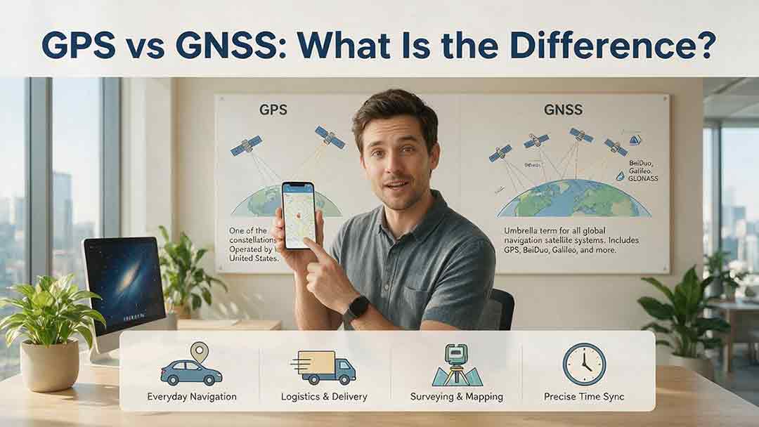
GPS and GNSS are often used as if they mean the same thing, but they describe different levels of satellite navigation technology. GPS is the United States’ satellite navigation system, while GNSS is the broader category that includes GPS, Galileo, GLONASS, BeiDou, and compatible regional systems such as QZSS and NavIC. This guide explains how GPS-only and multi-GNSS receivers differ, why access to more constellations may improve signal availability, and why a larger satellite count does not automatically guarantee greater accuracy. It also examines dual-frequency reception, satellite geometry, antenna quality, correction services, sensor integration, and common positioning errors. Readers can use the Receiver Capability Stack, buying checklist, real-world examples, and troubleshooting steps to evaluate phones, watches, vehicle navigators, outdoor devices, survey receivers, and timing systems. The article is based on official technical documentation and clearly distinguishes educational examples from recognized GNSS performance standards.

Why Does GPS Need Atomic Clocks?
GPS depends on atomic clocks because every satellite range begins as a timing measurement. Since radio signals travel at nearly the speed of light, even a nanosecond-level clock error can represent centimeters or meters of apparent distance. This article explains how GPS satellites use atomic frequency standards, ground monitoring, clock corrections, and navigation messages to maintain reliable timing. It also shows why ordinary smartphones do not need atomic clocks, why a basic three-dimensional GPS solution normally requires four suitable satellite measurements, and how relativity affects clocks in orbit. A worked timing-to-distance example, an original five-step evaluation framework, and a GPS error table help distinguish satellite clock error from atmospheric delay, multipath, receiver bias, poor geometry, and other limitations. Based on official GPS.gov, NIST, NAVCEN, and NOAA documentation, the guide provides a practical and carefully qualified explanation of why precise time is fundamental to modern satellite navigation.
Explore More Topics

How Do Satellites Detect Wildfires and Smoke?
Satellites detect wildfires by measuring unusual heat in infrared wavelengths, while visible, multispectral, and aerosol observations help analysts follow smoke across the atmosphere. This guide explains how systems such as GOES, VIIRS, MODIS, Landsat, and Sentinel contribute different pieces of the wildfire-monitoring picture. Readers will learn why a thermal hotspot is not the same as an exact fire perimeter, why satellite smoke imagery cannot replace ground-level PM2.5 measurements, and how clouds, terrain, viewing geometry, and satellite overpass timing can affect detection. The article also compares commonly used fire and smoke products, explains fire radiative power and the Normalized Burn Ratio, and provides a practical framework for choosing the right map. A documented Camp Fire example shows how multiple satellite and surface datasets can complement one another. Satellite information is valuable for situational awareness, but official emergency agencies remain the appropriate source for evacuation orders, road closures, and immediate safety decisions.

How Are Satellite Images Used in Agriculture?
Satellite images help farmers, agronomists, researchers, insurers, and public agencies monitor agricultural land across fields, regions, and growing seasons. This guide explains how optical, radar, thermal, and microwave satellite observations support crop-development monitoring, irrigation analysis, field mapping, flood and drought assessment, crop classification, and regional production forecasting. It distinguishes what satellites directly observe from calculated indices, classification results, and modeled estimates such as evapotranspiration. Readers will also learn how NDVI works, why spatial resolution and image timing matter, and when drones or field scouting are more appropriate. The original CosmoBasics SCALE Framework provides a practical way to decide whether satellite imagery fits a specific agricultural problem. Documented examples from USDA and OpenET show how operational products combine multiple observations, reference data, weather information, and models. Throughout the guide, satellite imagery is treated as a screening and monitoring tool—not a substitute for field verification, laboratory testing, or professional agricultural judgment.
What Is Synthetic Aperture Radar and How Does It Work?
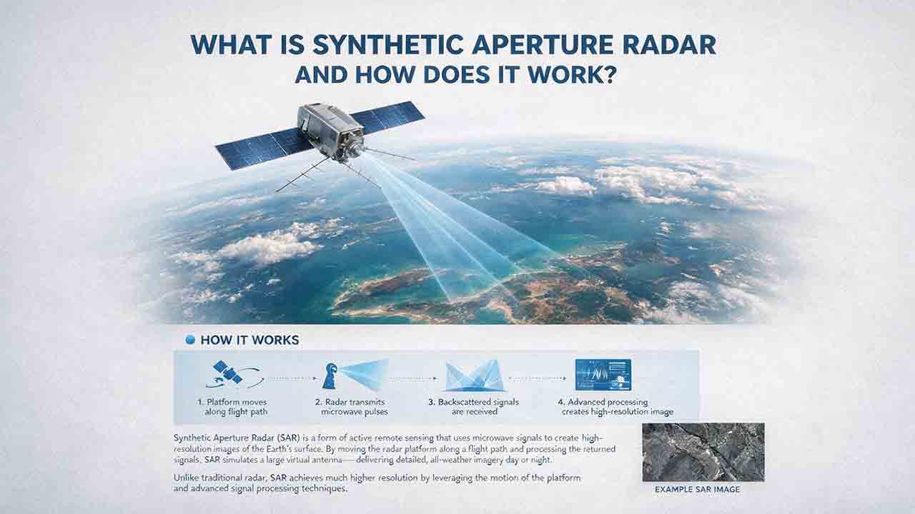
Synthetic aperture radar, or SAR, is an active Earth-observation technology that creates detailed images by transmitting microwave pulses and measuring the echoes returned from the surface. This article explains how a moving satellite or aircraft collects repeated observations to form a virtual antenna, why SAR can operate at night and through most cloud cover, and how amplitude, phase, wavelength, polarization, surface roughness, moisture, and viewing geometry affect radar imagery. It also distinguishes pixel spacing from true spatial resolution, provides a transparent range-resolution calculation, and compares SAR with optical satellite imagery. Practical sections examine scattering mechanisms, flood mapping, agriculture, forests, ice, maritime monitoring, and InSAR-based ground-deformation analysis. Original interpretation and data-selection frameworks help readers evaluate backscatter patterns, choose suitable products, identify common errors, troubleshoot unexpected results, and communicate uncertainty without treating derived radar products as guaranteed ground truth.