Why Does GPS Need Atomic Clocks?

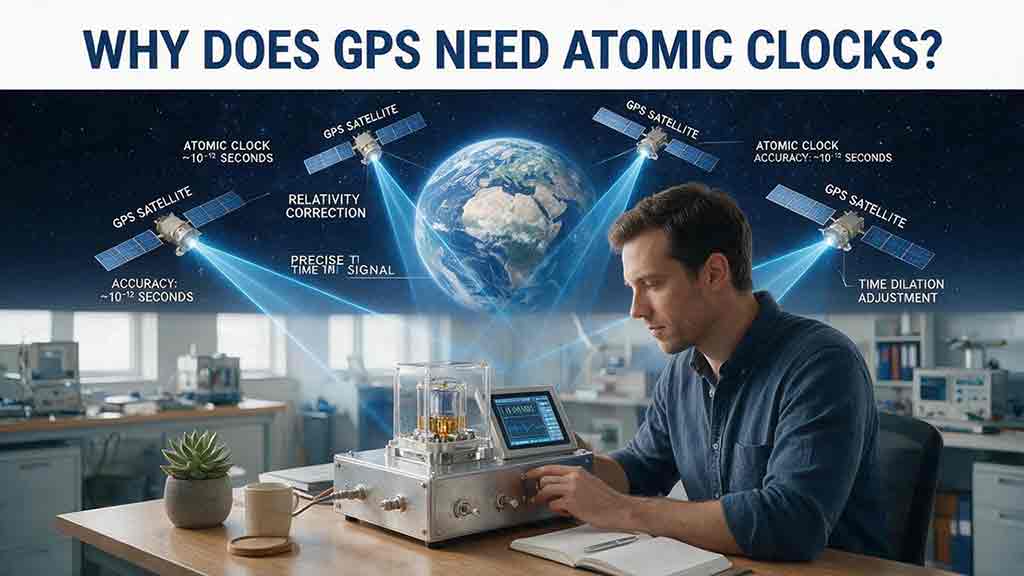
GPS needs atomic clocks because it estimates distance by timing radio signals transmitted by satellites. Light travels about 30 centimeters in one nanosecond in vacuum, so tiny clock errors can become meter-scale range errors. Atomic clocks keep satellite timing stable and predictable, while a receiver uses several satellite measurements to solve both its position and the error in its own ordinary clock.
Key Takeaways
- GPS determines satellite range primarily from signal travel time, not signal strength.
- One microsecond of timing error represents almost 300 meters of one-way range.
- GPS satellites need atomic clocks, but smartphones and most navigation receivers do not.
- A basic unconstrained three-dimensional solution normally requires four suitable satellite measurements.
- Relativistic effects change the rate of satellite clocks and must be included in the GPS timing model.
- Atomic clocks solve the satellite timing problem, but they cannot eliminate atmospheric delay, multipath, poor satellite geometry, interference, or receiver noise.
The central idea is simple: GPS turns time into distance. The engineering behind that idea is more demanding because satellite clocks, signal propagation, receiver clocks, and orbital data all have to work as one measurement system.
How this article was prepared: Technical statements were checked against GPS.gov, NIST, NAVCEN, and NOAA documentation. Numerical conversions were recalculated using the exact SI value of the speed of light, 299,792,458 meters per second. The calculations and tables are educational models rather than receiver tests, official performance guarantees, or professional surveying procedures.
How Does GPS Convert Time Into Distance?
GPS converts signal travel time into a simplified range estimate by multiplying that time by the speed of light.
Each GPS satellite broadcasts a precisely structured ranging signal. The broadcast also contains data that allow a receiver to estimate the satellite’s position and correct the satellite clock reading.
The simplified relationship is:
Simplified range estimate = signal travel time × speed of light
The speed of light in vacuum is exactly 299,792,458 meters per second, according to the NIST CODATA value.
At that speed, light travels approximately:
- 299,792 meters in one millisecond
- 299.8 meters in one microsecond
- 0.300 meter in one nanosecond
That conversion explains why timing quality matters so much. A clock discrepancy that appears insignificant in everyday life can represent a large apparent change in satellite-to-receiver range.
An Idealized 20,200-Kilometer Example
GPS satellites operate in medium Earth orbit at an altitude of roughly 20,200 kilometers above Earth’s surface, according to the official GPS Space Segment overview.
In an idealized overhead example that ignores receiver altitude and other geometric details, a signal traveling approximately 20,200 kilometers would take:
20,200,000 ÷ 299,792,458 ≈ 0.0674 seconds
That is about 67 milliseconds.
This is not the travel time for every GPS signal. A satellite near the horizon has a longer slant range to the receiver than a satellite almost directly overhead.
Real GPS processing must also consider:
- satellite motion during signal travel
- Earth’s rotation
- atmospheric propagation delay
- satellite clock corrections
- satellite orbit information
- receiver clock bias
- antenna and hardware delays
The calculation is intentionally simplified, but it reveals the scale of the problem: GPS measures a journey lasting only a small fraction of a second and must resolve extremely small differences within that journey.
What Does a GPS Receiver Actually Measure?
A GPS receiver initially measures a pseudorange rather than a perfect geometric distance.
The receiver compares the arriving ranging code with a locally generated version. The amount of code displacement indicates approximately how long the signal has been traveling.
The receiver’s local clock, however, is not perfectly synchronized with GPS system time. The resulting measurement includes a common receiver-clock bias as well as several other effects.
A simplified pseudorange can be expressed conceptually as:
Pseudorange = geometric distance + clock effects + propagation effects + measurement effects
Important contributors include:
- receiver clock bias
- residual satellite clock error
- satellite orbit error
- ionospheric delay
- tropospheric delay
- multipath
- antenna and receiver hardware delay
- measurement noise
The word pseudorange does not mean the measurement is false. It means the initial value contains more than the true geometric distance.
The receiver must estimate or correct enough of these additional terms to produce a useful position and time solution.
The Three-Layer Timing Chain
A practical way to understand GPS is to separate the measurement into three layers.
| Layer | Main job | What can go wrong |
|---|---|---|
| Satellite timing | Establish when the signal was transmitted | Clock offset, drift, prediction error, or a clock anomaly |
| Signal propagation | Carry the timing information to Earth | Atmospheric delay, blockage, reflection, or interference |
| Receiver solution | Combine measurements into position and time | Receiver clock bias, noise, poor geometry, or incorrect modeling |
Atomic clocks primarily strengthen the first layer. They do not automatically repair problems in the signal path or receiver solution.
This distinction is easy to overlook. A GPS device can receive timing derived from excellent atomic clocks and still produce a poor location because the signal reflected from a building or because too little of the sky is visible.
Why Are Ordinary Clocks Not Stable Enough for GPS Satellites?
Ordinary quartz clocks can drift too much to serve as the primary long-term timing reference for satellite ranging.
Quartz oscillators are compact, inexpensive, and energy-efficient. They are suitable for phones, watches, computers, and most navigation receivers.
Their frequency can nevertheless change slightly because of:
- temperature
- aging
- manufacturing variation
- vibration
- supply voltage
- environmental conditions
A small frequency difference causes a clock’s time offset to grow. In everyday use, a fraction of a second may be only an inconvenience. In GPS, the same amount would represent an enormous apparent distance.
Atomic clocks reduce this problem by controlling an electronic oscillator with a repeatable atomic transition frequency. NIST explains the principle in How Do Atomic Clocks Work?.
The atomic transition provides a stable reference against which the clock electronics can continually compare and adjust the oscillator.
Clock Accuracy and Clock Stability Are Different
A clock can be stable without showing the correct time. It can also show the correct time at one moment without remaining stable afterward.
| Term | Meaning in a GPS context |
|---|---|
| Clock offset | The clock reads earlier or later than the intended reference |
| Frequency offset | The clock runs at a slightly different rate |
| Drift | The clock’s offset or frequency gradually changes |
| Stability | The frequency behaves consistently over a stated interval |
| Accuracy | The clock agrees closely with the intended reference |
Suppose a clock remains consistently 100 nanoseconds late and changes only slowly. The system can observe, model, and correct that offset.
Another clock may be correct at one instant but then change unpredictably. That clock is harder to use because an earlier correction may quickly become obsolete.
Engineering insight: A predictable clock error is often easier to manage than an unstable clock whose behavior changes irregularly.
GPS does not require every physical satellite clock to display perfectly identical uncorrected time. It requires clock behavior that is stable enough to observe, predict, and correct.
Quartz and Atomic Clocks Serve Different Roles
| Characteristic | Quartz oscillator | Atomic frequency standard |
|---|---|---|
| Reference | Vibration of a manufactured crystal | Atomic energy transition |
| Typical GPS role | Receiver’s local oscillator | Satellite timing reference |
| Main advantage | Small, inexpensive, low power | Highly stable and predictable |
| Main limitation | Greater drift and environmental sensitivity | Greater cost, complexity, mass, and power demand |
| Suitable for a smartphone? | Yes | Usually unnecessary |
| Suitable as the main satellite reference? | Not for GPS-level long-term stability | Yes |
GPS satellites carry multiple atomic frequency standards. The precise combination depends on satellite generation and operational configuration.
How Does GPS Maintain Reliable Satellite Time?
GPS maintains reliable satellite time by combining onboard atomic clocks with ground monitoring, mathematical prediction, navigation-message updates, and receiver-side corrections.
The system is not simply a constellation of perfect clocks. It is a continuously managed timing network.
1. The Satellite Generates a Stable Frequency
An onboard atomic frequency standard supports the timing used to generate:
- ranging codes
- navigation data
- signal time tags
- radio carriers
The clock does more than display a time value. Its frequency helps define the structure of the signal that the receiver measures.
2. The Control Segment Observes the Satellite
Ground facilities track GPS satellites and estimate their orbit and clock behavior.
The monitoring process can identify:
- clock offset
- frequency offset
- gradual drift
- unexpected changes
- satellite health
- orbit deviations
Atomic clocks are highly stable, but their remaining behavior still needs to be measured and managed.
3. Clock and Orbit Corrections Are Predicted
The control segment estimates how each satellite clock differs from GPS system time. It also predicts how that difference is likely to evolve.
Orbit information and clock-correction parameters are then prepared for transmission through the navigation message.
4. The Satellite Broadcasts the Necessary Data
The GPS Standard Positioning Service Performance Standard, Fifth Edition describes the public GPS service and its signal-in-space performance framework.
More detailed signal and navigation-message interfaces are documented in the current IS-GPS-200N Interface Specification, dated August 1, 2022.
Depending on the signal and message type, the transmitted information supports calculations involving:
- satellite transmission time
- satellite position
- satellite clock correction
- satellite health
- ionospheric model parameters
- GPS system time
- UTC-related parameters
- constellation status
A receiver uses this information to estimate where the satellite was and what its corrected clock reading was when the signal was transmitted.
5. The Receiver Applies the Corrections
A receiver does not assume that the raw clock reading from every satellite is identical.
It applies the transmitted clock parameters and combines them with orbit and propagation models before forming the measurements used in the navigation solution.
Why Stability and Predictability Matter
An atomic clock may still have an offset, a small frequency error, gradual drift, or an operational anomaly.
Its value lies in the scale and predictability of those effects.
If satellite clocks changed rapidly and irregularly:
- correction data would become outdated sooner
- ground predictions would be less reliable
- pseudorange errors could grow more quickly
- timing would consume more of the system’s error budget
- operation between control updates would become more difficult
The practical requirement is not a clock with zero error.
It is a clock whose behavior remains stable, observable, predictable, and correctable.
How Much Distance Error Can a Tiny Timing Error Create?
Timing errors become range errors because GPS signals travel almost 300 million meters per second in vacuum.
The basic conversion is:
Range-equivalent error = timing error × speed of light
| Timing error | Approximate one-way range equivalent |
|---|---|
| 1 nanosecond | 0.300 meter |
| 10 nanoseconds | 3.00 meters |
| 50 nanoseconds | 14.99 meters |
| 100 nanoseconds | 29.98 meters |
| 1 microsecond | 299.79 meters |
| 1 millisecond | 299.79 kilometers |
These values are dimensional conversions. They are not automatic predictions of the horizontal error displayed on a map.
The final effect of a timing error depends on:
- which satellite observation contains the error
- where that satellite appears in the sky
- the geometry of the other satellites
- whether different errors are correlated
- atmospheric conditions
- receiver processing
- available correction data
Worked Example: A 50-Nanosecond Error
Suppose one pseudorange contains a residual timing error of 50 nanoseconds.
Convert the time to seconds:
50 nanoseconds = 0.000000050 seconds
Multiply by the speed of light:
0.000000050 × 299,792,458 = 14.9896 meters
The timing error represents approximately 15 meters of one-way range.
It does not necessarily produce a 15-meter horizontal map error. It is one contribution to one pseudorange before the receiver combines that observation with measurements from other satellites.
| Level | Statement |
|---|---|
| Published constant | Light travels exactly 299,792,458 meters per second in vacuum |
| Derived calculation | 50 nanoseconds corresponds to about 14.99 meters |
| Correct interpretation | The result is a range equivalent, not a guaranteed position error |
This distinction prevents a common technical mistake: treating clock error, pseudorange error, and final position error as if they were interchangeable quantities.
Why Does GPS Normally Need Four Satellites?
A basic GPS receiver normally needs four suitable satellite measurements because it must solve three position coordinates and one receiver clock bias.
The four unknowns are commonly represented as:
- x-coordinate
- y-coordinate
- z-coordinate
- receiver clock offset relative to GPS system time
Each suitable satellite measurement contributes another pseudorange equation to the navigation solution.
With four usable measurements, the receiver can solve for the four unknown values in a basic unconstrained three-dimensional model.
Why Three Satellites Are Not Normally Enough
In an idealized model, three range measurements can constrain a three-dimensional position if:
- receiver time is already known accurately
- satellite positions are known
- measurement errors are neglected
- any remaining geometric ambiguity is resolved by another condition
A normal consumer receiver does not begin with atomic-clock-quality knowledge of GPS time.
Its quartz oscillator may be offset by an amount that represents many kilometers of apparent range. Receiver clock bias must therefore be included as an additional unknown.
NIST provides accessible explanations in How Do You Measure Your Location Using GPS? and Knowing Where We Are.
Why More Than Four Satellites Can Help
Four suitable observations are the basic minimum for an unconstrained three-dimensional solution that includes receiver clock bias.
Modern receivers often use many more observations and may combine GPS with other global navigation satellite systems.
Additional measurements can improve:
- satellite geometry
- measurement redundancy
- continuity
- error detection
- availability when part of the sky is blocked
- estimation of atmospheric or receiver parameters
More satellites do not automatically guarantee greater accuracy. A weak reflected signal may contribute less useful information than a strong signal arriving directly from a well-positioned satellite.
The value of an additional satellite depends on signal quality and geometry, not merely the total count.
Why Does a Smartphone Not Need an Atomic Clock?
A smartphone does not need an atomic clock because GPS processing estimates the phone’s clock bias together with its position.
A phone uses an inexpensive electronic oscillator for local timing, signal acquisition, and tracking.
That oscillator is much less stable than the clocks aboard GPS satellites. It does not need to remain perfectly synchronized with GPS time before the position calculation begins.
When the receiver processes signals from four or more suitable satellites, it searches for a common receiver-clock correction that makes the measured pseudoranges consistent with one position.
This creates a major system-level advantage:
A relatively small number of satellites carry specialized timing hardware so that billions of receivers can operate without atomic clocks.
Placing a conventional space-grade atomic clock inside every phone would add cost, power consumption, size, calibration requirements, and complexity without being necessary for ordinary navigation.
Some specialized timing and resilient-navigation systems use higher-quality local oscillators. These oscillators may improve holdover, meaning the ability to maintain useful time for a limited period after satellite signals become unavailable.
That is an application-specific design choice, not a requirement for routine smartphone GPS.
Why Does Relativity Matter to GPS Atomic Clocks?
Relativity matters because clocks in GPS orbit do not run at exactly the same rate as comparable clocks near Earth’s surface.
Two principal effects act in opposite directions.
Motion Makes the Satellite Clocks Run Slower
GPS satellites move rapidly relative to observers on Earth.
Under special relativity, this motion causes the orbiting clocks to run approximately 7 microseconds per day slower than comparable clocks near Earth’s surface.
Weaker Gravity Makes the Satellite Clocks Run Faster
Gravity is weaker at GPS orbital altitude.
Under general relativity, clocks in weaker gravity run faster. This effect makes GPS satellite clocks run approximately 45 microseconds per day faster than comparable clocks near Earth’s surface.
The Net Relativistic Effect and Its Range Equivalent
Combining the two principal effects:
45 microseconds faster − 7 microseconds slower ≈ 38 microseconds faster per day
NIST explains these values in Putting Einstein to the Test.
The light-travel-distance equivalent is:
0.000038 × 299,792,458 ≈ 11,392 meters
That is approximately 11.4 kilometers of accumulated range equivalent per day.
The figure does not mean that every user’s displayed horizontal location would move by exactly 11.4 kilometers each day.
It means that the accumulated clock-rate difference corresponds to the time light requires to travel approximately 11.4 kilometers. An uncorrected timing difference would enter the clock and pseudorange calculations, while its effect on a particular position would depend on satellite geometry, receiver processing, and the behavior of the other measurements.
GPS accounts for the principal relativistic rate difference in the system design. Receivers also apply relevant periodic corrections associated with satellite orbital eccentricity, as specified in IS-GPS-200N.
Relativity is not an optional scientific refinement. It is part of the operational GPS timing model.
What Is the Difference Between GPS Time and UTC?
GPS time and Coordinated Universal Time are related, but they are not identical time scales.
GPS time is a continuous system time used for navigation. UTC is the internationally coordinated civil time scale used for clocks, legal timestamps, communication systems, and many other applications.
GPS time does not insert leap seconds in the same manner that UTC historically has. GPS navigation messages therefore contain parameters that allow suitable receivers to relate GPS system time to UTC as maintained by the U.S. Naval Observatory.
GPS.gov describes the public timing role of the system in GPS and Telling Time. NIST explains practical satellite-based time transfer in One-Way GNSS Time Transfer.
For ordinary navigation, receiver firmware normally handles the conversion.
Technical systems should still distinguish among:
- GPS system time
- UTC
- UTC as realized by a timing laboratory
- raw receiver time
- operating-system time
- local civil time
- application timestamps
- leap-second or time-smear handling
A receiver can calculate a valid position while software at another layer mishandles the displayed civil time.
Systems that depend on legally or operationally significant timestamps should follow current interface specifications and equipment documentation rather than assuming that GPS time and UTC are interchangeable.
Which GPS Errors Can Atomic Clocks Fix?
Atomic clocks control the satellite timing contribution, but most GPS errors require different solutions.
| Error category | How it affects GPS | Typical control method | Fixed by satellite atomic clocks? |
|---|---|---|---|
| Satellite clock | Adds timing and pseudorange error | Atomic standards, monitoring, prediction, and corrections | This is the main clock-related problem |
| Satellite orbit | Incorrect satellite position changes the calculated range | Ephemeris updates and correction services | No |
| Ionosphere | Charged particles alter signal propagation | Models, multiple frequencies, or augmentation | No |
| Troposphere | Air pressure and water vapor delay the signal | Atmospheric modeling | No |
| Multipath | Reflected signals distort code or carrier measurements | Antenna placement and signal processing | No |
| Receiver clock | Adds a common bias to receiver ranges | Solved as part of the navigation solution | No |
| Receiver noise | Electronics and tracking add uncertainty | Better hardware, filtering, and signal quality | No |
| Satellite geometry | Poor distribution amplifies measurement uncertainty | Use a more favorable satellite distribution | No |
| Interference | Jamming or nearby transmissions disrupt reception | Detection, mitigation, and resilient system design | No |
| Reference mismatch | Incorrect datum, frame, or map settings shift displayed coordinates | Correct software and coordinate configuration | No |
The table shows why accurate satellite time is necessary but not sufficient.
Improving one component cannot compensate without limit for weaknesses in every other component. Atomic clocks establish the timing foundation; orbit determination, propagation modeling, antenna placement, interference protection, and receiver processing complete the measurement chain.
The Five-Step Timing-to-Distance Test
The following framework separates clock performance from total positioning performance.
It can also be applied to other radio-ranging and time-transfer systems.
Step 1: Define the Distance Scale
Begin with the size of the distance or position change the application needs to distinguish.
Examples include:
- tens of meters for broad location awareness
- several meters for ordinary consumer navigation
- approximately one meter for more demanding applications
- centimeter-scale change for specialized surveying or geodesy
These are reasoning categories, not guaranteed GPS performance levels.
Step 2: Convert Distance Into a Timing Equivalent
Use:
Timing equivalent = distance ÷ speed of light
| Distance scale | Approximate light-travel-time equivalent |
|---|---|
| 100 meters | 334 nanoseconds |
| 10 meters | 33.4 nanoseconds |
| 3 meters | 10.0 nanoseconds |
| 1 meter | 3.34 nanoseconds |
| 0.1 meter | 0.334 nanosecond |
| 0.01 meter | 0.033 nanosecond |
This conversion reveals how demanding precision ranging becomes.
It does not describe the full measurement technique used by every high-accuracy GNSS system.
Step 3: Separate Clock Error From the Total Error Budget
A one-meter distance scale corresponds to approximately 3.34 nanoseconds of light travel.
That does not mean the satellite clock can consume the entire 3.34-nanosecond equivalent.
The complete system must also accommodate:
- orbit uncertainty
- atmospheric delay
- multipath
- antenna effects
- receiver hardware
- measurement noise
- satellite geometry
- processing assumptions
A robust positioning system manages the combined measurement chain rather than focusing on one error source.
Step 4: Separate Transmitter and Receiver Timing
Ask two different questions:
- How stable must the satellite clocks be?
- Can the receiver clock error be estimated mathematically?
GPS answers the first question with onboard atomic frequency standards supported by ground monitoring and correction data.
It answers the second by including receiver clock bias as an unknown in a solution based on several satellite observations.
Confusing these two problems leads to the mistaken belief that every GPS receiver must contain an atomic clock.
Step 5: Ask Whether the Error Is Predictable
A stable offset can often be measured and corrected.
A smooth drift may be modeled for a limited interval.
Rapid or irregular variation is more difficult because a correction may become inaccurate before the next monitoring and update cycle.
This final step explains why predictability can matter as much as the clock’s accuracy at one instant.
Why the Table Does Not Explain Centimeter-Level GNSS by Itself
The timing-equivalent table is a dimensional comparison, not a complete description of how centimeter-level GNSS positioning is achieved.
High-precision GNSS often relies on:
- carrier-phase observations
- differential corrections
- real-time kinematic processing
- precise point positioning
- multiple frequencies
- integer ambiguity resolution
- precise orbit and clock products
- reference-station networks
- detailed atmospheric modeling
These methods use information beyond a simple absolute code-travel-time measurement.
For current U.S. geodetic-control guidance, NOAA’s National Geodetic Survey publishes Technical Memorandum NOS NGS 92: Classifications, Standards, and Specifications for GNSS Geodetic Control Surveys Using OPUS Projects, dated October 23, 2024.
The practical lesson is:
A centimeter-scale distance corresponds to a very small light-travel time, but professional centimeter-level GNSS is achieved through a complete observation and processing strategy—not through one clock calculation alone.
Why Can GPS Still Look Wrong When the Satellite Clocks Are Precise?
A visible GPS problem often begins elsewhere in the measurement chain.
| Symptom | More likely explanation | Practical response |
|---|---|---|
| Position jumps beside tall buildings | Multipath or blocked sky view | Move to an open area and allow the receiver to reacquire |
| Slow or failed fix indoors | Signals are weak or obstructed | Move outdoors with a clearer view of the sky |
| Accuracy worsens beneath dense trees | Signal attenuation and multipath | Seek a less obstructed location |
| Position is stable but shifted on the map | Map, datum, reference-frame, or application issue | Check coordinate and software settings |
| Several receivers fail in the same area | Local interference or a broader signal-environment problem | Test elsewhere and check official advisories |
These checks do not diagnose every equipment problem. They show why satellite clocks should not become the default explanation for every inaccurate location.
A receiver can obtain excellent satellite timing and still produce a poor position if signals arrive through reflections, too little of the sky is visible, or an application uses an inconsistent coordinate reference.
Common Misconceptions About GPS Atomic Clocks
“GPS Calculates Distance From Signal Strength”
GPS does not primarily determine distance from received power.
Signal strength affects acquisition and tracking. Distance is derived mainly from ranging-code timing and, in precision systems, carrier-phase observations.
“Every GPS Receiver Contains an Atomic Clock”
Most smartphones, vehicle receivers, and handheld navigators use ordinary electronic oscillators.
The receiver estimates its clock bias as part of the navigation solution.
“GPS Always Needs Exactly Four Satellites”
Four suitable measurements are the basic minimum for an unconstrained three-dimensional solution that includes receiver clock bias.
Receivers often use more than four. Four satellites also do not guarantee an accurate result if the geometry or signal quality is poor.
“Atomic Clocks Never Drift”
Atomic clocks can have offsets, frequency errors, and gradual drift.
Their value is that their behavior is far more stable and predictable than that of ordinary oscillators.
“Relativity Is Too Small to Matter”
Relativistic effects are tiny compared with one full second but large compared with GPS timing requirements.
The system must account for both velocity-related and gravity-related changes in clock rate.
“Better Satellite Clocks Eliminate Every GPS Error”
Clock quality cannot remove multipath, atmospheric delay, poor geometry, interference, incorrect antenna installation, map errors, or receiver noise.
Atomic clocks solve a foundational problem, not the entire positioning problem.
Scope of This Guide
This article is intended for general readers, students, developers, technical writers, and GNSS users who want to understand the relationship between GPS timing and positioning.
It is an educational explanation rather than a surveying procedure, receiver certification document, safety-critical engineering standard, or guarantee of positioning performance. Professional geodetic, regulated, safety-critical, or high-availability applications should follow the relevant specifications, equipment documentation, and qualified technical review.
The Practical Conclusion
GPS needs atomic clocks because every satellite range begins as a time measurement.
The onboard clocks provide a frequency reference stable enough to be observed, predicted, and corrected. A receiver then combines corrected satellite measurements to estimate three-dimensional position and its own clock bias.
That architecture allows inexpensive phones and navigation devices to benefit from atomic-clock timing without carrying atomic clocks themselves.
Final accuracy still depends on the entire measurement chain. Precise satellite time cannot by itself correct a reflected signal, an inaccurate orbit estimate, poor satellite geometry, atmospheric delay, interference, or a misconfigured map.
Atomic clocks are not the whole of GPS—but GPS as we know it would not work without them.
Frequently Asked Questions
Does every GPS satellite carry atomic clocks?
Yes. GPS satellites carry multiple atomic frequency standards that support precise signal timing and operational redundancy. The exact clock types and configuration vary by satellite generation and current operational setup.
Why does a GPS satellite carry more than one atomic clock?
Multiple clocks provide redundancy and operational flexibility. If one clock develops abnormal behavior, operators can manage clock selection, corrections, satellite health, and service continuity without depending on a single timing unit.
Does a phone need an atomic clock to use GPS?
No. A normal phone estimates receiver clock bias as part of its navigation solution. Specialized systems may use higher-quality local oscillators for holdover or resilience, but an onboard atomic clock is not required for routine smartphone navigation.
What happens if a GPS satellite clock develops a fault?
The GPS control segment monitors satellite clock and signal behavior. Depending on the problem, correction data may be updated, the satellite may be managed operationally, or its navigation signal may be marked unhealthy so compliant receivers can exclude it.
Are atomic clocks radioactive?
Atomic clocks do not normally measure time by counting radioactive decay. They use electromagnetic radiation tuned to a repeatable atomic transition. The word “atomic” refers to the frequency reference, not to a radioactive countdown.
Is GPS mainly a navigation system or a timing system?
GPS provides positioning, navigation, and timing. Precise time is the foundation of satellite ranging, while the same system also distributes timing information used by communication networks, power systems, scientific instruments, and other infrastructure.
Editorial Verification Process
Before publication:
- GPS timing, orbital, and navigation-message statements were checked against GPS.gov, the GPS Standard Positioning Service Performance Standard, and the NAVCEN GPS technical-reference library.
- Atomic-clock and relativistic explanations were checked against NIST references.
- Timing-to-distance calculations were independently recalculated using the exact SI speed of light.
- Terminology was reviewed to distinguish satellite clock error, receiver clock bias, pseudorange error, range-equivalent error, and final position error.
- Precision-GNSS statements and source versions were checked against current NOAA National Geodetic Survey documentation.
This editorial process does not imply approval, certification, or endorsement by any cited institution.
Sources
GPS.gov — GPS and Telling Time
Official explanation of onboard atomic clocks and GPS timing applications.GPS.gov — Space Segment
Official overview of the GPS constellation, medium Earth orbit, and approximate orbital altitude.NIST — How Do Atomic Clocks Work?
Explanation of atomic transitions, oscillator control, stability, and atomic timekeeping.NIST — How Do You Measure Your Location Using GPS?
Plain-language explanation of satellite timing and multi-satellite positioning.NIST — Knowing Where We Are
Explanation of atomic clocks as a foundation of GPS positioning.NIST — Putting Einstein to the Test
Explanation of the principal special- and general-relativistic effects on GPS satellite clocks.NIST CODATA — Speed of Light in Vacuum
Official exact value of 299,792,458 meters per second.GPS Standard Positioning Service Performance Standard, Fifth Edition, April 2020
Official public GPS performance and service documentation.NAVCEN — GPS Technical References
Official index of GPS performance standards, interface specifications, and related technical documents.NAVCEN — IS-GPS-200N, August 1, 2022
Current IS-GPS-200 interface specification listed by NAVCEN for relevant GPS ranging signals and navigation data.NIST — One-Way GNSS Time Transfer
Explanation of GNSS time transfer and the effects of propagation, geometry, multipath, and hardware delay.NOAA Technical Memorandum NOS NGS 92, October 23, 2024
NGS classifications, standards, and specifications for GNSS geodetic-control surveys using OPUS Projects.
About the Author: Skylar writes explanatory guides about satellite navigation, timing systems, and space-based technology. The editorial process includes reviewing official technical documentation, recalculating numerical examples, and translating engineering concepts into practical explanations for general readers.
Editorial Note: This article is based on the official materials listed above. No hands-on receiver test, independent laboratory measurement, or institutional review was conducted.
More from GPS, Timing & Navigation
Why Does Your Phone Sometimes Show the Wrong Location?
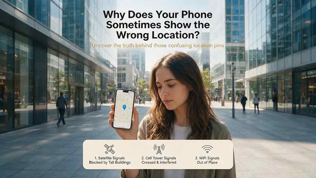
A phone’s location can appear incorrect even when its GPS hardware is functioning normally. Modern smartphones estimate position by combining satellite signals with Wi-Fi, cellular networks, Bluetooth, motion sensors, app permissions, and map data. This guide explains how blocked or reflected signals, cached locations, approximate permissions, battery restrictions, compass errors, and inaccurate map pins can affect the blue dot. It introduces two practical CosmoBasics troubleshooting tools—the Two Apps, Two Places Rule and the PLACE Test—to help readers distinguish app problems, environmental interference, stale data, mapping errors, and possible device-level issues. The article also provides step-by-step fixes for iPhone and Android, explains realistic smartphone accuracy under open-sky and indoor conditions, and identifies when contacting the manufacturer may be appropriate. All major technical claims are supported by first-party documentation from GPS.gov, Apple, Android, Google Maps, and Google for Developers.
How Accurate Is Consumer GPS?
Consumer GPS can often estimate horizontal position within about 5 meters under open sky, but actual accuracy varies significantly with the device, satellite geometry, signal blockage, reflected signals, antenna placement, and software processing. This guide explains what GPS accuracy figures really mean, why an app’s accuracy circle is not the same as measured error, and why smartphone references, Android confidence estimates, and government GPS performance standards should not be treated as interchangeable. It introduces the CosmoBasics Target Separation Test, a practical framework for deciding whether GPS uncertainty is small enough for a specific task. Readers will also learn how smartphones combine GNSS, Wi-Fi, cellular data, and sensors; how dual-frequency reception may improve performance; why altitude is less reliable than horizontal position; and how to test and troubleshoot a device. The article clearly identifies situations where consumer GPS is useful and where professional, certified, or regulated positioning methods are necessary.
GPS vs GNSS: What Is the Difference?
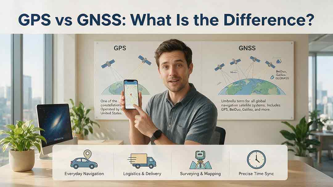
GPS and GNSS are often used as if they mean the same thing, but they describe different levels of satellite navigation technology. GPS is the United States’ satellite navigation system, while GNSS is the broader category that includes GPS, Galileo, GLONASS, BeiDou, and compatible regional systems such as QZSS and NavIC. This guide explains how GPS-only and multi-GNSS receivers differ, why access to more constellations may improve signal availability, and why a larger satellite count does not automatically guarantee greater accuracy. It also examines dual-frequency reception, satellite geometry, antenna quality, correction services, sensor integration, and common positioning errors. Readers can use the Receiver Capability Stack, buying checklist, real-world examples, and troubleshooting steps to evaluate phones, watches, vehicle navigators, outdoor devices, survey receivers, and timing systems. The article is based on official technical documentation and clearly distinguishes educational examples from recognized GNSS performance standards.
Explore More Topics

How Do Satellites Detect Wildfires and Smoke?
Satellites detect wildfires by measuring unusual heat in infrared wavelengths, while visible, multispectral, and aerosol observations help analysts follow smoke across the atmosphere. This guide explains how systems such as GOES, VIIRS, MODIS, Landsat, and Sentinel contribute different pieces of the wildfire-monitoring picture. Readers will learn why a thermal hotspot is not the same as an exact fire perimeter, why satellite smoke imagery cannot replace ground-level PM2.5 measurements, and how clouds, terrain, viewing geometry, and satellite overpass timing can affect detection. The article also compares commonly used fire and smoke products, explains fire radiative power and the Normalized Burn Ratio, and provides a practical framework for choosing the right map. A documented Camp Fire example shows how multiple satellite and surface datasets can complement one another. Satellite information is valuable for situational awareness, but official emergency agencies remain the appropriate source for evacuation orders, road closures, and immediate safety decisions.

How Are Satellite Images Used in Agriculture?
Satellite images help farmers, agronomists, researchers, insurers, and public agencies monitor agricultural land across fields, regions, and growing seasons. This guide explains how optical, radar, thermal, and microwave satellite observations support crop-development monitoring, irrigation analysis, field mapping, flood and drought assessment, crop classification, and regional production forecasting. It distinguishes what satellites directly observe from calculated indices, classification results, and modeled estimates such as evapotranspiration. Readers will also learn how NDVI works, why spatial resolution and image timing matter, and when drones or field scouting are more appropriate. The original CosmoBasics SCALE Framework provides a practical way to decide whether satellite imagery fits a specific agricultural problem. Documented examples from USDA and OpenET show how operational products combine multiple observations, reference data, weather information, and models. Throughout the guide, satellite imagery is treated as a screening and monitoring tool—not a substitute for field verification, laboratory testing, or professional agricultural judgment.
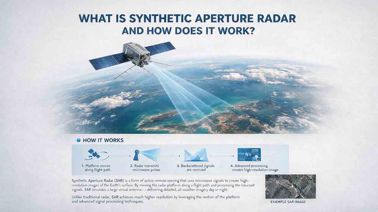
What Is Synthetic Aperture Radar and How Does It Work?
Synthetic aperture radar, or SAR, is an active Earth-observation technology that creates detailed images by transmitting microwave pulses and measuring the echoes returned from the surface. This article explains how a moving satellite or aircraft collects repeated observations to form a virtual antenna, why SAR can operate at night and through most cloud cover, and how amplitude, phase, wavelength, polarization, surface roughness, moisture, and viewing geometry affect radar imagery. It also distinguishes pixel spacing from true spatial resolution, provides a transparent range-resolution calculation, and compares SAR with optical satellite imagery. Practical sections examine scattering mechanisms, flood mapping, agriculture, forests, ice, maritime monitoring, and InSAR-based ground-deformation analysis. Original interpretation and data-selection frameworks help readers evaluate backscatter patterns, choose suitable products, identify common errors, troubleshoot unexpected results, and communicate uncertainty without treating derived radar products as guaranteed ground truth.