GPS vs GNSS: What Is the Difference?

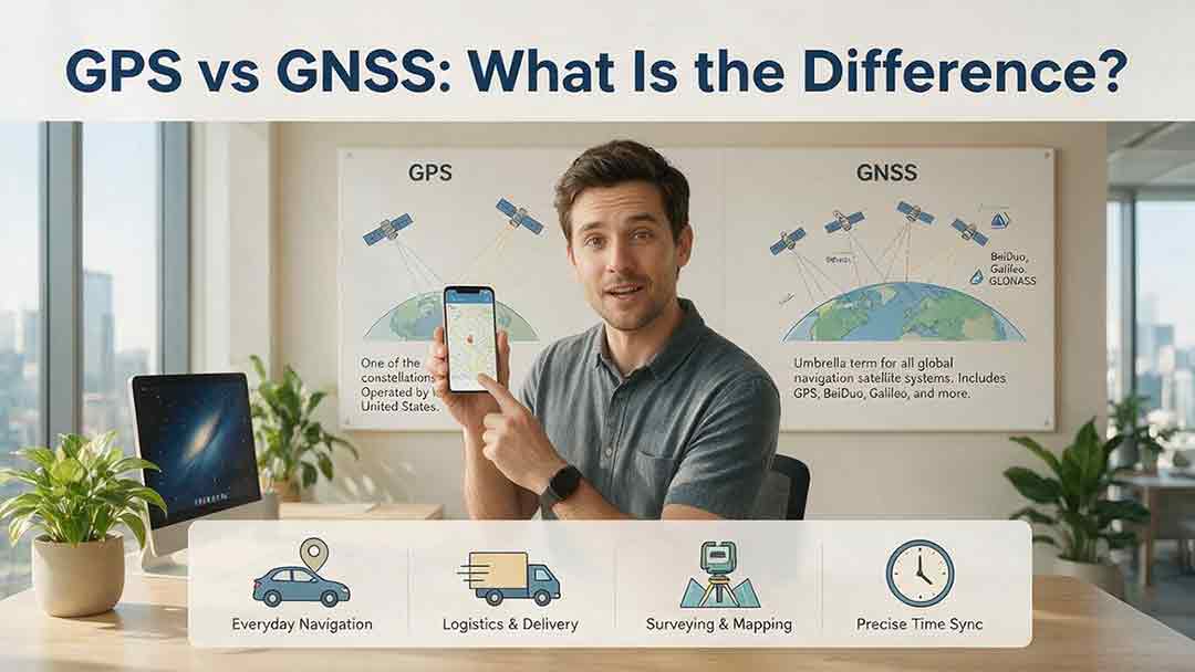
GPS is one satellite navigation system, while GNSS is the broader category that includes GPS and other systems such as Galileo, GLONASS, and BeiDou. A GPS-only receiver uses only GPS signals. A multi-GNSS receiver can combine compatible signals from several constellations, which may improve satellite availability when buildings, trees, or terrain block part of the sky.
Key Takeaways
- GPS is one type of GNSS, not an alternative to GNSS.
- GNSS is the wider category covering global and regional satellite navigation systems.
- Multi-GNSS can increase the number and distribution of usable signals, particularly where the sky is partly obstructed.
- More satellites do not automatically mean greater accuracy. Antenna design, signal frequencies, corrections, receiver processing, and local conditions also matter.
- The receiver’s complete specification matters more than whether its label says GPS or GNSS.
This guide explains the relationship between GPS and GNSS, how multi-constellation and dual-frequency receivers differ, and which specifications matter when choosing a phone, watch, vehicle navigator, outdoor device, survey receiver, or timing system.
Who This Guide Is For
This guide is for consumers and professional buyers who need a practical explanation of GPS, GNSS, multi-constellation positioning, and dual-frequency reception.
It provides general educational information. Equipment used for aviation, maritime navigation, legal surveying, autonomous operation, emergency response, or critical-infrastructure timing should be selected and operated under the applicable regulations, professional standards, manufacturer instructions, and site-specific risk assessments.
How This Article Was Researched
This guide was prepared by comparing official material from GPS.gov, the Federal Aviation Administration, the United Nations Office for Outer Space Affairs, the European Space Agency, ISRO, Japan’s QZSS program, the official BeiDou program, and the National Institute of Standards and Technology.
The source review focused on:
- The formal relationship between GPS and GNSS
- Global and regional navigation-system classifications
- Availability, geometry, accuracy, continuity, and integrity
- Multi-constellation and multi-frequency receiver capabilities
- Consumer, surveying, vehicle, outdoor, and timing applications
No phone, watch, tracker, survey receiver, or timing product was physically tested for this article. The Receiver Capability Stack and satellite-redundancy example are original educational tools, not official GNSS standards, validated scoring systems, or product benchmarks.
GPS vs GNSS at a Glance
| Feature | GPS | GNSS |
|---|---|---|
| Full name | Global Positioning System | Global Navigation Satellite System |
| Meaning | A specific U.S. satellite navigation system | The general category for satellite navigation systems |
| Scope | One global constellation | Multiple global and regional systems |
| Operator | United States | Several governments and regional organizations |
| Examples | GPS | GPS, Galileo, GLONASS, BeiDou, NavIC, and QZSS |
| Receiver use | May use only GPS signals | May use one or several compatible constellations |
| Main practical benefit | Global positioning, navigation, and timing | Access to a broader selection of compatible signals |
| Automatic accuracy advantage | No | No—performance depends on the complete receiver |
The clearest description is:
GPS is one type of GNSS. A GNSS receiver may use GPS alone or combine GPS with signals from other compatible navigation systems.
GNSS is not a premium version of GPS. It is the broader category to which GPS belongs.
Terminology used in this guide: “GPS-only” means a receiver configured to use only GPS signals, whether because of a hardware limitation or the selected operating mode.
What Does GPS Mean?
GPS is the satellite-based positioning, navigation, and timing system operated by the United States.
The system has three main parts:
- Satellites that broadcast navigation signals
- Ground facilities that monitor and control the satellites
- Receivers that process the signals
According to GPS.gov, the United States is committed to maintaining at least 24 operational GPS satellites 95% of the time. Additional satellites are normally operated to support coverage, maintenance, and continuity.
A GPS receiver can use the broadcasts to estimate:
- Latitude and longitude
- Altitude
- Velocity and course over ground when sufficient movement can be estimated
- Time referenced to the navigation system
Course over ground is not the same as device heading. A receiver can estimate the direction in which it is moving, but a stationary device generally needs a compass or other sensor to determine which way it is pointing.
Similarly, timing performance varies widely. A phone receiving GPS time is not equivalent to a calibrated timing receiver used in a telecommunications or power network.
How Does a GPS Receiver Calculate Position?
A conventional GPS position is calculated through a sequence of range measurements.
Each satellite broadcasts timing and orbital information.
The receiver needs to know where the satellite was when the signal was transmitted.The receiver measures signal travel time.
Radio signals travel at approximately the speed of light, so the elapsed time can be converted into an estimated range.The receiver calculates pseudoranges.
They are called pseudoranges because the measurements include receiver-clock error and other sources of uncertainty.Measurements from several satellites are combined.
The receiver uses the satellite locations and estimated ranges to calculate its position.Corrections and quality controls are applied.
The receiver may account for satellite-clock information, orbital data, atmospheric delay, signal quality, motion, and other available measurements.
The Federal Aviation Administration explains that a fourth suitable satellite measurement allows a conventional receiver to solve for three-dimensional position and receiver-clock offset without carrying its own satellite-grade atomic clock.
The familiar four-satellite rule is a mathematical starting point, not a guarantee of a reliable result.
Four suitable measurements represent the conventional minimum for an unconstrained, three-dimensional satellite-only solution that also estimates receiver-clock error.
Real receivers may use altitude constraints, stored time, inertial sensors, maps, filtering, or other measurements. They may also need considerably more than four signals to detect poor measurements and maintain a stable position in difficult conditions.
GPS positioning is based on timing and ranging measurements from multiple satellites.
What Does GNSS Mean?
GNSS is the generic term for satellite navigation systems that provide positioning, navigation, and timing services.
The United Nations Office for Outer Space Affairs describes GNSS as a combination of orbiting satellite constellations, ground-control networks, and receivers that calculate positions from satellite signals.
The four major global constellations are:
| System | Operator | Coverage classification | Main function |
|---|---|---|---|
| GPS | United States | Global | Positioning, navigation, and timing |
| Galileo | European Union | Global | Civilian-controlled positioning, navigation, timing, and related services |
| GLONASS | Russian Federation | Global | Positioning, navigation, and timing |
| BeiDou Navigation Satellite System | China | Global | Positioning, navigation, timing, and related services |
The European Space Agency describes Galileo as Europe’s global navigation satellite system and states that it is interoperable with compatible systems including GPS and GLONASS.
The official BeiDou system overview describes BeiDou as a positioning, navigation, and timing infrastructure serving global users.
The operational status, supported signals, and available services of any constellation can change. Specialized users should consult current program documentation and receiver manuals rather than relying on a fixed satellite count quoted in an older article.
Are NavIC and QZSS Also GNSS?
Yes. NavIC and QZSS are generally included in the wider GNSS ecosystem, although they are designed primarily for regional service.
NavIC, operated by India, serves India and surrounding areas. ISRO’s official navigation overview provides current information about its service area, signals, and interoperability with other systems.
QZSS, operated by Japan, complements compatible positioning systems in Japan and parts of the Asia-Oceania region. Japan’s Cabinet Office explains that QZSS is compatible with GPS and is designed to improve the availability of useful signals where buildings, trees, or terrain obstruct parts of the sky.
Regional systems may be highly useful within their intended service areas, but their coverage should not be assumed to match a global constellation.
Why Do People Use GPS and GNSS Interchangeably?
GPS became the most familiar name for satellite positioning, so people often use it as a general term.
A smartphone may show a GPS icon while its receiver is processing GPS, Galileo, GLONASS, BeiDou, QZSS, or NavIC signals. A fitness watch may call an operating option “GPS mode” even when several constellations are enabled.
The phrase “GPS device” may therefore describe:
- Hardware limited to GPS
- A multi-GNSS device running in GPS-only mode
- A multi-GNSS product marketed under the familiar GPS name
- A navigation product that combines GNSS with maps, cellular assistance, Wi-Fi, and motion sensors
The specification sheet and technical manual are more reliable than the product name or interface icon.
Is GNSS More Accurate Than GPS?
GNSS is not automatically more accurate than GPS because GNSS is a category, not a defined level of performance.
A capable multi-GNSS receiver may have access to more suitable satellite measurements than a GPS-only receiver. This can improve availability or geometry when part of the sky is blocked.
Final accuracy also depends on:
- Satellite geometry
- Signal blockage
- Reflected signals
- Atmospheric delay
- Supported frequencies
- Antenna design and placement
- Receiver algorithms
- Correction services
- Sensor integration
- Local interference
- Mapping software
GPS.gov distinguishes between the accuracy of the signal broadcast in space and the accuracy experienced by an end user. Receiver quality and local conditions remain part of the result.
Multi-GNSS increases the number and distribution of signals a receiver can evaluate, but it does not guarantee a fixed improvement in accuracy.
Availability, Geometry, Accuracy, Continuity, and Integrity
These terms describe different characteristics.
| Concept | Practical meaning | Can more constellations help? |
|---|---|---|
| Availability | Whether enough suitable signals and services are available for a position solution | Often, by increasing the pool of potential measurements |
| Geometry | How the usable satellites are distributed across the sky | Often, if the added satellites improve spatial distribution |
| Accuracy | How close the estimated position is to the true position | Sometimes, when the added measurements are suitable and correctly processed |
| Continuity | Whether a usable solution can be maintained during the required period | Sometimes, because the loss of a few signals may be less disruptive |
| Integrity | Whether the system can warn the user when the result may no longer meet a stated requirement | Not automatically; integrity requires monitoring, detection, alerting, and application-specific design |
Integrity is especially important in safety-critical operations. It may involve certified augmentation, fault detection, alert limits, time-to-alert requirements, receiver design, and operating procedures.
It should not be inferred from the number of satellites shown on a screen.
What Is the Difference Between Multi-GNSS and Dual-Frequency GNSS?
Multi-GNSS allows a receiver to use several satellite constellations. Dual-frequency GNSS allows it to process compatible signals on more than one radio-frequency band.
They address different limitations.
| Capability | Main purpose | Potential benefit |
|---|---|---|
| Multi-GNSS | Access several constellations | More potential measurements and better availability |
| Dual-frequency reception | Compare measurements on different frequency bands | Better estimation of some frequency-dependent errors |
| Correction services | Apply external orbit, clock, atmospheric, or local corrections | Higher accuracy when correctly supported and configured |
| Sensor fusion | Combine GNSS with motion sensors, wheel data, or maps | Better continuity during brief signal loss or degradation |
The ionosphere affects different radio frequencies differently. Comparing compatible measurements on two frequencies allows a receiver to estimate and reduce part of that delay.
GPS.gov identifies dual-frequency reception as one method used by higher-accuracy receivers to address atmospheric signal distortion.
Multi-constellation support increases potential satellite availability, while dual-frequency support helps address certain frequency-dependent errors, including ionospheric delay.
Dual-frequency reception can also give a well-designed receiver more measurements to evaluate in difficult environments. It does not inherently eliminate multipath caused by reflected signals.
Urban performance still depends on:
- Antenna design
- Radio-frequency front-end quality
- Signal-selection algorithms
- Multipath detection
- Sensor fusion
- Map matching
- The specific signals being processed
A dual-frequency label alone does not prove that one device will outperform another.
How Does Multi-GNSS Help in Real-World Conditions?
Urban Streets
Tall buildings block some direct signals and reflect others. A reflected signal follows a longer path to the receiver, creating a multipath error.
Multi-GNSS gives the receiver a larger set of measurements to assess. A capable receiver may reject questionable signals while retaining enough useful ones to calculate a position.
The benefit depends on the quality and distribution of those measurements, not merely their number.
Mountains and Valleys
A steep slope or narrow valley can hide a large section of the sky.
A GPS-only receiver may lose useful geometry if most visible GPS satellites occupy the same part of the remaining sky. A multi-GNSS receiver has more opportunities to find well-placed satellites in the visible area.
Forests
Leaves, branches, moisture, and terrain can attenuate or scatter navigation signals.
Multi-GNSS may improve availability, but outdoor users should also consider antenna position, battery endurance, offline maps, route-reversal tools, weather resistance, and an appropriate backup navigation method.
Vehicle Navigation
Vehicle systems may combine GNSS with:
- Gyroscopes
- Accelerometers
- Wheel-speed information
- Road maps
- Cellular assistance
- Other vehicle sensors
This combination can produce a smoother estimated position through tunnels, parking structures, and dense streets. Multi-GNSS improves the satellite input, but it is only one part of the navigation system.
Surveying and Mapping
Professional receivers may combine multiple constellations with:
- Multiple frequency bands
- Carrier-phase measurements
- Calibrated antennas
- RTK corrections
- Precise point positioning
- Specialized processing software
For these applications, “supports GNSS” is not a sufficient specification.
Users should verify the supported signals, raw measurement access, correction formats, antenna calibration, coordinate-system support, base-rover compatibility, and the conditions attached to any accuracy claim.
Timing and Synchronization
GNSS signals are used to synchronize telecommunications, electrical power systems, financial networks, broadcasting infrastructure, data systems, and scientific instruments.
A timing receiver may use GPS alone or several constellations. Its practical performance also depends on antenna and cable delays, calibration, local oscillator quality, output configuration, monitoring, and holdover during signal loss.
The National Institute of Standards and Technology documents the dependence of critical infrastructure on GPS timing and the need to understand the complete timing system rather than treating the satellite signal as the only component.
A GNSS timing system is only as resilient as its antenna path, receiver, local oscillator, monitoring, holdover capability, and independent backup strategy.
An Illustrative Satellite-Redundancy Example
One simple way to visualize measurement redundancy is to compare how many suitable satellite measurements remain after several are lost.
The following example is hypothetical. It is not an accuracy test, engineering margin, safety calculation, or product-ranking method.
| Receiver example | Suitable measurements initially used | Measurements lost | Suitable measurements remaining |
|---|---|---|---|
| GPS-only example | 6 | 3 | 3 |
| Multi-GNSS example | 14 | 3 | 11 |
In this scenario, both receivers lose three measurements after moving closer to a building.
The GPS-only example falls below the conventional four-measurement reference for an unconstrained three-dimensional solution with receiver-clock estimation. The multi-GNSS example retains more measurements that its positioning engine can evaluate.
This illustrates measurement redundancy only. It does not measure:
- Position accuracy
- Integrity
- Resistance to interference
- Resistance to spoofing
- Antenna quality
- Receiver processing quality
- Overall product performance
Visible, Tracked, and Used Are Not the Same
Satellite-status displays may report several different counts:
- Visible: expected or detected above the local horizon
- Tracked: the receiver is following a signal
- Used: the measurement contributes to the final position solution
A satellite can be visible or tracked without being used. Its signal may be too weak, obstructed, inconsistent, or rejected by the receiver’s quality controls.
This is why a large satellite count on a status screen cannot be treated as a direct accuracy score.
The Receiver Capability Stack
To make receiver specifications easier to compare, this guide organizes them into a four-layer Receiver Capability Stack.
It is an educational receiver-selection framework, not an industry standard or validated performance-scoring system.
Layer 1: Constellation Access
Which satellite systems can the receiver use?
Possible systems include:
- GPS
- Galileo
- GLONASS
- BeiDou
- QZSS
- NavIC
Check whether the named systems can be used simultaneously. A chipset may support several constellations while a particular device, firmware version, region, or operating mode enables only some of them.
Layer 2: Signal Access
Which frequencies and signal types can the receiver process?
Check:
- Single-frequency or dual-frequency operation
- The specific supported bands and signals
- Antenna compatibility
- Whether dual-frequency operation is automatic or optional
- Whether some constellations are disabled in certain modes
A list of constellation names does not reveal which signals from those constellations are actually processed.
Layer 3: Positioning Support
What additional measurements or corrections can the receiver combine?
Relevant capabilities may include:
- Assisted GNSS
- Satellite-based augmentation
- RTK corrections
- Precise point positioning
- Raw observation output
- Accelerometers and gyroscopes
- Barometric altitude
- Wheel-speed integration
- Map matching
This layer often explains why two receivers with similar constellation support produce different results.
Layer 4: Operational Assurance
How does the system detect and manage degraded performance?
Depending on the application, examine:
- Fault monitoring
- Integrity functions
- Interference alerts
- Signal-loss behavior
- Certification
- Firmware support
- Holdover performance
- Backup positioning or timing sources
- Manufacturer-defined operating limits
A long constellation list cannot compensate automatically for weaknesses elsewhere in the stack.
A receiver may support GPS, Galileo, GLONASS, and BeiDou but still perform poorly because of an obstructed antenna, limited signal support, aggressive power saving, weak multipath rejection, poor installation, or unsuitable software.
Receiver Capability Stack Worksheet
| Layer | Question to ask | Best evidence | Warning sign |
|---|---|---|---|
| Constellations | Which systems work simultaneously? | Official specification sheet or supported-system table | “Supports GNSS” without naming systems |
| Signals | Which frequencies and signals are processed? | Technical manual, integration guide, or signal table | “Dual-band” without identifying bands |
| Positioning support | Which corrections, sensors, and measurements are available? | Firmware documentation, interface manual, or defined test conditions | Accuracy claim without a stated method |
| Assurance | How are faults and signal loss handled? | Certification records, alert documentation, or manufacturer operating limits | “Reliable everywhere” or another absolute claim |
For serious purchasing decisions, prioritize manufacturer technical documents over retailer titles, packaging slogans, or marketplace descriptions.
GPS-Only vs Multi-GNSS: Pros and Cons
| Receiver type | Potential advantages | Important limitations |
|---|---|---|
| GPS-only | Simple and potentially sufficient under open sky | Fewer potential measurements when the sky is obstructed |
| Multi-GNSS, single-frequency | Broader satellite availability and potentially better geometry | Atmospheric and reflected-signal errors can remain significant |
| Multi-GNSS, dual-frequency | More constellations plus additional frequency-dependent measurements | Performance still depends on antenna, processing, and implementation |
| Corrected professional GNSS | Supports specialized high-accuracy workflows | Requires compatible corrections, setup, expertise, and suitable conditions |
Power use cannot be inferred from the GPS or GNSS label.
It may depend on:
- Chipset design
- Enabled constellations and frequencies
- Position update rate
- Signal conditions
- Antenna design
- Device firmware
- Background application behavior
Multi-GNSS or dual-frequency modes may consume more power on some devices, but the difference varies by product and operating mode.
Which Receiver Type Should You Choose?
A well-implemented multi-GNSS receiver is usually the more flexible choice for a new consumer or professional device. A GPS-only receiver may still be adequate where conditions are simple and its documented performance already meets the requirement.
GPS-Only May Be Enough When:
- The application is non-critical
- The receiver normally has an open view of the sky
- Existing GPS-only equipment already meets the requirement
- Simplicity or cost matters more than difficult-environment performance
- Additional constellation support offers no clear operational benefit
Multi-GNSS Is More Useful When:
- Buildings, trees, or terrain regularly block part of the sky
- Maintaining a position during partial obstruction matters
- The device will be used across different regions
- More potential measurements would improve availability
- The specifications confirm simultaneous multi-constellation operation
Dual-Frequency Deserves Priority When:
- Atmospheric delay is an important error source
- Better repeatability or lower measurement noise is required
- The receiver uses additional signals to improve measurement selection
- Mapping, surveying, precision agriculture, or robotics is involved
- The antenna and software are designed for the supported frequencies
- The additional power demand is acceptable
Dual-frequency reception should not be purchased on the assumption that it automatically eliminates urban position drift.
Professional or Certified Equipment Is Necessary When:
- A wrong position or time could create a safety risk
- Legal measurements are involved
- Aviation or maritime operations depend on the output
- Autonomous machinery relies on the position
- Critical infrastructure relies on timing
- Integrity, certification, or documented failure behavior is required
Recommendations by User Type
| User or application | Practical recommendation |
|---|---|
| Smartphone navigation | Look for documented multi-GNSS support, but also consider mapping quality, software integration, and update support |
| Fitness watch | Compare track repeatability, antenna design, battery life, sampling behavior, and selectable GNSS modes |
| Hiker or backpacker | Use offline maps, adequate battery reserves, and an appropriate backup navigation method alongside GNSS |
| Vehicle tracker | Check antenna placement, startup performance, update rate, cellular assistance, firmware support, and operating limits |
| Drone or robotic system | Evaluate frequency support, update rate, inertial integration, interference handling, and behavior after signal loss |
| Surveyor | Use professional multi-frequency equipment compatible with the required correction service, data format, and workflow |
| Timing-system operator | Require calibrated delays, monitoring, holdover, alarms, and an independent timing strategy |
| Aviation or maritime user | Use approved equipment and follow the applicable operational and regulatory standards |
GNSS Receiver Buying Checklist
Before buying or specifying a receiver, verify:
- Each supported constellation is named
- Simultaneous multi-constellation operation is documented
- Supported frequencies and signal types are listed
- The antenna supports the advertised bands
- Dual-frequency mode requirements are explained
- The position update rate suits the application
- Power consumption is acceptable in the intended mode
- Required correction or augmentation services are supported
- Raw observations or standard outputs are available when needed
- Firmware and assistance-data updates are provided
- Accuracy claims include conditions and limitations
- Signal-loss and interference behavior are documented
- Required professional certification is available
- A backup plan exists if satellite service is unavailable
What Does “Supports More Than 100 Satellites” Really Mean?
A claim such as “supports more than 100 satellites” normally refers to the combined satellites belonging to every supported constellation.
It does not mean that 100 satellites will be visible, tracked, or used simultaneously at one location.
Before relying on the claim, check:
- Whether several constellations operate at the same time
- Which signals and frequencies are supported
- Whether some constellations are disabled in certain modes
- Whether dual-frequency reception must be enabled manually
- Whether the high-performance mode changes battery life
- Whether the device reports satellites used in the solution
- Whether its antenna supports the advertised bands
The total number of satellites belonging to several worldwide constellations is not a receiver-performance specification.
Three Real-World Examples
A Phone Between Tall Buildings
A GPS-only receiver may have access to relatively few direct signals on a street lined with tall buildings. A multi-GNSS phone may have more measurements to evaluate.
Those additional measurements can improve availability, but reflected signals may still place the user on the wrong road or side of the street. The result depends on the receiver’s antenna, signal processing, sensor fusion, and mapping software.
A Fitness Watch Under Tree Cover
Two watches may support the same constellations but record different tracks.
Possible reasons include antenna placement, frequency support, measurement filtering, sampling rate, motion-sensor integration, track-smoothing software, and power-saving behavior.
The constellation list alone cannot explain the difference.
A Survey Receiver in Open Terrain
A professional receiver may support GPS, Galileo, GLONASS, and BeiDou, yet its precision does not come from constellation count alone.
Carrier-phase measurements, multiple frequencies, corrections, antenna calibration, setup quality, coordinate-system selection, and specialized processing may all contribute to the result.
Common GPS vs GNSS Mistakes
Treating GPS and GNSS as Competitors
GPS belongs to the GNSS category.
The useful comparison is normally between a receiver using only GPS and one using several GNSS constellations.
Assuming a GPS-Labeled Product Uses Only GPS
GPS is often used as a consumer-friendly label.
The device may support several constellations, or its hardware may support them while the selected mode currently uses GPS alone.
Equating Satellite Count With Accuracy
A large set of weak, reflected, or poorly distributed measurements may be less useful than a smaller set of direct, well-distributed signals.
The receiver must decide which measurements to use and how much weight to give them.
Confusing Multi-Constellation With Multi-Frequency
A receiver can support several constellations on one frequency, or fewer constellations across several frequencies.
These are separate capabilities and should be checked independently.
Ignoring the Antenna
A sophisticated chipset cannot process a signal that the antenna fails to receive properly.
Antenna orientation, placement, cable quality, supported frequencies, nearby electronics, and the user’s body can all influence reception.
Blaming GNSS for a Map Error
A receiver can calculate reasonable coordinates while the application displays an outdated road, incorrect address, or faulty road match.
Satellite positioning, mapping, geocoding, and routing are different parts of the user experience.
Assuming Multi-GNSS Prevents Jamming or Spoofing
Supporting additional constellations may provide more measurements, but it does not make a receiver immune to radio interference or deceptive signals.
GPS.gov identifies adjacent-band emissions, intentional or unintentional jamming, and space weather among the potential sources of GPS interference.
Systems requiring resilience may need specialized antennas, interference monitoring, independent references, inertial sensors, authenticated services where available, and defined safe-failure procedures.
How Do You Troubleshoot Poor GPS or GNSS Performance?
Begin by separating four possible causes:
- The receiver
- The surrounding environment
- The application
- The map or address database
| Symptom | Possible cause | Practical check |
|---|---|---|
| No position indoors | Walls and roofs are blocking weak satellite signals | Test outdoors with a wide view of the sky |
| Slow first position | Old assistance data, long period since use, or obstructed sky | Leave the device stationary outdoors and allow time for updated data |
| Position jumps near buildings | Reflected signals or weak satellite geometry | Move away from reflective structures and compare open-sky performance |
| Track drifts under trees | Signal attenuation, antenna orientation, or power-saving behavior | Reposition the device and compare available GNSS modes |
| Screen says GPS despite multi-GNSS specifications | GPS is being used as a general interface label | Check the technical manual or manufacturer specification |
| Correct coordinates appear on the wrong road | Mapping, geocoding, or map-matching error | Enter the same coordinates into another reputable map |
| External receiver loses signals intermittently | Antenna, cable, connector, power, or interference problem | Inspect the installation and test known-good components |
| Professional receiver cannot reach expected precision | Missing corrections, configuration error, poor initialization, or unsuitable conditions | Check correction status, antenna settings, coordinates, and manufacturer workflow |
Step-by-Step Diagnostic Process
Test under open sky.
This establishes whether the receiver works under favorable conditions.Allow time for a complete position fix.
Do not judge performance from the first few seconds after activation.Record the latitude and longitude.
Compare coordinates before comparing map displays. Two applications may use similar coordinates but place their markers differently.Compare open-sky and problem-location performance.
Good open-sky results combined with poor performance beside buildings or under trees usually point to an environmental limitation rather than a complete receiver failure.Check power-saving settings.
Some devices reduce update frequency, background access, or enabled signals to extend battery life.Review the specifications.
Confirm which constellations, frequencies, simultaneous modes, and correction services are actually supported.Update the device.
Firmware, operating-system, chipset, and assistance-data updates may affect positioning.Inspect the antenna path.
For external receivers, check the antenna, connectors, cable, mounting position, nearby electronics, and power supply.Repeat the test.
Satellite geometry and environmental conditions change. One short test may not represent normal performance.Follow the manufacturer’s diagnostic process.
Professional equipment may require specific initialization, calibration, antenna, correction, and coordinate-system settings.
Additional Surveying Checks
Professional surveying users may also need to verify:
- Coordinate reference system
- Antenna height
- Antenna model and calibration
- Base-station coordinates
- Correction source
- RTK fixed or float status
- Observation duration
- Firmware version
- Radio or cellular correction link
- Local multipath conditions
Additional Timing-System Checks
Timing operators may need to verify:
- Antenna and cable delay
- Receiver time reference
- Local oscillator status
- Holdover configuration
- UTC offset settings
- Output-signal configuration
- Interference alarms
- Backup clock status
- Calibration records
- Leap-second handling
Bottom Line: Choose the Receiver, Not the Acronym
GPS and GNSS are not competing technologies. GPS is one satellite navigation system within the wider GNSS category.
For ordinary navigation, a well-designed multi-GNSS receiver usually offers more flexibility than a GPS-only configuration. Consumers should still compare antenna performance, frequency support, software, battery life, mapping features, and the conditions attached to accuracy claims—not just the advertised satellite total.
Professional users should evaluate the complete Receiver Capability Stack: constellation access, signal access, corrections and sensors, and operational assurance. Surveying, autonomous operation, aviation, maritime navigation, and infrastructure timing may also require certification, calibrated installation, monitoring, integrity functions, and independent backup systems.
The right receiver is the one whose documented capabilities match the operating environment, required accuracy, acceptable downtime, and consequences of failure.
Frequently Asked Questions
Can GNSS Work Without Internet Access?
Yes. A GNSS receiver can calculate a basic position directly from satellite broadcasts without Wi-Fi or mobile service.
Internet access may provide faster startup assistance, maps, traffic information, or correction data. These services can improve convenience or performance, but they are not required for basic satellite ranging.
Why Does My Phone Say GPS If It Uses Other Systems?
GPS is widely used as a familiar consumer term for satellite positioning.
A phone may display a GPS icon while processing signals from GPS, Galileo, GLONASS, BeiDou, QZSS, or NavIC. The exact combination depends on the hardware, firmware, region, antenna, and selected operating mode.
Is GLONASS the Same as GNSS?
No. GLONASS is one global satellite navigation system.
GNSS is the broader category that includes GLONASS, GPS, Galileo, BeiDou, and compatible regional systems.
Is Dual-Frequency GNSS Always Better?
No. Dual-frequency reception provides additional measurements and can reduce certain frequency-dependent atmospheric errors.
The practical benefit depends on the supported signals, antenna, receiver processing, environment, software, and operating mode. It does not automatically eliminate reflected-signal errors or guarantee professional-level accuracy.
Are NavIC and QZSS Alternatives to GPS?
They are regional navigation systems that can provide or complement positioning services within their intended coverage areas.
Compatible receivers often combine their signals with GPS or other constellations rather than using only one system.
Can Multi-GNSS Protect a Receiver From Jamming or Spoofing?
Not by itself.
Several constellations or frequencies may provide additional measurements, but they can still be affected by interference or deceptive signals. Resilient applications may require detection systems, specialized antennas, inertial sensors, independent references, authenticated services where available, and documented failure procedures.
Sources
GPS.gov — GPS.
Used for the official GPS definition, system segments, ownership, and positioning, navigation, and timing functions. Accessed August 2, 2026.GPS.gov — Space Segment.
Used for the nominal constellation design and the U.S. commitment to maintain at least 24 operational satellites 95% of the time. Accessed August 2, 2026.GPS.gov — GPS Accuracy.
Used for the distinction between signal-in-space and user accuracy, environmental error sources, mapping errors, and dual-frequency reception. Accessed August 2, 2026.GPS.gov — Spectrum and Interference Issues.
Used for general information about interference, jamming, spectrum protection, and reporting suspected interference. Accessed August 2, 2026.Federal Aviation Administration — GPS: How It Works.
Used for the satellite-ranging explanation and the role of the fourth satellite measurement in solving receiver-clock error. Accessed August 2, 2026.United Nations Office for Outer Space Affairs — Global Navigation Satellite Systems.
Used for the general GNSS definition, system components, applications, interoperability, and multi-system context. Accessed August 2, 2026.European Space Agency — What Is Galileo?.
Used for Galileo’s classification as Europe’s global, civilian-controlled navigation system and its interoperability with other constellations. Accessed August 2, 2026.BeiDou Navigation Satellite System — System Overview.
Used for BeiDou’s global positioning, navigation, timing, and system-architecture description. Accessed August 2, 2026.Indian Space Research Organisation — Satellite Navigation Services.
Used for NavIC’s regional classification, intended service area, available services, signals, and interoperability information. Accessed August 2, 2026.Cabinet Office, Government of Japan — Overview of QZSS.
Used for QZSS compatibility with GPS, its regional role, and its intended benefits where sky visibility is restricted. Accessed August 2, 2026.National Institute of Standards and Technology — An Evaluation of Dependencies of Critical Infrastructure Timing Systems on GPS.
Used for critical-infrastructure timing, synchronization, local-clock, and system-dependency considerations. Accessed August 2, 2026.
More from GPS, Timing & Navigation
Why Does Your Phone Sometimes Show the Wrong Location?
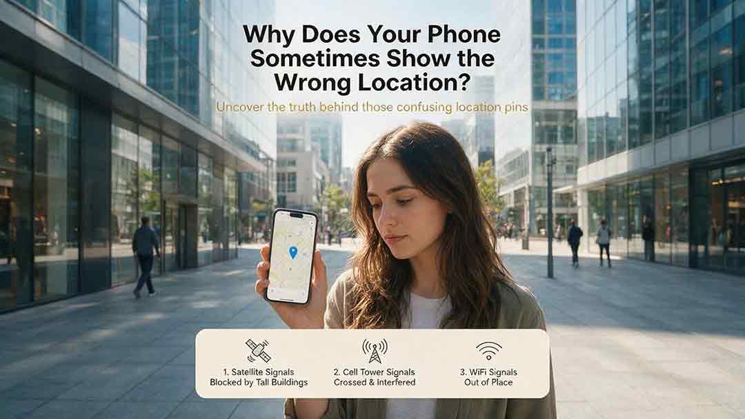
A phone’s location can appear incorrect even when its GPS hardware is functioning normally. Modern smartphones estimate position by combining satellite signals with Wi-Fi, cellular networks, Bluetooth, motion sensors, app permissions, and map data. This guide explains how blocked or reflected signals, cached locations, approximate permissions, battery restrictions, compass errors, and inaccurate map pins can affect the blue dot. It introduces two practical CosmoBasics troubleshooting tools—the Two Apps, Two Places Rule and the PLACE Test—to help readers distinguish app problems, environmental interference, stale data, mapping errors, and possible device-level issues. The article also provides step-by-step fixes for iPhone and Android, explains realistic smartphone accuracy under open-sky and indoor conditions, and identifies when contacting the manufacturer may be appropriate. All major technical claims are supported by first-party documentation from GPS.gov, Apple, Android, Google Maps, and Google for Developers.

How Accurate Is Consumer GPS?
Consumer GPS can often estimate horizontal position within about 5 meters under open sky, but actual accuracy varies significantly with the device, satellite geometry, signal blockage, reflected signals, antenna placement, and software processing. This guide explains what GPS accuracy figures really mean, why an app’s accuracy circle is not the same as measured error, and why smartphone references, Android confidence estimates, and government GPS performance standards should not be treated as interchangeable. It introduces the CosmoBasics Target Separation Test, a practical framework for deciding whether GPS uncertainty is small enough for a specific task. Readers will also learn how smartphones combine GNSS, Wi-Fi, cellular data, and sensors; how dual-frequency reception may improve performance; why altitude is less reliable than horizontal position; and how to test and troubleshoot a device. The article clearly identifies situations where consumer GPS is useful and where professional, certified, or regulated positioning methods are necessary.

Why Does GPS Need Atomic Clocks?
GPS depends on atomic clocks because every satellite range begins as a timing measurement. Since radio signals travel at nearly the speed of light, even a nanosecond-level clock error can represent centimeters or meters of apparent distance. This article explains how GPS satellites use atomic frequency standards, ground monitoring, clock corrections, and navigation messages to maintain reliable timing. It also shows why ordinary smartphones do not need atomic clocks, why a basic three-dimensional GPS solution normally requires four suitable satellite measurements, and how relativity affects clocks in orbit. A worked timing-to-distance example, an original five-step evaluation framework, and a GPS error table help distinguish satellite clock error from atmospheric delay, multipath, receiver bias, poor geometry, and other limitations. Based on official GPS.gov, NIST, NAVCEN, and NOAA documentation, the guide provides a practical and carefully qualified explanation of why precise time is fundamental to modern satellite navigation.
Explore More Topics
How Do Satellites Detect Wildfires and Smoke?
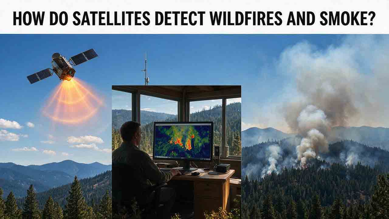
Satellites detect wildfires by measuring unusual heat in infrared wavelengths, while visible, multispectral, and aerosol observations help analysts follow smoke across the atmosphere. This guide explains how systems such as GOES, VIIRS, MODIS, Landsat, and Sentinel contribute different pieces of the wildfire-monitoring picture. Readers will learn why a thermal hotspot is not the same as an exact fire perimeter, why satellite smoke imagery cannot replace ground-level PM2.5 measurements, and how clouds, terrain, viewing geometry, and satellite overpass timing can affect detection. The article also compares commonly used fire and smoke products, explains fire radiative power and the Normalized Burn Ratio, and provides a practical framework for choosing the right map. A documented Camp Fire example shows how multiple satellite and surface datasets can complement one another. Satellite information is valuable for situational awareness, but official emergency agencies remain the appropriate source for evacuation orders, road closures, and immediate safety decisions.

How Are Satellite Images Used in Agriculture?
Satellite images help farmers, agronomists, researchers, insurers, and public agencies monitor agricultural land across fields, regions, and growing seasons. This guide explains how optical, radar, thermal, and microwave satellite observations support crop-development monitoring, irrigation analysis, field mapping, flood and drought assessment, crop classification, and regional production forecasting. It distinguishes what satellites directly observe from calculated indices, classification results, and modeled estimates such as evapotranspiration. Readers will also learn how NDVI works, why spatial resolution and image timing matter, and when drones or field scouting are more appropriate. The original CosmoBasics SCALE Framework provides a practical way to decide whether satellite imagery fits a specific agricultural problem. Documented examples from USDA and OpenET show how operational products combine multiple observations, reference data, weather information, and models. Throughout the guide, satellite imagery is treated as a screening and monitoring tool—not a substitute for field verification, laboratory testing, or professional agricultural judgment.
What Is Synthetic Aperture Radar and How Does It Work?
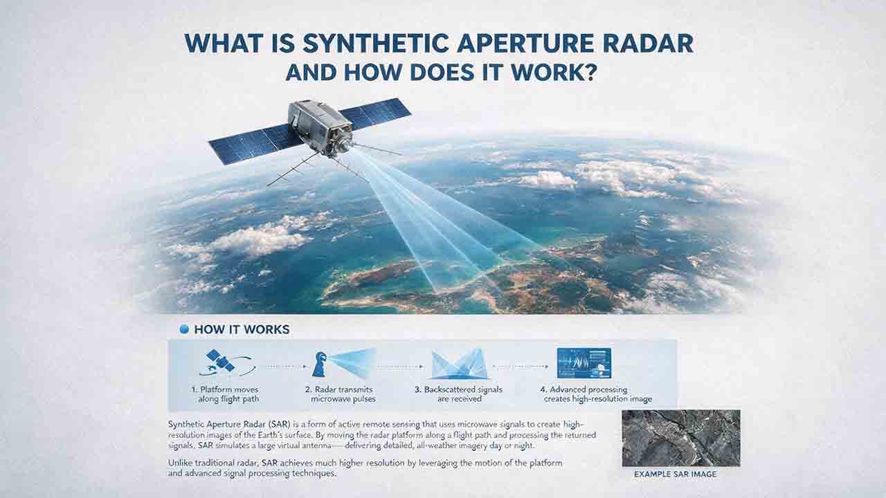
Synthetic aperture radar, or SAR, is an active Earth-observation technology that creates detailed images by transmitting microwave pulses and measuring the echoes returned from the surface. This article explains how a moving satellite or aircraft collects repeated observations to form a virtual antenna, why SAR can operate at night and through most cloud cover, and how amplitude, phase, wavelength, polarization, surface roughness, moisture, and viewing geometry affect radar imagery. It also distinguishes pixel spacing from true spatial resolution, provides a transparent range-resolution calculation, and compares SAR with optical satellite imagery. Practical sections examine scattering mechanisms, flood mapping, agriculture, forests, ice, maritime monitoring, and InSAR-based ground-deformation analysis. Original interpretation and data-selection frameworks help readers evaluate backscatter patterns, choose suitable products, identify common errors, troubleshoot unexpected results, and communicate uncertainty without treating derived radar products as guaranteed ground truth.