How Does GPS Work? A Simple Step-by-Step Explanation

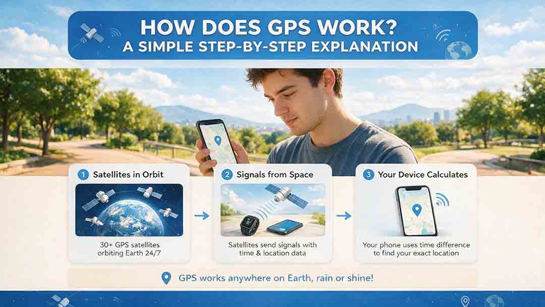
GPS works by measuring how long radio signals take to travel from several satellites to a receiver. Each satellite broadcasts its transmission time and orbital position. The receiver converts those travel times into estimated distances, then combines measurements from at least four satellites to calculate its three-dimensional position and correct the error in its own clock.
Key Takeaways
- GPS satellites broadcast precise time, orbital, and system-status information.
- A receiver estimates distance using distance = signal speed × travel time.
- Four satellite measurements normally solve three position coordinates and one receiver-clock error.
- Buildings, reflected signals, atmospheric delay, interference, and poor satellite geometry can reduce accuracy.
- GPS calculates coordinates; mapping software separately provides roads, addresses, and routes.
This guide follows a GPS signal from its transmission in orbit to the position displayed on a device. It explains why four satellites are normally required, why tiny timing errors matter, what limits GPS accuracy, and how to separate a reception problem from a map or routing problem.
Methodology note: This guide synthesizes official GPS program documentation and publications from NIST, NOAA, NASA, and a device manufacturer. The numerical examples were recalculated, and the technical terminology, source links, and safety statements were checked on August 2, 2026. This article does not report hands-on receiver testing or professional engineering certification.
How Does GPS Work in One Sentence?
GPS determines your location by measuring your apparent distance from multiple satellites whose positions and transmission times are known.
The Global Positioning System is a U.S.-owned positioning, navigation, and timing system. It includes satellites in space, ground facilities that monitor and update them, and receivers such as phones, vehicle navigation units, survey instruments, aircraft equipment, and timing systems.
GPS satellites send one-way radio signals. A receiver listens to those signals and calculates its own position locally; it does not transmit a request asking a satellite where it is.
Which Parts of GPS Make Positioning Possible?
GPS has three main segments.
| GPS segment | What it includes | What it does |
|---|---|---|
| Space segment | Satellites in medium Earth orbit | Broadcasts time, orbit, health, and navigation data |
| Control segment | Monitoring stations, control facilities, and ground antennas | Tracks satellites, monitors their clocks and orbits, and uploads updates |
| User segment | Phones, navigation units, survey equipment, and timing receivers | Receives signals and calculates position, velocity, or time |
The space and control segments are operated and maintained by the U.S. Space Force.
The baseline GPS architecture uses 24 constellation slots distributed across six orbital planes. The operational system normally includes additional satellites to preserve coverage during maintenance, replacement, repositioning, and system updates.
Twenty-four describes the core service architecture—not a permanent real-time count of every working GPS satellite.
Official reference: GPS.gov — Space Segment
How Does GPS Work Step by Step?
The process can be remembered as the CosmoBasics GPS Position Chain:
Broadcast → Measure → Range → Solve → Correct → Interpret
This is an editorial teaching framework, not an official GPS performance standard.
Step 1: A Satellite Broadcasts Time and Orbital Data
Each GPS satellite continuously transmits a coded navigation signal.
The signal allows a compatible receiver to determine:
- Which satellite transmitted it
- When the signal was transmitted
- Where the satellite was in its orbit
- Whether the satellite signal is considered healthy
- Which clock and orbital corrections should be applied
A GPS satellite does not transmit a street map, identify nearby buildings, or actively track the receiver. It functions more like a precisely timed radio beacon.
Step 2: The Signal Travels From Orbit to Earth
GPS radio signals travel through space at approximately the defined speed of light:
299,792,458 meters per second
The basic relationship is:
Distance = Speed × Travel Time
For GPS:
- Distance is the estimated range between a satellite and receiver.
- Speed is approximately the speed of light.
- Travel time is inferred from the difference between transmission and reception time.
The mathematical relationship is simple. Measuring the travel time accurately—and correcting everything that disturbs it—is the difficult part.
Official reference: GPS.gov — Trilateration
Step 3: The Receiver Measures Apparent Travel Time
The receiver compares the transmission time encoded in the signal with the time indicated by its own internal clock.
The difference provides an apparent signal travel time. Multiplying that value by the speed of light produces an estimated distance to the satellite.
A phone or ordinary navigation receiver does not contain an atomic clock perfectly synchronized with GPS time. Its initial distance estimates therefore include a common error caused by the receiver’s clock.
For that reason, the initial measurement is called a pseudorange.
Pseudorange: An estimated satellite-to-receiver distance that still contains receiver-clock error and other signal delays.
Step 4: The Receiver Builds Several Distance Constraints
One satellite measurement cannot identify one location.
It tells the receiver that it must be somewhere on an imaginary sphere centered on that satellite. Every point on that sphere has the same apparent distance from the transmitter.
A second satellite produces another sphere and narrows the possibilities. A third independent measurement narrows them further.
This distance-based positioning method is called trilateration. It differs from triangulation, which normally determines position from measured angles.
Flat illustrations often use intersecting circles to explain trilateration. That is a helpful teaching model, but real GPS positioning occurs in three dimensions around a rotating Earth and includes timing, atmospheric, orbital, geometric, and relativistic corrections.
Step 5: Four Satellites Solve Position and Clock Error
A practical three-dimensional GPS fix normally uses at least four satellite measurements because the receiver must solve four unknown values.
| Unknown | What it represents |
|---|---|
| X coordinate | Position along one Earth-centered axis |
| Y coordinate | Position along a second Earth-centered axis |
| Z coordinate | Position along a third Earth-centered axis |
| Receiver clock bias | Difference between receiver time and GPS system time |
The receiver later converts the three Earth-centered coordinates into latitude, longitude, and altitude.
The fourth satellite is not required because GPS uses a mysterious fourth spatial dimension. It is needed because the receiver’s clock is not accurate enough to be treated as perfectly synchronized.
Additional satellites provide more observations. They may improve redundancy, availability, error estimation, and satellite geometry, but a larger satellite count does not automatically guarantee a more accurate position.
Step 6: The Receiver Models and Reduces Known Errors
Raw pseudoranges are not perfect geometric distances.
A receiver may need to account for:
- Satellite clock offsets
- Small orbital prediction errors
- Ionospheric delay
- Tropospheric delay
- Relativistic effects
- Earth’s rotation during signal travel
- Reflections from buildings or terrain
- Receiver and antenna delays
- Poor satellite geometry
A basic receiver relies mainly on broadcast correction data and internal software models.
More capable equipment may also use multiple frequencies, reference-station observations, satellite-based augmentation, real-time correction services, or post-processing.
Step 7: Software Turns Coordinates Into Useful Information
The receiver’s fundamental output is a position and time estimate, often accompanied by velocity and quality indicators.
A phone or navigation application may then combine that output with:
- A digital map
- An address database
- Road and trail data
- Route-planning rules
- Device motion sensors
- Wi-Fi positioning
- Bluetooth information
- Cellular-network data
- Previously measured locations
Apple states that compatible Location Services can combine GPS and Bluetooth with crowd-sourced Wi-Fi hotspot and cellular-tower information.
That description applies specifically to compatible Apple devices. It should not be treated as a universal specification for every receiver or operating system.
Official reference: Apple Support — Location Services and GPS
How Is Signal Travel Time Converted Into Distance?
Consider an illustrative signal that appears to take 0.070 seconds, or 70 milliseconds, to reach a receiver.
The calculation is:
299,792,458 m/s × 0.070 s = 20,985,472.06 m
Converted to kilometers:
20,985,472.06 m ÷ 1,000 = 20,985.472 km
The apparent pseudorange is therefore approximately:
20,985 kilometers
This is not a complete position fix.
It is one illustrative measurement from one satellite before the receiver has fully corrected its clock bias, atmospheric delay, orbital information, and other errors. A single range also cannot identify a unique location.
Why Does a One-Microsecond Timing Error Matter?
One microsecond is:
0.000001 seconds
During that time, light travels:
299,792,458 m/s × 0.000001 s = 299.792458 m
Rounded for explanation:
About 300 meters
That figure describes signal travel distance. It does not mean that every one-microsecond clock error moves the final calculated position by exactly 300 meters.
The final effect depends on satellite geometry, shared clock bias, correction models, measurement quality, and how all observations are combined. The calculation shows why precise timing is fundamental to satellite navigation.
Why Does GPS Need Atomic Clocks?
GPS satellites need highly stable clocks because the ranging process depends on knowing when each signal was transmitted.
If a satellite clock drifts, a receiver interprets part of that timing error as extra or missing distance.
Atomic clocks use atomic transitions as highly stable frequency references. Their stability allows the control system, satellites, and receivers to maintain a consistent timing framework.
A phone does not need its own atomic clock. The receiver treats its local clock offset as an unknown and solves for it using the fourth satellite measurement.
GPS timing also supports systems that do not display maps. NIST identifies GPS as a major source of synchronization for telecommunications, electric-power, financial, and other critical-infrastructure systems.
This creates an easily overlooked dependency:
A system may rely heavily on GPS even when it never displays a location or navigation route.
Official reference: NIST Technical Note 2189 — GPS Timing Dependencies
Why Does GPS Need Relativity Corrections?
GPS must account for both special and general relativity because satellite clocks do not run at exactly the same rate as clocks on Earth.
NASA summarizes the main effects:
- Satellite motion causes orbiting clocks to run approximately 7 microseconds per day slower relative to clocks on Earth.
- The weaker gravitational field at GPS altitude causes them to run approximately 45 microseconds per day faster.
- The combined difference is approximately 38 microseconds per day faster.
GPS engineering accounts for these effects so that they do not accumulate into rapidly growing timing and positioning errors.
Relativity is therefore not an optional theoretical detail. It is part of the practical clock model that allows GPS to function.
Official reference: NASA — A Century of General Relativity
What Is the Four-Layer GPS Fix Framework?
The CosmoBasics Four-Layer GPS Fix Framework separates a positioning result into four parts:
- Signal
- Time
- Geometry
- Correction
This is an editorial analysis tool. It is not an official GPS standard and does not replace professional engineering diagnostics.
1. Signal: Can the Receiver Hear the Satellites Clearly?
Roofs, tunnels, tall buildings, terrain, dense foliage, and radio interference can weaken or block the incoming signals.
Practical response: Move to a location with a wider, less obstructed view of the sky.
2. Time: Are the Travel-Time Measurements Consistent?
Receiver-clock bias, atmospheric delay, and hardware delays affect the apparent signal travel time.
Practical response: Allow the receiver to reacquire signals and stabilize before judging the result.
3. Geometry: Are the Satellites Spread Across the Sky?
Satellites clustered in similar directions provide weaker geometric information than satellites distributed across several directions and elevations.
Practical response: Wait for the geometry to change or use a compatible receiver that can access additional GNSS constellations.
4. Correction: Can the Remaining Errors Be Reduced?
Some errors can be modeled, measured on additional frequencies, or corrected using reference data and augmentation services.
Practical response: Match the receiver and correction method to the accuracy required by the task.
The Better Question to Ask
A common reaction to a poor GPS result is:
“How many satellites can the device see?”
That question is incomplete.
A receiver may see many satellites but still perform poorly if their signals are weak, reflected, or clustered in similar directions. A more useful question is:
Which layer—signal, time, geometry, or correction—is limiting the result?
How Accurate Is GPS?
There is no single GPS accuracy number that applies to every receiver, location, and environment.
GPS.gov publishes a daily global-average signal-in-space user range error commitment of no more than 2 meters, with 95% probability, across healthy satellites in their assigned constellation slots.
Important: The GPS signal-in-space accuracy commitment is not the same as the final horizontal accuracy displayed by a phone.
User range error describes uncertainty associated with a satellite’s broadcast orbit and clock information.
A final position also depends on:
- Satellite geometry
- Atmospheric delay
- Signal blockage
- Reflected signals
- Antenna quality
- Receiver design
- Supported frequencies
- Correction methods
- Software processing
- Radio interference
A phone should therefore not be expected to remain within two meters in every environment merely because the official signal-in-space commitment contains a two-meter figure.
Official reference: GPS.gov — GPS Accuracy
Which Conditions Commonly Affect GPS Accuracy?
| Condition | What happens | Likely consequence |
|---|---|---|
| Open outdoor area | Fewer signals are blocked or reflected | More stable positioning |
| Tall buildings | Direct signals are blocked and others reflect from surfaces | Position may drift or jump |
| Indoor location | Roofs and walls weaken satellite signals | Slow, unstable, or unavailable fix |
| Dense tree cover | Foliage attenuates and scatters signals | Reduced consistency |
| Poor satellite geometry | Satellites appear in similar directions | Errors are harder to separate |
| Ionospheric variation | Charged particles delay signals | Increased range uncertainty |
| Radio interference | Desired signals are overwhelmed or distorted | Degraded or lost positioning |
| Limited receiver design | Antenna or processing capability is restricted | Less reliable output |
| Incorrect map data | Coordinates may be reasonable while displayed context is wrong | Wrong road, address, or route |
Why Do Tall Buildings Cause GPS Problems?
Tall buildings create two major problems: signal blockage and multipath.
Signal blockage occurs when a structure prevents a direct satellite signal from reaching the receiver.
Multipath occurs when a signal reflects from glass, concrete, metal, terrain, or another surface before arriving. The reflected route is longer, so the signal appears to have traveled farther.
In an urban canyon, a receiver may process a changing mixture of direct, reflected, weakened, and blocked signals. A blue dot may move to the wrong side of a street or jump between nearby locations.
A Real-World Example
Imagine walking from an open park into a street surrounded by tall buildings.
In the park, the phone receives several relatively clear signals distributed across the sky. As the phone enters the street, some direct signals disappear while reflected signals arrive from windows and walls.
The phone may still display a location, but the solution now depends on weaker geometry and less reliable ranges. The blue dot can drift even though the GPS satellites themselves continue operating normally.
How Does the Ionosphere Affect GPS?
The ionosphere is a region of the upper atmosphere containing electrically charged particles.
Changes in the number and distribution of electrons along a satellite-to-receiver path can delay the signal. Because GPS converts travel time into apparent distance, an uncorrected delay becomes a ranging error.
NOAA’s Global Total Electron Content model provides ionospheric situational awareness for systems affected by radio signals passing through the ionosphere. NOAA notes that total-electron-content maps can be used to estimate GNSS signal delay, particularly during geomagnetic disturbances.
Dual-frequency receivers can compare how two frequencies are delayed and remove much of the ionospheric contribution. Single-frequency receivers depend more heavily on broadcast models and estimated corrections.
Official reference: NOAA Space Weather Prediction Center — GloTEC
How Can You Tell Whether GPS or the Map Is Wrong?
A GPS error and a map error are not the same problem.
GPS signals allow a receiver to calculate coordinates. They do not contain street names, business listings, property boundaries, traffic conditions, or driving routes.
The CosmoBasics Navigation Error Diagnostic Model separates a navigation result into four layers.
| Layer | Question to ask | Example problem |
|---|---|---|
| Position | Is the blue dot physically in the correct place? | The dot jumps between two streets |
| Map | Is the road, building, or address represented correctly? | A building appears on the wrong parcel |
| Routing | Did the application choose an unsuitable path? | The route uses a closed entrance |
| Connectivity | Did the application receive current online data? | Traffic, search results, or map tiles are missing |
GPS.gov’s official archive distinguishes the position behind the blue dot from the privately maintained map, address, and route information used by navigation applications.
Official reference: GPS.gov Official Archive — Address, Route, and Map Problems
A Practical Interpretation Rule
- The blue dot is wrong in several unrelated apps: Check reception, permissions, device settings, or possible interference.
- The blue dot is correct but the street or address is wrong: The problem is probably in the map data.
- The position and map are correct but the route is unsuitable: Check routing rules, road restrictions, or outdated route data.
- The blue dot works but online map content is missing: Check connectivity or downloaded maps.
CosmoBasics observation: A navigation result can be wrong even after GPS has calculated a reasonable position. If the blue dot is correct but the route or address is wrong, the failure occurred after the satellite-positioning stage.
The 10-Minute GPS Error Isolation Test
This test is designed to identify the most likely problem category. It cannot confirm the exact engineering cause of a positioning failure.
The ten-minute label is an approximate practical target, not a guaranteed diagnosis time.
Step 1: Move Into an Open Outdoor Area
Stand away from roofs, tall buildings, tunnels, parking structures, dense trees, vehicles, and large metal objects.
Do not begin beside a reflective building if you are trying to establish a clean baseline.
Step 2: Check Location Permissions
Confirm that location services are enabled for the application.
If the device offers approximate and precise location settings, verify that the selected permission matches the task.
Step 3: Open Two Unrelated Location Applications
Use two applications with different map or routing systems where possible.
This comparison helps reveal whether the problem is limited to one app’s map data, permissions, cached information, or routing logic.
Step 4: Allow the Position to Stabilize
Leave the device still for several minutes.
Moving immediately after opening an application can make it difficult to distinguish an old cached location from a newly calculated position.
Step 5: Compare the Physical Blue-Dot Position
Judge whether the dot matches your real physical location.
Do not rely only on the displayed address. An address label can be wrong even when the coordinate is reasonable.
Step 6: Repeat the Test Near an Obstruction
Move beside a tall building, under a roof edge, or near another substantial obstruction.
Observe whether the position becomes less stable, shifts, or begins jumping.
How Should You Interpret the Results?
Both apps work outdoors but drift near buildings
The most likely category is signal blockage or multipath. Repeat the test in a wider open area.
Both apps remain wrong in open sky
Do not immediately assume that the satellites or receiver hardware have failed. Use this order:
- Recheck permissions and location settings.
- Restart the applications and location services.
- Update the operating system and applications.
- Repeat the test in a different open location.
- Check official GPS status or interference information.
- Investigate the device if the problem continues.
Only one app shows the wrong road or address
The problem is more likely to involve that application’s map or location database. Report the issue to the map provider.
The blue dot is correct but the route is unsuitable
Check road restrictions, closures, entrances, and routing preferences. Compare the route with another service.
The blue dot works but map tiles or traffic information are missing
Check the internet connection or confirm that the required offline map has been downloaded.
The result improves after several minutes outdoors
The receiver may have needed more time to acquire current signals, replace stale assistance information, or obtain better satellite geometry.
Does GPS Need Internet or Cellular Service?
The core GPS position calculation does not require cellular service, a SIM card, or an internet connection.
A compatible receiver can receive satellite signals and calculate coordinates locally.
Internet access may still be needed for:
- Downloading maps
- Searching for addresses or businesses
- Receiving live traffic information
- Sharing a location
- Loading assistance data
- Synchronizing cloud services
- Retrieving correction information
- Updating road restrictions
A phone with stored offline maps can therefore continue displaying a satellite-derived position without mobile coverage, provided the receiver can obtain enough usable satellite signals.
What Is the Difference Between GPS and GNSS?
GPS is one satellite-navigation system. GNSS is the broader category.
GNSS stands for Global Navigation Satellite System, a general term for satellite constellations that provide positioning, navigation, and timing services globally or regionally.
| Term | Meaning | Examples |
|---|---|---|
| GPS | The U.S.-owned Global Positioning System | GPS |
| GNSS | The broader family of satellite-navigation systems | GPS, Galileo, GLONASS, BeiDou, and regional systems |
| Multi-GNSS receiver | A receiver that supports signals from more than one constellation | Many phones and professional receivers |
Other systems include Europe’s Galileo, Russia’s GLONASS, China’s BeiDou, India’s NavIC, and Japan’s QZSS.
Many modern phones and navigation receivers use compatible signals from several constellations even when the interface casually labels the result as “GPS.”
Access to more constellations can increase the number of usable observations, especially where part of the sky is blocked. It does not guarantee better accuracy.
The final result still depends on:
- Supported frequencies and signals
- Antenna and receiver design
- Satellite geometry
- Signal quality
- Local surroundings
- Correction services
- Processing software
Official reference: GPS.gov — Other Global Navigation Satellite Systems
How Can GPS Accuracy Be Improved?
For Everyday Phone Navigation
- Move outdoors or closer to an open view of the sky.
- Confirm that the app has the required location permission.
- Enable precise location when the task requires it.
- Allow time for the position to stabilize.
- Update the operating system, application, and stored maps.
- Compare the result with a second application.
- Separate an incorrect address label from an incorrect physical position.
For Vehicle Navigation
- Position the receiver where the vehicle blocks as little sky as practical.
- Keep map and route data current.
- Compare questionable directions with road signs and restrictions.
- Do not assume that every routing error is a GPS error.
For Hiking and Remote Travel
- Download maps before leaving coverage.
- Carry sufficient battery capacity.
- Store important coordinates separately.
- Learn how to read coordinates without relying only on a moving map.
- Carry an appropriate paper map, compass, beacon, or other backup.
- Do not treat a consumer position estimate as proof that a route is open or safe.
For Surveying and High-Precision Work
Standalone consumer GPS may not meet professional accuracy requirements.
Higher-precision workflows may use:
- Multi-frequency receivers
- Calibrated antennas
- Continuously operating reference stations
- Differential corrections
- Real-time kinematic processing
- Precise point positioning
- Static observation and post-processing
GPS.gov defines augmentation as an external system that improves accuracy, integrity, availability, or another aspect of positioning, navigation, and timing.
Public examples include the Federal Aviation Administration’s Wide Area Augmentation System and NOAA’s Continuously Operating Reference Stations.
Official reference: GPS.gov — Augmentation Systems
For Aviation, Maritime, and Critical Timing Uses
Use equipment, procedures, notices, charts, correction services, redundancy, and backup systems appropriate to the regulated or safety-critical activity.
Safety and scope note: This article provides general educational information. It does not replace approved equipment, operating procedures, current charts, navigation warnings, regulations, engineering analysis, surveying standards, or professional requirements applicable to aviation, maritime operations, emergency response, critical infrastructure, or other regulated activities.
What Are the Main Advantages and Limitations of GPS?
| Advantages | Limitations |
|---|---|
| Available worldwide | Signals are weak by the time they reach Earth |
| Does not depend on nearby cellular towers | Buildings, roofs, terrain, and foliage can block reception |
| Supports position, velocity, navigation, and timing | Reflections can create multipath errors |
| Can operate without internet access | Atmospheric delay affects apparent range |
| Works across many receiver types | Interference or deceptive signals can degrade results |
| Can be augmented for specialized applications | GPS alone does not provide maps or safe-route judgments |
GPS is especially valuable where terrestrial positioning infrastructure is limited.
It is less dependable where the receiver has little view of the sky or where one undetected error could create a serious safety, operational, or financial consequence.
What Are the Most Common GPS Misunderstandings?
“The Satellites Track My Phone”
GPS satellites broadcast one-way signals. The receiver calculates its own position.
A connected application or service may separately store or transmit that location according to its settings and permissions.
“Three Satellites Are Always Enough”
Three satellite ranges illustrate the geometry, but a practical three-dimensional fix normally requires a fourth observation to solve receiver-clock bias.
“GPS and a Mapping App Are the Same System”
GPS supplies a coordinate estimate. Mapping software supplies roads, addresses, restrictions, labels, and routes.
“No Cell Service Means No GPS”
Satellite positioning can work without cell service, although maps, searches, traffic, assistance data, and location sharing may still require connectivity.
“More Satellites Always Mean Better Accuracy”
More usable observations can help, but signal quality and geometry matter. A smaller set of clear, well-distributed signals may be more useful than a larger group containing weak reflections.
“The Official Two-Meter Figure Applies to Every Phone”
The two-meter figure describes a signal-in-space user range error commitment. It is not a universal guarantee for a consumer device’s final position.
What Should You Do If GPS Suddenly Stops Working?
Move into open sky.
Leave buildings, tunnels, covered parking areas, and dense obstructions.Check permissions and device settings.
Confirm that location services are enabled and that privacy or battery-saving settings are not limiting the app.Compare multiple applications.
Determine whether the position itself is wrong or only one map provider is affected.Restart the location process.
Reopen the application or restart the device if it appears stuck on an old location.Repeat the test elsewhere.
Testing in another open location can help separate a local environmental problem from a persistent device issue.Check official service information.
A problem affecting several receivers in one area may involve interference, planned testing, space weather, or a wider disruption.Use an appropriate backup.
Do not depend on one consumer receiver where loss of positioning could create a serious hazard.
GPS.gov states that interference can result from emissions in nearby bands, intentional or unintentional jamming, and naturally occurring space weather. It directs U.S. civilian users experiencing suspected radio interference to official reporting channels.
Consumers cannot legally use signal jammers in the United States. This article does not provide instructions for obtaining, constructing, configuring, or operating interference equipment.
Official references:
What Is the Practical Conclusion?
GPS converts tiny differences in satellite-signal arrival time into apparent distance measurements.
A receiver combines measurements from multiple satellites to solve its position and local clock offset, then applies atmospheric, orbital, geometric, timing, and relativistic corrections.
For everyday users, three principles matter most:
- GPS calculates coordinates; mapping software interprets them.
- Signal quality and satellite geometry matter more than the raw number of visible satellites.
- Safety-critical work requires suitable equipment, procedures, and backup—not just a consumer blue dot.
For ordinary navigation, check permissions, maintain a clear sky view, and keep map data current.
For remote travel, store maps offline and carry an appropriate independent backup.
For surveying, regulated navigation, or critical timing, use equipment and correction services designed for the required accuracy, integrity, availability, and resilience.
Frequently Asked Questions
Can GPS Work Without a SIM Card?
Yes. A compatible receiver can calculate a satellite-based position without a SIM card, although online maps, searches, traffic data, assistance services, and location sharing may still require connectivity.
Why Can My Phone Locate Me Indoors?
Phones may combine weak satellite information with Wi-Fi, Bluetooth, cellular networks, motion sensors, and previously known locations. The position shown indoors is therefore not necessarily a GPS-only fix.
Does GPS Transmit My Location to the Satellites?
No. Standard GPS positioning uses one-way broadcasts from satellites to receivers. An application, cellular connection, vehicle system, or other connected service may separately transmit location data according to its permissions and privacy settings.
Can Weather Stop GPS From Working?
Ordinary rain and clouds are usually less disruptive to consumer GPS than buildings, roofs, dense foliage, or radio interference. Conditions in the ionosphere can change signal delay and reduce GNSS positioning or timing performance.
Why Is the Blue Dot Correct but the Address Wrong?
Coordinates and addresses come from different data systems. The receiver may have calculated a reasonable position while the map provider has an incorrect road, parcel, address, entrance, or business record.
Is GPS More Accurate Than Galileo or Other GNSS Systems?
There is no universal winner for every receiver and environment. Performance depends on receiver design, supported frequencies, visible satellites, geometry, signal quality, corrections, and local conditions. Many receivers combine compatible signals from several systems.
Sources
GPS.gov — Space Segment
Official description of the baseline constellation architecture, orbital arrangement, additional operational satellites, and GPS operation by the U.S. Space Force. Accessed August 2, 2026.GPS.gov — Trilateration
Official educational explanation of trilateration and the distance-rate-time relationship used in GPS ranging. Accessed August 2, 2026.GPS.gov — GPS Accuracy
Official explanation of signal-in-space user range error, final user accuracy, satellite geometry, blockage, atmospheric effects, multipath, and receiver limitations. Accessed August 2, 2026.GPS.gov — Other Global Navigation Satellite Systems
Official overview of GNSS terminology and other global or regional navigation systems. Accessed August 2, 2026.GPS.gov — Augmentation Systems
Official description of GPS augmentation and public systems including WAAS and CORS. Accessed August 2, 2026.GPS.gov Official Archive — Address, Route, and Map Problems
Archived official explanation of the distinction between GPS coordinates and privately maintained map, address, and route data. Accessed August 2, 2026.NOAA Space Weather Prediction Center — GloTEC
Official explanation of total electron content, ionospheric monitoring, and effects on GNSS signal delay, positioning, and timing. Accessed August 2, 2026.NIST Technical Note 2189 — An Evaluation of Dependencies of Critical Infrastructure Timing Systems on GPS
NIST publication by Michael A. Lombardi covering GPS timing dependencies in telecommunications, electric power, financial systems, and other infrastructure. Published November 2021. Accessed August 2, 2026.NASA Physics of the Cosmos — A Century of General Relativity
NASA explanation of special- and general-relativistic clock effects in GPS satellites. Accessed August 2, 2026.Apple Support — Location Services and GPS
Official explanation of how compatible Apple devices may combine GPS, Bluetooth, Wi-Fi, and cellular information. Published January 14, 2026. Accessed August 2, 2026.GPS.gov — Spectrum and Interference Issues
Official information about interference sources, reporting channels, spectrum protection, and the legal status of consumer signal jammers in the United States. Accessed August 2, 2026.
Editorial Note
Editorial scope
This article was prepared from the primary sources listed above. It is an educational source review, not a professional engineering peer review, regulated navigation assessment, surveying certification, or guarantee of positioning performance.
More from GPS, Timing & Navigation
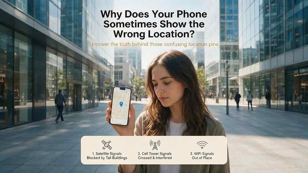
Why Does Your Phone Sometimes Show the Wrong Location?
A phone’s location can appear incorrect even when its GPS hardware is functioning normally. Modern smartphones estimate position by combining satellite signals with Wi-Fi, cellular networks, Bluetooth, motion sensors, app permissions, and map data. This guide explains how blocked or reflected signals, cached locations, approximate permissions, battery restrictions, compass errors, and inaccurate map pins can affect the blue dot. It introduces two practical CosmoBasics troubleshooting tools—the Two Apps, Two Places Rule and the PLACE Test—to help readers distinguish app problems, environmental interference, stale data, mapping errors, and possible device-level issues. The article also provides step-by-step fixes for iPhone and Android, explains realistic smartphone accuracy under open-sky and indoor conditions, and identifies when contacting the manufacturer may be appropriate. All major technical claims are supported by first-party documentation from GPS.gov, Apple, Android, Google Maps, and Google for Developers.
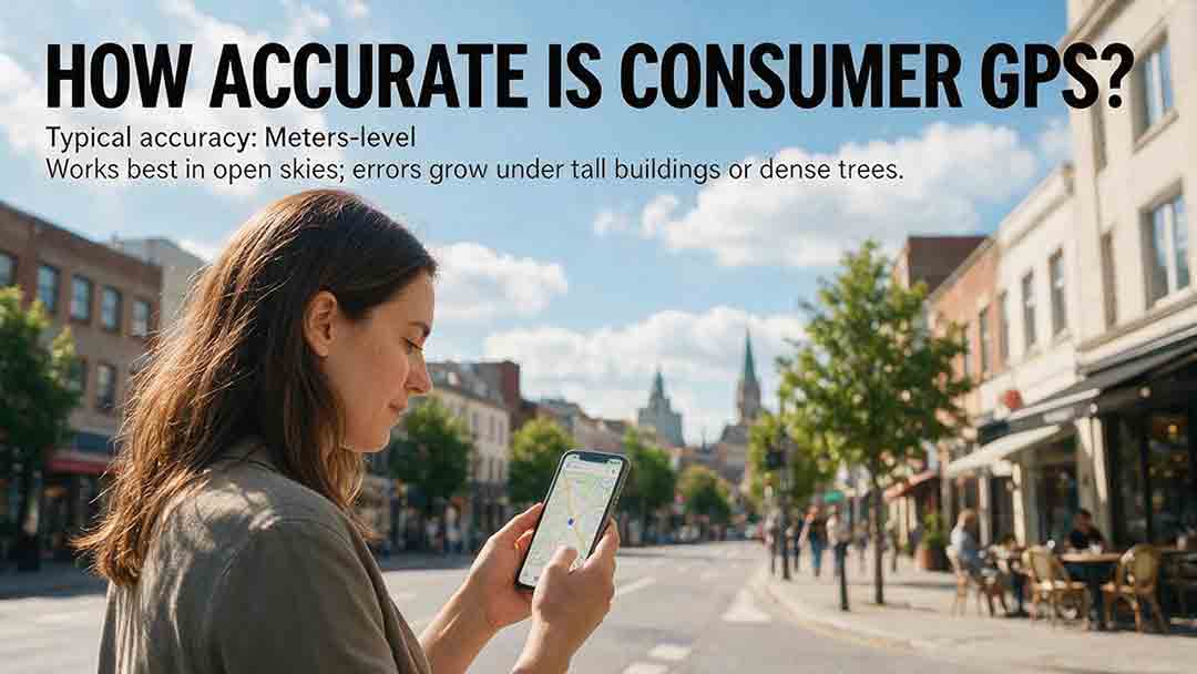
How Accurate Is Consumer GPS?
Consumer GPS can often estimate horizontal position within about 5 meters under open sky, but actual accuracy varies significantly with the device, satellite geometry, signal blockage, reflected signals, antenna placement, and software processing. This guide explains what GPS accuracy figures really mean, why an app’s accuracy circle is not the same as measured error, and why smartphone references, Android confidence estimates, and government GPS performance standards should not be treated as interchangeable. It introduces the CosmoBasics Target Separation Test, a practical framework for deciding whether GPS uncertainty is small enough for a specific task. Readers will also learn how smartphones combine GNSS, Wi-Fi, cellular data, and sensors; how dual-frequency reception may improve performance; why altitude is less reliable than horizontal position; and how to test and troubleshoot a device. The article clearly identifies situations where consumer GPS is useful and where professional, certified, or regulated positioning methods are necessary.
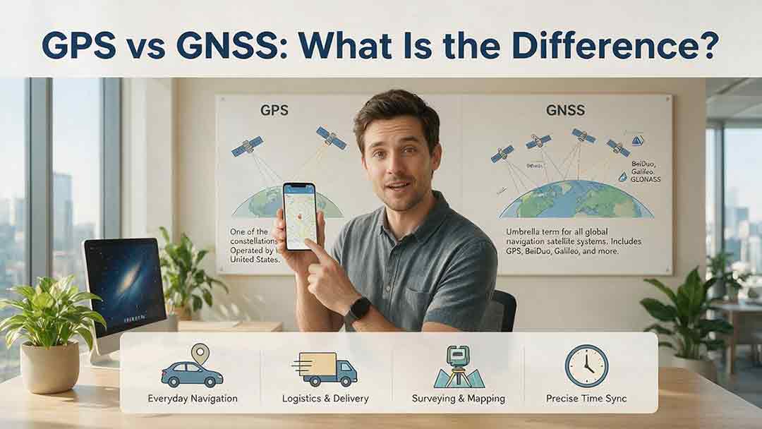
GPS vs GNSS: What Is the Difference?
GPS and GNSS are often used as if they mean the same thing, but they describe different levels of satellite navigation technology. GPS is the United States’ satellite navigation system, while GNSS is the broader category that includes GPS, Galileo, GLONASS, BeiDou, and compatible regional systems such as QZSS and NavIC. This guide explains how GPS-only and multi-GNSS receivers differ, why access to more constellations may improve signal availability, and why a larger satellite count does not automatically guarantee greater accuracy. It also examines dual-frequency reception, satellite geometry, antenna quality, correction services, sensor integration, and common positioning errors. Readers can use the Receiver Capability Stack, buying checklist, real-world examples, and troubleshooting steps to evaluate phones, watches, vehicle navigators, outdoor devices, survey receivers, and timing systems. The article is based on official technical documentation and clearly distinguishes educational examples from recognized GNSS performance standards.
Explore More Topics
How Do Satellites Detect Wildfires and Smoke?
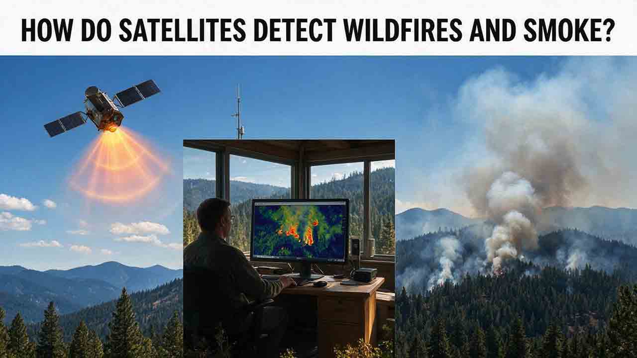
Satellites detect wildfires by measuring unusual heat in infrared wavelengths, while visible, multispectral, and aerosol observations help analysts follow smoke across the atmosphere. This guide explains how systems such as GOES, VIIRS, MODIS, Landsat, and Sentinel contribute different pieces of the wildfire-monitoring picture. Readers will learn why a thermal hotspot is not the same as an exact fire perimeter, why satellite smoke imagery cannot replace ground-level PM2.5 measurements, and how clouds, terrain, viewing geometry, and satellite overpass timing can affect detection. The article also compares commonly used fire and smoke products, explains fire radiative power and the Normalized Burn Ratio, and provides a practical framework for choosing the right map. A documented Camp Fire example shows how multiple satellite and surface datasets can complement one another. Satellite information is valuable for situational awareness, but official emergency agencies remain the appropriate source for evacuation orders, road closures, and immediate safety decisions.

How Are Satellite Images Used in Agriculture?
Satellite images help farmers, agronomists, researchers, insurers, and public agencies monitor agricultural land across fields, regions, and growing seasons. This guide explains how optical, radar, thermal, and microwave satellite observations support crop-development monitoring, irrigation analysis, field mapping, flood and drought assessment, crop classification, and regional production forecasting. It distinguishes what satellites directly observe from calculated indices, classification results, and modeled estimates such as evapotranspiration. Readers will also learn how NDVI works, why spatial resolution and image timing matter, and when drones or field scouting are more appropriate. The original CosmoBasics SCALE Framework provides a practical way to decide whether satellite imagery fits a specific agricultural problem. Documented examples from USDA and OpenET show how operational products combine multiple observations, reference data, weather information, and models. Throughout the guide, satellite imagery is treated as a screening and monitoring tool—not a substitute for field verification, laboratory testing, or professional agricultural judgment.
What Is Synthetic Aperture Radar and How Does It Work?
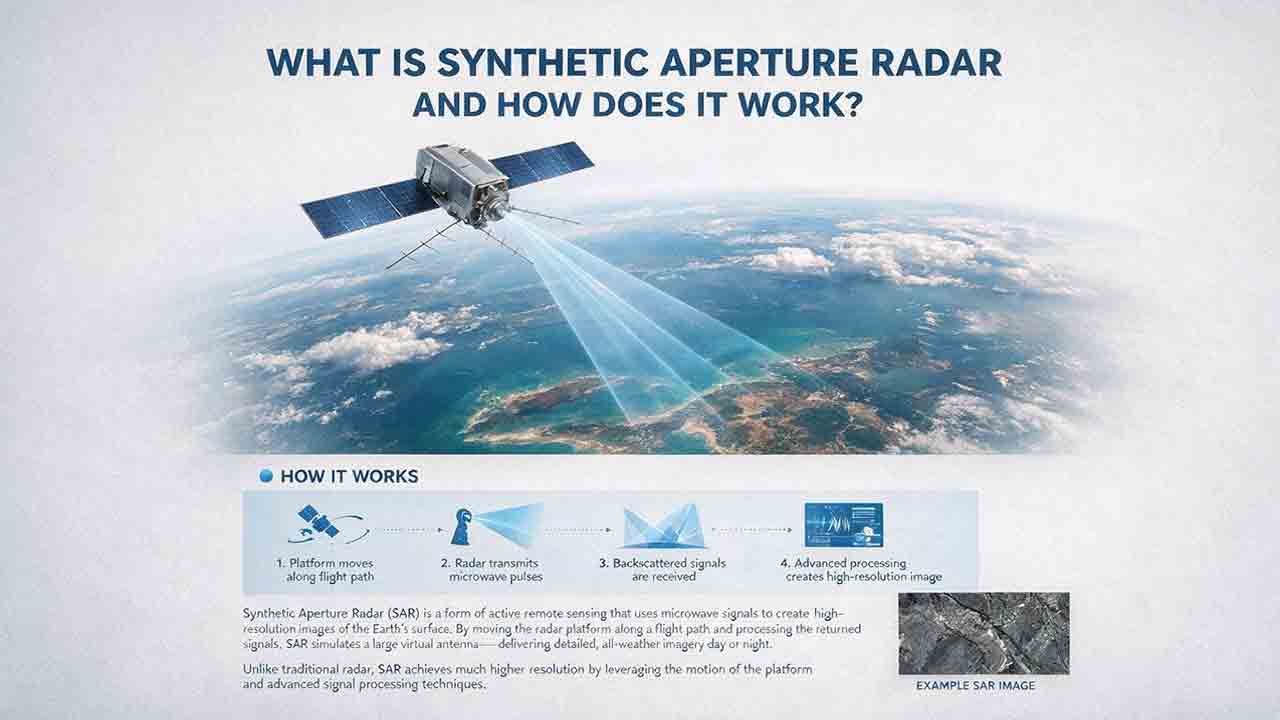
Synthetic aperture radar, or SAR, is an active Earth-observation technology that creates detailed images by transmitting microwave pulses and measuring the echoes returned from the surface. This article explains how a moving satellite or aircraft collects repeated observations to form a virtual antenna, why SAR can operate at night and through most cloud cover, and how amplitude, phase, wavelength, polarization, surface roughness, moisture, and viewing geometry affect radar imagery. It also distinguishes pixel spacing from true spatial resolution, provides a transparent range-resolution calculation, and compares SAR with optical satellite imagery. Practical sections examine scattering mechanisms, flood mapping, agriculture, forests, ice, maritime monitoring, and InSAR-based ground-deformation analysis. Original interpretation and data-selection frameworks help readers evaluate backscatter patterns, choose suitable products, identify common errors, troubleshoot unexpected results, and communicate uncertainty without treating derived radar products as guaranteed ground truth.